Category:Thornton Steward
Jump to navigation
Jump to search
village in North Yorkshire, England, UK  | |||||
| Upload media | |||||
| Instance of | |||||
|---|---|---|---|---|---|
| Location | Richmondshire, North Yorkshire, Yorkshire and the Humber, England | ||||
 | |||||
Subcategories
This category has the following 2 subcategories, out of 2 total.
D
- Danby Hall, Thornton Steward (3 F)
O
Media in category "Thornton Steward"
The following 143 files are in this category, out of 143 total.
-
 113 metre spot height on Longdike Lane - geograph.org.uk - 6095040.jpg 1,024 × 768; 163 KB
-
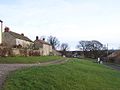
 19th Century house in Thornton Steward - geograph.org.uk - 416260.jpg 480 × 640; 157 KB
-
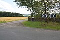
 A minor road off No Man's Moor Lane - geograph.org.uk - 3101493.jpg 800 × 600; 86 KB
-
 A row of hawthorn trees beside footpath - geograph.org.uk - 4327979.jpg 1,024 × 683; 218 KB
-
 Access Lane leading onto No Man's Moor Lane - geograph.org.uk - 5566197.jpg 5,184 × 3,456; 5.72 MB
-
 Access road to Danby Grange from Back Lane - geograph.org.uk - 4086433.jpg 4,608 × 3,456; 3.93 MB
-
 Access track to Woodhouse Farm - geograph.org.uk - 6095043.jpg 1,600 × 1,200; 402 KB
-
 Along Back Lane - geograph.org.uk - 2379341.jpg 640 × 480; 94 KB
-
 Approaching Danby Grange - geograph.org.uk - 107494.jpg 640 × 480; 89 KB
-
 Approaching West Marriforth Plantation - geograph.org.uk - 5563901.jpg 5,184 × 3,456; 6.15 MB
-
 Back Lane - geograph.org.uk - 2379324.jpg 640 × 480; 133 KB
-
 Back Lane passing north of Thornton Steward - geograph.org.uk - 4086448.jpg 4,608 × 3,456; 4.27 MB
-
 Benchmark on building at Hollins Farm - geograph.org.uk - 5315671.jpg 669 × 1,024; 290 KB
-
 Benchmark on Eagle Lodge - geograph.org.uk - 5315864.jpg 683 × 1,024; 244 KB
-
 Benchmark on gatepost at bend in Back Lane - geograph.org.uk - 5315948.jpg 669 × 1,024; 187 KB
-

-
 Benchmark on gatepost, No Man's Moor Lane - geograph.org.uk - 4325228.jpg 683 × 1,024; 274 KB
-
 Benchmark on stone at crossroads - geograph.org.uk - 4328009.jpg 1,024 × 683; 302 KB
-
-
 Benchmark on Ulshaw Cottage - geograph.org.uk - 3195302.jpg 683 × 1,024; 273 KB
-
 Bridge over the River Ure at Ulshaw - geograph.org.uk - 2983189.jpg 1,600 × 1,200; 466 KB
-
 Bridleway to Finghall - geograph.org.uk - 2587903.jpg 3,232 × 1,819; 1.26 MB
-
 Bridleway west of Thornton Steward - geograph.org.uk - 4329007.jpg 4,320 × 3,240; 3.64 MB
-
 Buildings at Kilgram Grange - geograph.org.uk - 107536.jpg 640 × 480; 142 KB
-
 Cattle grazing east of Thornton Grange - geograph.org.uk - 6094927.jpg 1,600 × 900; 228 KB
-
 Cattle grazing near Thornton Grange - geograph.org.uk - 6094923.jpg 1,571 × 883; 298 KB
-
 Church of St Simon ^ St Jude, Ulshaw - geograph.org.uk - 4329058.jpg 4,260 × 3,160; 2.65 MB
-

-
 Cottage on Barf Bank - geograph.org.uk - 2379358.jpg 640 × 480; 124 KB
-
 Culverted stream at south end of Limekiln Wood - geograph.org.uk - 5315650.jpg 683 × 1,024; 334 KB
-
 Dolly Bog Wood - geograph.org.uk - 2379349.jpg 480 × 640; 192 KB
-
 Dolly Bog Wood - geograph.org.uk - 4556089.jpg 4,000 × 2,659; 3.42 MB
-
 Drive to Danby Grange - geograph.org.uk - 2379347.jpg 640 × 480; 133 KB
-

-
 Eagle Lodge at entrance to Danby Hall - geograph.org.uk - 5315902.jpg 1,024 × 683; 147 KB
-
 Farm buildings at Hollins Farm - geograph.org.uk - 5315686.jpg 1,024 × 683; 182 KB
-
 Farmland from Barf Bank - geograph.org.uk - 2379365.jpg 480 × 640; 116 KB
-
 Farmland on the north side of Longdike Lane - geograph.org.uk - 6095037.jpg 1,251 × 938; 414 KB
-
 Fields north of Longdike Lane - geograph.org.uk - 4086466.jpg 4,608 × 3,456; 3.43 MB
-

-
 Fish Ponds from the Six Dales Trail - geograph.org.uk - 4458481.jpg 4,598 × 3,442; 7.77 MB
-
 Following a Footpath below Marriforth Hill - geograph.org.uk - 5563975.jpg 5,184 × 3,456; 5.71 MB
-
 Footpath leading to Ruswick Manor farm - geograph.org.uk - 1956516.jpg 800 × 533; 157 KB
-

-
 Footpath via Fox Covert - geograph.org.uk - 1955672.jpg 800 × 533; 123 KB
-
 Gateway to field from No Man's Moor Lane - geograph.org.uk - 4325238.jpg 1,024 × 683; 231 KB
-
 Guide post opposite Eagle Lodge - geograph.org.uk - 5315931.jpg 683 × 1,024; 301 KB
-
 Guide post-gatepost with double benchmarks - geograph.org.uk - 5311264.jpg 683 × 1,024; 293 KB
-
 Guidepost with Cut Bench Marks - geograph.org.uk - 4767315.jpg 2,368 × 4,208; 3.87 MB
-
 Hill Crest Farm, from the south-west - geograph.org.uk - 6094625.jpg 1,600 × 1,200; 404 KB
-
 Hollins Farm - geograph.org.uk - 4084540.jpg 4,608 × 3,456; 3.72 MB
-
 Hollins Farm - geograph.org.uk - 4556121.jpg 4,000 × 2,660; 3.11 MB
-
 I wonder who lives here^ - geograph.org.uk - 4329011.jpg 3,219 × 2,881; 2.21 MB
-
 In West Marriforth Plantation - geograph.org.uk - 5563986.jpg 5,184 × 3,456; 7.52 MB
-
 Inlet and inlet tower, Thornton Steward reservoir - geograph.org.uk - 6095021.jpg 1,600 × 1,199; 338 KB
-
 Kilgram Bridge and the River Ure - geograph.org.uk - 339884.jpg 464 × 640; 79 KB
-
 Line of sycamores on the approach to Danby Park - geograph.org.uk - 4329026.jpg 3,233 × 3,543; 4.45 MB
-
 Lodge and Gateway to Danby Hall - geograph.org.uk - 4084544.jpg 4,608 × 3,456; 3.05 MB
-
 Long Hull - geograph.org.uk - 5566219.jpg 5,184 × 3,456; 6.27 MB
-
 Longdike Lane - geograph.org.uk - 2379314.jpg 640 × 480; 91 KB
-

-
 Longdike Lane toward Sandhill Plantation - geograph.org.uk - 4086479.jpg 4,608 × 3,456; 3.29 MB
-
 Longdike Lane toward Thornton Steward - geograph.org.uk - 4086471.jpg 4,608 × 3,456; 3.63 MB
-
 Looking downstream from Ulshaw Bridge - geograph.org.uk - 4329047.jpg 4,320 × 2,736; 2.37 MB
-

-
 Near Woodhouse Farm - geograph.org.uk - 3490793.jpg 1,600 × 1,200; 718 KB
-
 No Man's Moor Lane - geograph.org.uk - 5566202.jpg 5,184 × 3,456; 5.64 MB
-
 No Man's Moor Lane - geograph.org.uk - 6093281.jpg 1,024 × 768; 162 KB
-

-
 No Man's Moor Lane at Cocked Hat - geograph.org.uk - 6220923.jpg 1,024 × 768; 178 KB
-
 No Man's Moor Lane crossroads - geograph.org.uk - 4328011.jpg 1,024 × 683; 134 KB
-
 Off Longdike Lane - geograph.org.uk - 2377491.jpg 640 × 480; 101 KB
-
 Outbuilding at Marriforth Cottage - geograph.org.uk - 5563979.jpg 5,184 × 3,456; 6.25 MB
-
 Patchwork fields - geograph.org.uk - 1955803.jpg 800 × 533; 106 KB
-
 Path from Kilgram Bridge to Thornton Steward - geograph.org.uk - 4328689.jpg 4,320 × 3,240; 5.03 MB
-
 Path to Thornton Steward - geograph.org.uk - 4328687.jpg 4,320 × 3,240; 2.78 MB
-
 Perimeter path, Thornton Steward reservoir - geograph.org.uk - 6095018.jpg 1,600 × 1,200; 490 KB
-
 Picnic benches in the reservoir car park - geograph.org.uk - 6095004.jpg 1,600 × 1,201; 549 KB
-
 Rape off Back Lane - geograph.org.uk - 2379337.jpg 640 × 480; 122 KB
-
 River Ure - geograph.org.uk - 3490937.jpg 1,600 × 1,200; 590 KB
-
 River Ure in Flood - geograph.org.uk - 4759392.jpg 4,208 × 2,368; 3.47 MB
-
 Road into Thornton Steward village from Back Lane - geograph.org.uk - 4086459.jpg 4,608 × 3,456; 4.75 MB
-
 Road Junction in Dolly Bog Wood - geograph.org.uk - 4556103.jpg 4,000 × 2,660; 4.11 MB
-
 Sailing under a stormy sky - geograph.org.uk - 2587940.jpg 3,238 × 1,632; 855 KB
-
 Sheep in field below Arklow Hill - geograph.org.uk - 4327022.jpg 1,024 × 683; 262 KB
-
 Sheep on the bank of the River Ure - geograph.org.uk - 4458738.jpg 1,024 × 768; 608 KB
-
 Sixpenny Wood - geograph.org.uk - 2587894.jpg 3,238 × 1,632; 846 KB
-
 Something lurking in the undergrowth - geograph.org.uk - 4329070.jpg 3,233 × 2,881; 3.07 MB
-
 South shore, Thornton Steward reservoir - geograph.org.uk - 6095010.jpg 1,600 × 1,200; 363 KB
-

-
 St Simon ^ St Jude, Ulshaw - geograph.org.uk - 4556134.jpg 4,000 × 2,250; 1.87 MB
-
 St Simon ^ St Jude, Ulshaw Bridge - Calvary - geograph.org.uk - 5961299.jpg 1,000 × 760; 785 KB
-
 St Simon ^ St Jude, Ulshaw Bridge - Calvary - geograph.org.uk - 5961301.jpg 773 × 1,000; 714 KB
-
 St Simon ^ St Jude, Ulshaw Bridge - geograph.org.uk - 5961304.jpg 1,000 × 706; 785 KB
-
 St Simon ^ St Jude, Ulshaw Bridge - geograph.org.uk - 5961307.jpg 1,000 × 746; 777 KB
-
 St Simon ^ St Jude, Ulshaw Bridge - Notice board - geograph.org.uk - 5961297.jpg 1,000 × 750; 665 KB
-
 St.Oswald's, Thornton Steward - geograph.org.uk - 5545406.jpg 2,500 × 1,875; 5.31 MB
-
 St.Oswald's, Thornton Steward - geograph.org.uk - 5545420.jpg 2,000 × 2,500; 5.27 MB
-
 Stile beside Longdike Lane - geograph.org.uk - 5563905.jpg 5,184 × 3,456; 7.6 MB
-
 Summer evening, lower Wensleydale - geograph.org.uk - 1352143.jpg 640 × 341; 46 KB
-
 Telephone Box, Thornton Steward - geograph.org.uk - 3166499.jpg 1,024 × 682; 226 KB
-
 The entrance to Danby Grange - geograph.org.uk - 3101462.jpg 800 × 600; 188 KB
-
 The Fishpond - geograph.org.uk - 4329003.jpg 4,320 × 2,952; 3.78 MB
-
 The shallow valley of Moor Beck - geograph.org.uk - 6094817.jpg 1,600 × 1,200; 400 KB
-
 The Ure at Danby Low Mill - geograph.org.uk - 4329021.jpg 4,320 × 3,240; 4.29 MB
-
 The village of Thornton Steward - geograph.org.uk - 3101471.jpg 800 × 600; 108 KB
-
 Thornton Grange - geograph.org.uk - 2587935.jpg 2,422 × 2,177; 1.13 MB
-
 Thornton Grange - geograph.org.uk - 4556050.jpg 4,000 × 2,660; 2.02 MB
-
 Thornton Steward from Stark Bank - geograph.org.uk - 5053245.jpg 4,320 × 3,240; 2.74 MB
-
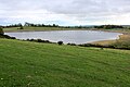
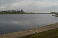
 Thornton Steward Reservoir - geograph.org.uk - 1956423.jpg 800 × 533; 85 KB
-
 Thornton Steward Reservoir - geograph.org.uk - 2576034.jpg 3,245 × 1,787; 944 KB
-
 Thornton Steward Reservoir - geograph.org.uk - 2587923.jpg 3,264 × 2,448; 1.65 MB
-
 Thornton Steward Reservoir - geograph.org.uk - 3101484.jpg 800 × 600; 69 KB
-
 Thornton Steward Reservoir - geograph.org.uk - 5566217.jpg 5,184 × 3,456; 5.75 MB
-
 ThorntonSteward.jpg 640 × 480; 78 KB
-
 ThorntonStewardReservoir.JPG 2,272 × 1,504; 1.62 MB
-
 Track in Danby Park - geograph.org.uk - 4329030.jpg 4,196 × 3,068; 3.43 MB
-
 Track to Danby Grange from bend in Back Lane - geograph.org.uk - 5316021.jpg 1,024 × 683; 208 KB
-
-
 Ulshaw - view of the bridge over the River Ure - geograph.org.uk - 2227326.jpg 1,600 × 1,200; 301 KB
-
 Ulshaw Bridge - geograph.org.uk - 4329066.jpg 4,135 × 2,160; 1.77 MB
-
 Ulshaw Bridge over River Ure - geograph.org.uk - 4004224.jpg 640 × 447; 52 KB
-
 Ulshaw Bridge over the River Ure - geograph.org.uk - 4084529.jpg 4,608 × 3,456; 3.74 MB
-
 Ulshaw Church - geograph.org.uk - 2379360.jpg 640 × 480; 84 KB
-
 Ulshaw Cottage, Barf Bank - geograph.org.uk - 3195305.jpg 1,024 × 683; 133 KB
-
 View across the river - geograph.org.uk - 4328996.jpg 4,320 × 2,160; 2.38 MB
-

-

-
 Village Green, Thornton Steward - geograph.org.uk - 3166500.jpg 1,024 × 682; 194 KB
-
 Village Institute, Thornton Steward - geograph.org.uk - 416256.jpg 640 × 480; 154 KB
-
 Waiting for the main season to start at the reservoir - geograph.org.uk - 6095025.jpg 1,600 × 1,200; 279 KB
-
 Farm track near Kilgram Grange - geograph.org.uk - 1401446.jpg 640 × 480; 69 KB
-
 Former school at Thornton Steward - geograph.org.uk - 416262.jpg 640 × 480; 129 KB
-
 Green Track, Danby Park - geograph.org.uk - 439833.jpg 480 × 640; 138 KB
-
 In Jervaulx Park - geograph.org.uk - 107571.jpg 640 × 480; 76 KB
-
 Jervaulx Park - geograph.org.uk - 270709.jpg 640 × 480; 51 KB
-
 Kilgram Bridge - geograph.org.uk - 93640.jpg 640 × 409; 83 KB
-
 Lane House Farm - geograph.org.uk - 107547.jpg 640 × 480; 74 KB
-
 Rookwith House Farm - geograph.org.uk - 330999.jpg 640 × 480; 82 KB
-
 Thornton Reservoir - geograph.org.uk - 139376.jpg 640 × 480; 69 KB
-
 Village Pump, Thornton Steward - geograph.org.uk - 416248.jpg 480 × 640; 157 KB
-

-
 Woodhouse Farm - geograph.org.uk - 107531.jpg 640 × 480; 142 KB


