Category:Therfield
Jump to navigation
Jump to search
English: Therfield is both a small village of approximately 4,761 acres (19 km²) and a parish (originally in Odsey Hundred and Royston Union) which sits upon the chalk range, three miles southwest of Royston, and six miles (10 km) northeast of Baldock) and within the English county of Hertfordshire.
village in the United Kingdom  | |||||
| Upload media | |||||
| Instance of | |||||
|---|---|---|---|---|---|
| Location | North Hertfordshire, Hertfordshire, East of England, England | ||||
| Said to be the same as | Therfield (Wikimedia duplicated page, civil parish) | ||||
 | |||||
Subcategories
This category has the following 2 subcategories, out of 2 total.
M
T
- Therfield Heath (17 F)
Media in category "Therfield"
The following 200 files are in this category, out of 303 total.
(previous page) (next page)-
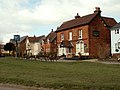
 "The Fox and Duck" public house - geograph.org.uk - 4091543.jpg 688 × 600; 172 KB
-
-
 A field of rather flattened oats - geograph.org.uk - 507132.jpg 640 × 480; 99 KB
-

-

-
 A10 heading north - geograph.org.uk - 5678309.jpg 640 × 428; 83 KB
-
 A10 heading north - geograph.org.uk - 5678310.jpg 640 × 428; 101 KB
-
 A10 heading north - geograph.org.uk - 5678311.jpg 640 × 428; 119 KB
-
 A10 heading north - geograph.org.uk - 5678312.jpg 640 × 428; 103 KB
-
 A10 heading north - geograph.org.uk - 5678315.jpg 640 × 428; 131 KB
-
 A10, Buckland - geograph.org.uk - 4784597.jpg 640 × 426; 52 KB
-
 A10, Ermine Street - geograph.org.uk - 4784588.jpg 640 × 426; 29 KB
-
 A10, Reed - geograph.org.uk - 4784574.jpg 640 × 426; 62 KB
-
 A10, southbound - geograph.org.uk - 4784562.jpg 640 × 426; 79 KB
-
 A10, southbound - geograph.org.uk - 4784564.jpg 640 × 426; 47 KB
-
 A10, southbound - geograph.org.uk - 4784565.jpg 640 × 426; 40 KB
-
 A10, southbound - geograph.org.uk - 4784571.jpg 640 × 426; 53 KB
-
 A10, southbound - geograph.org.uk - 4784578.jpg 640 × 384; 52 KB
-
 A10, southbound - geograph.org.uk - 4784582.jpg 640 × 426; 38 KB
-
 A505 - geograph.org.uk - 5203171.jpg 640 × 426; 44 KB
-
 A505 - geograph.org.uk - 5203172.jpg 640 × 426; 38 KB
-

-
 A505 heading north-east - geograph.org.uk - 5683392.jpg 640 × 428; 86 KB
-
 A505 heading north-east - geograph.org.uk - 5683398.jpg 640 × 428; 94 KB
-
 A505 heading north-east - geograph.org.uk - 5683413.jpg 640 × 428; 83 KB
-

-
 Across the Green at Therfield, Herts - geograph.org.uk - 2872325.jpg 640 × 425; 66 KB
-
 Another hand car wash - geograph.org.uk - 3023679.jpg 2,560 × 1,920; 1.06 MB
-

-
 Autumn sown crop - geograph.org.uk - 4208980.jpg 1,600 × 1,200; 893 KB
-
 Baldock Road - geograph.org.uk - 1994264.jpg 640 × 480; 61 KB
-
 Baldock Road entering Royston - geograph.org.uk - 5782406.jpg 2,048 × 1,536; 1.49 MB
-
 Blue sky, green fields, red machinery - geograph.org.uk - 4781409.jpg 1,024 × 731; 912 KB
-
 Building work at Reed End Farm - geograph.org.uk - 4780603.jpg 1,024 × 732; 1,016 KB
-
 Buntingford from the air - geograph.org.uk - 5462060.jpg 3,264 × 2,448; 3.31 MB
-
 Candy Floss Stall - geograph.org.uk - 4029140.jpg 1,600 × 1,200; 818 KB
-
 Chain Walk (or Duck's Green) - geograph.org.uk - 4208650.jpg 1,600 × 1,200; 1.08 MB
-
 Chain Walk - geograph.org.uk - 1507956.jpg 480 × 640; 268 KB
-
 Chain Walk - geograph.org.uk - 1507979.jpg 480 × 640; 205 KB
-
 Chain Walk - geograph.org.uk - 4208632.jpg 1,600 × 1,380; 1.02 MB
-
 Church of St Mary the Virgin, Therfield - geograph.org.uk - 5072993.jpg 1,600 × 1,216; 444 KB
-
 Cottages, Therfield - geograph.org.uk - 4527687.jpg 4,320 × 3,240; 4.4 MB
-
 Disused chalk pit - geograph.org.uk - 1507994.jpg 640 × 480; 218 KB
-
 Ditch between fields - geograph.org.uk - 4209095.jpg 1,600 × 1,200; 911 KB
-
 Duckpuddle Bush and Pantile Farm - geograph.org.uk - 91949.jpg 640 × 482; 93 KB
-
 East of the Icknield Way Trail - geograph.org.uk - 4781447.jpg 1,024 × 732; 979 KB
-
 East or West^ - geograph.org.uk - 2426747.jpg 1,024 × 768; 175 KB
-
 Entering Buckland on the A10 - geograph.org.uk - 4784593.jpg 640 × 426; 48 KB
-

-
 Ermine Street, Buckland - geograph.org.uk - 5587055.jpg 2,048 × 1,536; 866 KB
-
 Farm land near to Therfield - geograph.org.uk - 3445573.jpg 4,320 × 3,240; 4.5 MB
-

-
 Farm track off Kelshall Lane - geograph.org.uk - 4208637.jpg 1,600 × 1,200; 728 KB
-
 Farm track, as seen from the A.10 - geograph.org.uk - 459633.jpg 640 × 412; 51 KB
-
 Fields by Icknield Way - geograph.org.uk - 4208971.jpg 1,600 × 1,200; 759 KB
-
 Fields by Icknield Way - geograph.org.uk - 4208987.jpg 1,600 × 1,200; 656 KB
-
 Fields north of Therfield - geograph.org.uk - 2828820.jpg 2,592 × 1,944; 931 KB
-
 Fishing at lake near Slate Hall farm - geograph.org.uk - 3445505.jpg 4,320 × 3,240; 5.02 MB
-
 Five House Farm Barns - geograph.org.uk - 261622.jpg 640 × 480; 42 KB
-
 Footpath across field - geograph.org.uk - 4209079.jpg 1,600 × 1,200; 826 KB
-
 Footpath across tilled field - geograph.org.uk - 4208676.jpg 1,600 × 1,200; 790 KB
-
 Footpath away from Buckland - geograph.org.uk - 4209063.jpg 1,600 × 1,200; 607 KB
-
 Footpath bridge - geograph.org.uk - 4208679.jpg 1,600 × 1,200; 897 KB
-
 Footpath by Brandish Wood - geograph.org.uk - 4208749.jpg 1,600 × 1,343; 796 KB
-
 Footpath from Buckland - geograph.org.uk - 4209097.jpg 1,600 × 1,200; 599 KB
-
 Footpath to Brandish Wood - geograph.org.uk - 4208754.jpg 1,600 × 1,200; 789 KB
-
 Footpath to Brandish Wood - geograph.org.uk - 4209086.jpg 1,600 × 1,107; 628 KB
-
 Footpath to Chapel Green - geograph.org.uk - 4208693.jpg 1,600 × 1,200; 729 KB
-
 Footpath to Chapel Green - geograph.org.uk - 4208762.jpg 1,600 × 1,200; 1.03 MB
-
 Footpath to Therfield - geograph.org.uk - 4208654.jpg 1,600 × 1,200; 785 KB
-
 Footpath to Therfield - geograph.org.uk - 4208655.jpg 1,600 × 1,200; 747 KB
-
 Ford at Chapel Green - geograph.org.uk - 3373855.jpg 3,872 × 2,592; 2.37 MB
-
 Fordhams Wood - geograph.org.uk - 91947.jpg 640 × 482; 109 KB
-
 Former inn, The Horse and Groom - geograph.org.uk - 5964676.jpg 1,600 × 1,142; 734 KB
-
 Fox Covert Nature Reserve - geograph.org.uk - 272933.jpg 640 × 480; 134 KB
-
 Fox ^ Duck pub - geograph.org.uk - 4056931.jpg 3,648 × 2,736; 2.65 MB
-
 GOC Royston 001 Therfield Heath (29025954313).jpg 4,061 × 3,046; 4.19 MB
-
 GOC Royston 002 Therfield Heath (29569039791).jpg 4,288 × 3,216; 4.23 MB
-
 GOC Royston 003 Therfield Heath (29025955803).jpg 4,288 × 3,216; 4.36 MB
-
 GOC Royston 004 Therfield Heath (29025956483).jpg 4,288 × 3,216; 4.24 MB
-
 GOC Royston 005 View from Therfield Heath (29025957023).jpg 4,288 × 3,216; 3.79 MB
-
 GOC Royston 006 Therfield Heath (29045322384).jpg 4,149 × 3,115; 3.73 MB
-
 GOC Royston 007 Therfield Heath (29636262836).jpg 4,288 × 3,216; 4.4 MB
-
 GOC Royston 008 Therfield Heath (29047204233).jpg 4,288 × 3,216; 4.19 MB
-
 GOC Royston 009 Therfield Heath (29047205053).jpg 4,288 × 3,216; 4.68 MB
-
 GOC Royston 010 McDonald's (29047205743).jpg 3,602 × 2,711; 2.25 MB
-
 GOC Therfield 001 Hay Farm House, Therfield (49300284043).jpg 3,931 × 2,953; 3.37 MB
-
 GOC Therfield 002 The Grange, Therfield (49300283863).jpg 4,608 × 3,456; 4.6 MB
-
 GOC Therfield 004 Haywood House, Therfield (49300770371).jpg 3,519 × 2,636; 2.99 MB
-
 GOC Therfield 005 Pond (49300770211).jpg 4,608 × 3,456; 5.5 MB
-
 GOC Therfield 013 Pond (49304717057).jpg 4,608 × 3,456; 5.38 MB
-
 GOC Therfield 015 Rose Cottage, Therfield (49304507041).jpg 3,911 × 2,941; 3.48 MB
-
 GOC Therfield 016 Reed End (49304506906).jpg 3,796 × 2,853; 4.09 MB
-
 GOC Therfield 017 Greenacres, Therfield (49304017363).jpg 3,939 × 2,954; 4.1 MB
-
 GOC Therfield 018 White Horse Cottage, Therfield (49309669311).jpg 4,219 × 3,167; 4.76 MB
-
 GOC Therfield 019 Mardleybury Manor, Therfield (49309669806).jpg 3,642 × 2,734; 3.55 MB
-
 GOC Therfield 020 Mardleybury Manor, Therfield (49309870472).jpg 3,072 × 2,304; 2.5 MB
-
 GOC Therfield 021 28-29 Reed End, Therfield (49309884147).jpg 3,593 × 2,697; 3.27 MB
-
 GOC Therfield 022 Cooper's Cottage, Therfield (49309164573).jpg 3,884 × 2,914; 3.9 MB
-
 GOC Therfield 023 Reed End Farm, Therfield (49314566923).jpg 3,898 × 2,928; 3.59 MB
-
 GOC Therfield 026 Pond (49315068491).jpg 4,608 × 3,456; 4.97 MB
-
 GOC Therfield 027 Pond (49314566723).jpg 4,608 × 3,456; 5.61 MB
-
 GOC Therfield 028 Dane End Cottage, Therfield (49315061331).jpg 3,583 × 2,686; 3.41 MB
-
 GOC Therfield 031 Landscape (49323411546).jpg 4,608 × 3,456; 6.3 MB
-
 GOC Therfield 032 Landscape (49323410081).jpg 4,608 × 3,456; 6.07 MB
-
 GOC Therfield 034 Farm stuff (49322920333).jpg 4,608 × 3,456; 5.32 MB
-
 GOC Therfield 035 Muddy field (49323611977).jpg 4,608 × 3,456; 5.78 MB
-
 GOC Therfield 039 Landscape (49328567643).jpg 4,608 × 3,456; 5.62 MB
-
 GOC Therfield 041 St Mary's Church, Therfield (49329259307).jpg 3,131 × 4,183; 4.61 MB
-
 GOC Therfield 042 Turner Monument, Therfield (49329258682).jpg 4,147 × 3,110; 3.89 MB
-
 GOC Therfield 057 Fox & Duck, Therfield (interior) (49328565658).jpg 4,608 × 3,456; 4.28 MB
-
 GOC Therfield 060 Fox & Duck, Therfield (interior) (49333443536).jpg 4,608 × 3,456; 4.54 MB
-
 GOC Therfield 062 Fox & Duck, Therfield (interior) (49333664342).jpg 4,608 × 3,456; 5.05 MB
-
 GOC Therfield 063 Fox & Duck, Therfield (49332975808).jpg 3,654 × 2,737; 3.56 MB
-
 GOC Therfield 064 Fox & Duck, Therfield (49333663267).jpg 4,290 × 3,226; 4.34 MB
-
 GOC Therfield to Sandon 001 Fox and Duck, Therfield (32074206564).jpg 3,961 × 2,976; 3.2 MB
-
 GOC Therfield to Sandon 003 Notley Lane, Kelshall Therfield border (32074207504).jpg 4,288 × 3,216; 4.47 MB
-
 GOC Therfield to Sandon 005 Tichney, Green End, Sandon (32074208154).jpg 4,017 × 3,020; 3.51 MB
-
 GOC Therfield to Sandon 007 Blagrove, Green End, Sandon (32074209324).jpg 4,288 × 2,690; 3.41 MB
-
 GOC Therfield to Sandon 008 Blagrove Common, Sandon (32828350961).jpg 4,143 × 3,109; 4.21 MB
-
 GOC Therfield to Sandon 009 Blagrove Common, Sandon (32828351741).jpg 4,149 × 3,115; 4.43 MB
-
 GOC Therfield to Sandon 011 Blagrove Common, Sandon (32828352821).jpg 4,181 × 3,140; 3.97 MB
-
 GOC Therfield to Sandon 013 Blagrove Common, Sandon (32952698085).jpg 4,137 × 3,102; 3.87 MB
-
 GOC Therfield to Sandon 015 Roe Green, Sandon (32798886072).jpg 4,288 × 3,216; 4.23 MB
-
 GOC Therfield to Sandon 016 Roe Green, Sandon (32863942331).jpg 4,288 × 3,216; 4.4 MB
-
 GOC Therfield to Sandon 020 The Old Anchor, Roe Green, Sandon (32863954691).jpg 3,923 × 2,951; 3.62 MB
-
 GOC Therfield to Sandon 023 Wrest Cottage, Sandon (32863958331).jpg 3,677 × 2,755; 2.68 MB
-
 GOC Therfield to Sandon 025 Sandon village sign (32607581020).jpg 2,607 × 1,961; 1.72 MB
-
 GOC Therfield to Sandon 027 Old Sextons, Sandon (32627437790).jpg 3,904 × 2,933; 3.15 MB
-
 GOC Therfield to Sandon 029 Old Sextons, Sandon (32627438090).jpg 3,898 × 2,933; 3.3 MB
-
 GOC Therfield to Sandon 030 All Saints' Church, Sandon (32853888002).jpg 3,620 × 2,717; 2.86 MB
-
 GOC Therfield to Sandon 031 All Saints' Church, Sandon (32853888302).jpg 3,216 × 4,288; 3.74 MB
-
 GOC Therfield to Sandon 032 Old Sextons, Sandon (32853888552).jpg 3,526 × 2,649; 2.87 MB
-
 GOC Therfield to Sandon 033 All Saints' Church, Sandon (32687754200).jpg 4,288 × 3,216; 4.49 MB
-
 GOC Therfield to Sandon 034 All Saints' Church, Sandon (32687754510).jpg 4,111 × 2,569; 3.09 MB
-
 GOC Therfield to Sandon 035 Sandon sign (32687754730).jpg 3,412 × 2,567; 2.64 MB
-
 GOC Therfield to Sandon 036 Pond, Kelshall (32913501992).jpg 4,061 × 3,045; 3.65 MB
-
 GOC Therfield to Sandon 039 St Faith's Church, Kelshall (32913502312).jpg 3,892 × 2,920; 3.41 MB
-
 GOC Therfield to Sandon 040 Lychgate of St Faith's Church, Kelshall (32727349450).jpg 3,789 × 2,850; 3.09 MB
-
 GOC Therfield to Sandon 041 Broken medieval churchyard cross, Kelshall (32953439572).jpg 4,288 × 3,216; 4.03 MB
-
 GOC Therfield to Sandon 042 St Faith's Church, Kelshall (32953445642).jpg 4,288 × 3,216; 4.37 MB
-
 GOC Therfield to Sandon 044 The Old Rectory, Kelshall (32953450242).jpg 3,980 × 2,988; 3.41 MB
-
 GOC Therfield to Sandon 045 Kelshall (32982929901).jpg 3,747 × 2,812; 2.97 MB
-

-
 GOC Therfield to Sandon 049 The Old Crown, Kelshall (32747068940).jpg 3,910 × 2,939; 3.55 MB
-
 GOC Therfield to Sandon 050 Kelshall village library (32747073600).jpg 2,939 × 3,935; 3.24 MB
-
 GOC Therfield to Sandon 052 The Grange, Kelshall (32747078780).jpg 4,156 × 3,121; 3.74 MB
-
 GOC Therfield to Sandon 053 Foxhall Cottage, Kelshall (32972999852).jpg 3,835 × 2,882; 3.1 MB
-
 GOC Therfield to Sandon 054 Fox Hall, Kelshall (33106445556).jpg 3,910 × 2,939; 3.2 MB
-
 GOC Therfield to Sandon 055 Fox Hall, Kelshall (33148012945).jpg 3,255 × 2,441; 2.17 MB
-
 GOC Therfield to Sandon 056 Village pond, Kelshall (33148013715).jpg 3,891 × 2,926; 3.15 MB
-
 GOC Therfield to Sandon 058 The Gables, Kelshall (33148014415).jpg 3,923 × 2,951; 3.61 MB
-
 GOC Therfield to Sandon 059 Water tower, Therfield (33146059046).jpg 4,288 × 3,216; 4.6 MB
-
 GOC Therfield to Sandon 060 St Mary's Church, Therfield (33146059936).jpg 4,080 × 3,058; 4.05 MB
-
 GOC Therfield to Sandon 061 St Mary's Church, Therfield (33146060766).jpg 2,855 × 3,809; 3.66 MB
-
 GOC Therfield to Sandon 062 Turner monument, Therfield (32372634923).jpg 3,986 × 2,989; 3.42 MB
-
 GOC Therfield to Sandon 063 Old School House, Therfield (32805359710).jpg 3,400 × 2,554; 2.34 MB
-
 GOC Therfield to Sandon 064 Church Gate, Therfield (33230654255).jpg 4,042 × 3,034; 3.36 MB
-
 GOC Therfield to Sandon 065 Church Cottage, Therfield (32415560233).jpg 3,823 × 2,869; 3.38 MB
-
 GOC Therfield to Sandon 066 The Firs, Therfield (32415563053).jpg 3,967 × 2,976; 3.62 MB
-
 GOC Therfield to Sandon 067 The Limes, Therfield (32386386194).jpg 4,288 × 3,216; 3.88 MB
-
 GOC Therfield to Sandon 068 Hope Cottages, Therfield (32447449533).jpg 4,194 × 3,147; 3.75 MB
-
 GOC Therfield to Sandon 069 Suffolk House, Therfield (32447457053).jpg 3,476 × 2,610; 2.59 MB
-
 GOC Therfield to Sandon 070 Vixen Cottage, Therfield (32447463793).jpg 3,746 × 2,812; 2.95 MB
-
 GOC Therfield to Sandon 072 Fox & Duck, Therfield (32447469113).jpg 3,860 × 2,907; 3.13 MB
-
 Golfer on Therfield Heath - geograph.org.uk - 3445671.jpg 4,320 × 3,240; 4.76 MB
-
 Hay Green - geograph.org.uk - 3445536.jpg 4,320 × 3,240; 4.44 MB
-
 Hay Green Cottage - geograph.org.uk - 389584.jpg 640 × 422; 63 KB
-
 Hay Green on New Year's Eve - geograph.org.uk - 4780650.jpg 1,024 × 682; 825 KB
-
 Holborn Farm, near to Reed End, Herts. - geograph.org.uk - 261636.jpg 640 × 480; 142 KB
-
 Horse and Groom - still derelict - geograph.org.uk - 2440038.jpg 640 × 415; 36 KB
-
 Horse ^ Groom - Baldock Road - geograph.org.uk - 5516670.jpg 640 × 480; 102 KB
-
 House on Hay Green, Therfield - geograph.org.uk - 3144652.jpg 640 × 425; 73 KB
-

-
 Icknield Way - geograph.org.uk - 4208975.jpg 1,600 × 1,200; 1.08 MB
-
 Icknield Way - geograph.org.uk - 4208979.jpg 1,600 × 1,200; 1.04 MB
-
 Icknield Way - geograph.org.uk - 4208984.jpg 1,600 × 1,200; 815 KB
-
 Icknield Way - geograph.org.uk - 4208989.jpg 1,600 × 1,200; 752 KB
-
 Icknield Way - geograph.org.uk - 4208995.jpg 1,600 × 1,200; 1,008 KB
-
 Icknield Way near Therfield - geograph.org.uk - 31172.jpg 640 × 480; 108 KB
-
 Icknield Way path (5019357160).jpg 2,640 × 1,980; 822 KB
-
 Impressive entrance to Reed End Farm - geograph.org.uk - 2870872.jpg 640 × 425; 106 KB
-
 Industrial area in Royston - geograph.org.uk - 5783722.jpg 1,930 × 1,362; 1.12 MB
-
 Johnson Matthey site with kites - geograph.org.uk - 5066041.jpg 1,024 × 768; 157 KB
-
 Junction on The Causeway, Therfield - geograph.org.uk - 5790169.jpg 2,008 × 1,480; 1.54 MB
-

-
 Kings Ride - geograph.org.uk - 4166721.jpg 640 × 360; 37 KB
-
 Lay-by on A505 - geograph.org.uk - 5964684.jpg 1,600 × 1,200; 680 KB
-
 Layby on the A505 - geograph.org.uk - 2440044.jpg 640 × 406; 29 KB
-
 Litlington turning off the A505 - geograph.org.uk - 2439515.jpg 640 × 420; 37 KB
-
 London Rd, A10 - geograph.org.uk - 4784563.jpg 640 × 426; 33 KB
-
 Looking across Therfield Hill - geograph.org.uk - 5783723.jpg 1,898 × 1,306; 1.02 MB
-

-

-

-

-
 Maize cover crop - geograph.org.uk - 4208751.jpg 1,600 × 1,236; 935 KB
-
 No more beer - geograph.org.uk - 2747903.jpg 640 × 429; 34 KB
-
 North Herts to North Essex - geograph.org.uk - 4781420.jpg 1,024 × 732; 878 KB
-
 Oats - geograph.org.uk - 3024975.jpg 2,560 × 1,920; 1.02 MB


_-_geograph.org.uk_-_4208650.jpg)


.jpg)
.jpg)
.jpg)
.jpg)
.jpg)
.jpg)
.jpg)
.jpg)
.jpg)
.jpg)
.jpg)
.jpg)
.jpg)
.jpg)
.jpg)
.jpg)
.jpg)
.jpg)
.jpg)
.jpg)
.jpg)
.jpg)
.jpg)
.jpg)
.jpg)
.jpg)
.jpg)
.jpg)
.jpg)
.jpg)
.jpg)
.jpg)
.jpg)
.jpg)
_(49328565658).jpg)
_(49333443536).jpg)
_(49333664342).jpg)
.jpg)
.jpg)
.jpg)
.jpg)
.jpg)
.jpg)
.jpg)
.jpg)
.jpg)
.jpg)
.jpg)
.jpg)
.jpg)
.jpg)
.jpg)
.jpg)
.jpg)
.jpg)
.jpg)
.jpg)
.jpg)
.jpg)
.jpg)
.jpg)
.jpg)
.jpg)
.jpg)
.jpg)
.jpg)
.jpg)
.jpg)
.jpg)
.jpg)
.jpg)
.jpg)
.jpg)
.jpg)
.jpg)
.jpg)
.jpg)
.jpg)
.jpg)
.jpg)
.jpg)
.jpg)
.jpg)
.jpg)
.jpg)
.jpg)
.jpg)
.jpg)
.jpg)


.jpg)


