Category:The Pyg Track
Jump to navigation
Jump to search

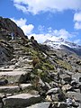
The Pyg Track is the shortest and least steep pathway up Snowdon.
Media in category "The Pyg Track"
The following 198 files are in this category, out of 198 total.
-
 A level section of the Pyg Track - geograph.org.uk - 445691.jpg 640 × 480; 99 KB
-

-
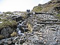
 A stream by the PYG track - geograph.org.uk - 769897.jpg 480 × 640; 270 KB
-

-

-
 A view down the Zig-Zag path in the mist - geograph.org.uk - 1173690.jpg 640 × 480; 107 KB
-
 A view east along part of the Pyg Track - geograph.org.uk - 1190069.jpg 640 × 480; 159 KB
-

-

-
-

-
 A view of Crib Goch from the Pyg track - geograph.org.uk - 770636.jpg 480 × 640; 213 KB
-
 A view of the Glyderau from the Pyg track - geograph.org.uk - 768901.jpg 640 × 480; 187 KB
-

-
 A view towards Glaslyn from the Pyg track - geograph.org.uk - 774395.jpg 480 × 640; 208 KB
-
 A view up the Zig-Zag path - geograph.org.uk - 1173731.jpg 640 × 480; 98 KB
-

-
-
 A walk up the Pyg track - a narrow path - geograph.org.uk - 772988.jpg 480 × 640; 205 KB
-
 A walk up the Pyg track - a rocky section - geograph.org.uk - 768878.jpg 640 × 480; 222 KB
-
-

-

-

-

-

-
 A walk up the Pyg track - bags of rocks - geograph.org.uk - 773267.jpg 640 × 480; 222 KB
-

-

-

-
 A walk up the Pyg track - glaciated rocks - geograph.org.uk - 772997.jpg 640 × 480; 236 KB
-
 A walk up the Pyg track - in the snow - geograph.org.uk - 773357.jpg 640 × 480; 197 KB
-
-

-
 A walk up the Pyg track - level again - geograph.org.uk - 768825.jpg 640 × 480; 210 KB
-
 A walk up the Pyg track - losing height - geograph.org.uk - 768875.jpg 480 × 640; 218 KB
-

-
 A walk up the Pyg track - on the level - geograph.org.uk - 772358.jpg 480 × 640; 205 KB
-

-

-

-

-
 A walk up the Pyg track - the only stiles - geograph.org.uk - 772140.jpg 640 × 480; 177 KB
-

-

-

-

-
-
 A welcome sight - geograph.org.uk - 275260.jpg 480 × 640; 140 KB
-
 Approaching the rim - geograph.org.uk - 1534480.jpg 476 × 640; 63 KB
-
-

-

-
 Crib Goch - geograph.org.uk - 1022218.jpg 640 × 480; 201 KB
-
 Crib Goch ridge from the Pyg track - geograph.org.uk - 774310.jpg 640 × 480; 105 KB
-

-

-

-
 Descending the PYG Track - geograph.org.uk - 1214177.jpg 640 × 446; 100 KB
-
 Dinas Cromlech.JPG 2,112 × 2,816; 1.06 MB
-
 Dodgy descent - geograph.org.uk - 451997.jpg 640 × 595; 212 KB
-
 Gabions by the Pyg track - geograph.org.uk - 1173641.jpg 640 × 480; 210 KB
-
 Gaeaf yr Wyddfa.jpg 4,608 × 2,592; 2.63 MB
-
 Garnedd Ugain from the Pyg track - geograph.org.uk - 1174598.jpg 640 × 480; 193 KB
-
 Glaciated rocks by the Pyg track - geograph.org.uk - 774422.jpg 640 × 480; 209 KB
-

-
 Glaslyn - geograph.org.uk - 1022199.jpg 640 × 480; 174 KB
-
 Glaslyn - geograph.org.uk - 47859.jpg 640 × 316; 52 KB
-
 Glaslyn and Llyn Llydaw - geograph.org.uk - 887375.jpg 640 × 480; 83 KB
-
 Glaslyn and the Miners' Track - geograph.org.uk - 1615810.jpg 640 × 480; 75 KB
-

-
 Glaslyn comes into view - geograph.org.uk - 886403.jpg 640 × 480; 58 KB
-
 Glaslyn from the Pyg Track - geograph.org.uk - 1616000.jpg 640 × 480; 63 KB
-
 Glaslyn from the Pyg Track - geograph.org.uk - 531711.jpg 640 × 483; 139 KB
-
 Glaslyn from the Pyg track - geograph.org.uk - 887368.jpg 640 × 480; 73 KB
-

-
 Head of the Llanberis Pass - geograph.org.uk - 748380.jpg 1,000 × 671; 398 KB
-
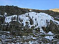
 Ice formations on the Pyg track - geograph.org.uk - 701764.jpg 480 × 640; 195 KB
-
 Llanberis Pass - geograph.org.uk - 748386.jpg 1,000 × 668; 415 KB
-
 Llanberis pass from the pyg track - geograph.org.uk - 827478.jpg 640 × 427; 104 KB
-

-
 Llyn Cwmffynnon - geograph.org.uk - 1295565.jpg 640 × 480; 77 KB
-

-
 Llyn Glaslyn from the Pyg Track - geograph.org.uk - 445456.jpg 640 × 480; 144 KB
-
 Llyn Llydaw - geograph.org.uk - 1022208.jpg 640 × 480; 182 KB
-
 Llyn Llydaw from the Pyg Track - geograph.org.uk - 445716.jpg 640 × 480; 106 KB
-
 Llyn Llydaw from the Pyg track - geograph.org.uk - 748416.jpg 1,000 × 666; 319 KB
-

-
 Low mist in the Llanberis Pass - geograph.org.uk - 99972.jpg 640 × 480; 107 KB
-
 Mountain railway - geograph.org.uk - 1022194.jpg 640 × 480; 171 KB
-

-
 Pen y Pass - geograph.org.uk - 1295603.jpg 640 × 480; 110 KB
-
 Pen-y-Pass - geograph.org.uk - 531589.jpg 640 × 479; 128 KB
-

-
 Pen-Y-Pass Youth Hostel - geograph.org.uk - 885210.jpg 640 × 480; 93 KB
-
 Pen-Y-Pass Youth Hostel - geograph.org.uk - 885215.jpg 640 × 480; 94 KB
-
 Pen-Y-Pass Youth Hostel - geograph.org.uk - 892266.jpg 640 × 480; 81 KB
-
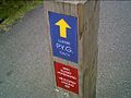
 Pyg Track marker post - geograph.org.uk - 275783.jpg 480 × 640; 109 KB
-
 Pyg Track Snowdon.jpg 1,612 × 2,702; 1.36 MB
-
 Rock outcrop by The Pyg Track - geograph.org.uk - 3201310.jpg 640 × 430; 73 KB
-
 Rocky knoll to one side of the Pyg Track - geograph.org.uk - 1112943.jpg 640 × 480; 102 KB
-
 Snow 'sculptures' above the Pyg track - geograph.org.uk - 1173785.jpg 640 × 480; 115 KB
-
 Snow and mist on the Pyg track - geograph.org.uk - 1173633.jpg 640 × 480; 128 KB
-
 Snowdon and Glaslyn from the Pyg track - geograph.org.uk - 737498.jpg 487 × 640; 107 KB
-
 Snowdon from the Pyg Track - geograph.org.uk - 1638224.jpg 640 × 480; 89 KB
-
 Snowdon Wishing post.jpg 3,840 × 2,160; 3.54 MB
-
 Start of a route up Crib Goch - geograph.org.uk - 886398.jpg 640 × 480; 72 KB
-
 Steps on the Pyg Track - geograph.org.uk - 1190064.jpg 640 × 480; 194 KB
-
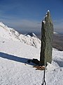
 Stone Obelisk, Snowdon - geograph.org.uk - 531272.jpg 480 × 640; 129 KB
-
 The A4086 from the Cwmffynnon Ridge - geograph.org.uk - 244822.jpg 640 × 480; 103 KB
-

-

-
 The departure of the more intrepid - geograph.org.uk - 445671.jpg 640 × 480; 104 KB
-

-
 The great curve above Llyn Glaslyn - geograph.org.uk - 452022.jpg 640 × 471; 139 KB
-
 The icy Pyg Track and Crib Goch - geograph.org.uk - 1187121.jpg 640 × 480; 129 KB
-
 The initial stage of the Pyg Track - geograph.org.uk - 1495996.jpg 640 × 469; 82 KB
-
 The Llanberis Pass from the PYG track - geograph.org.uk - 768802.jpg 640 × 480; 175 KB
-
 The Llanberis Pass from the Pyg track ^2 - geograph.org.uk - 768838.jpg 640 × 480; 178 KB
-

-
 The obelisk at Bwlch Glas - geograph.org.uk - 1174676.jpg 640 × 480; 150 KB
-
 The Pyg track - geograph.org.uk - 1022242.jpg 640 × 480; 193 KB
-
 The Pyg Track - geograph.org.uk - 3201305.jpg 640 × 430; 76 KB
-
 The Pyg Track - geograph.org.uk - 3201317.jpg 640 × 430; 56 KB
-
 The Pyg track - geograph.org.uk - 748429.jpg 1,000 × 669; 411 KB
-
 The Pyg track - geograph.org.uk - 885238.jpg 640 × 480; 93 KB
-
 The Pyg track - geograph.org.uk - 886407.jpg 640 × 480; 94 KB
-

-

-

-
 The Pyg Track below Bwlch y Moch - geograph.org.uk - 262698.jpg 640 × 445; 104 KB
-
 The Pyg Track below Crib Goch - geograph.org.uk - 278196.jpg 640 × 427; 56 KB
-
 The PYG Track on Snowdon - geograph.org.uk - 33612.jpg 640 × 480; 131 KB
-
 The Pyg track towards Bwlch Glas - geograph.org.uk - 1173769.jpg 640 × 480; 87 KB
-
 The Pyg track towards Bwlch Glas - geograph.org.uk - 1173833.jpg 640 × 480; 195 KB
-
 The Pyg Track towards Bwlch y Moch - geograph.org.uk - 1187404.jpg 640 × 480; 168 KB
-
 The Pyg track up to the obelisk - geograph.org.uk - 1174649.jpg 480 × 640; 163 KB
-

-
 The Pyg track. - geograph.org.uk - 885221.jpg 640 × 480; 72 KB
-

-
 The start of the Crib Goch path - geograph.org.uk - 1022228.jpg 640 × 480; 229 KB
-
-
 The Summit Ridge Snowdon.jpg 2,592 × 1,944; 426 KB
-
 The top of the Pyg Track - geograph.org.uk - 278222.jpg 640 × 480; 132 KB
-
 The Upper Pyg Track on Snowdon - geograph.org.uk - 217355.jpg 582 × 640; 105 KB
-
 The way to Crib Goch - geograph.org.uk - 1018722.jpg 640 × 480; 74 KB
-

-
 The Zig-Zags below Bwlch Glas - geograph.org.uk - 1498745.jpg 640 × 480; 103 KB
-

-
 To Glaslyn on the Miners' Track - geograph.org.uk - 531715.jpg 640 × 480; 167 KB
-
 Top of the Zig-Zag on the Pyg Track - geograph.org.uk - 254145.jpg 640 × 474; 78 KB
-
 Towards Crib Goch - geograph.org.uk - 531701.jpg 640 × 462; 111 KB
-

-
 Two cairns on the Pyg Track - geograph.org.uk - 1190093.jpg 640 × 480; 187 KB
-
 View along the Pyg track towards Glaslyn - geograph.org.uk - 1173659.jpg 640 × 480; 160 KB
-
 View down the Llanberis Pass - geograph.org.uk - 1187106.jpg 640 × 480; 131 KB
-

-

-

-
 View from Bwlch y Moch - geograph.org.uk - 1187357.jpg 640 × 480; 144 KB
-
 View from Llanberis Pass.jpg 3,026 × 2,210; 5.34 MB
-
 View from the Pyg track towards Glaslyn - geograph.org.uk - 1173805.jpg 640 × 480; 162 KB
-
 View north from the Pyg track - geograph.org.uk - 1022235.jpg 640 × 480; 192 KB
-

-

-
 View towards Crib Goch - geograph.org.uk - 1071633.jpg 421 × 640; 98 KB
-
 View towards Crib Goch - geograph.org.uk - 748394.jpg 1,000 × 696; 343 KB
-
 View towards Garnedd Ugain and Crib Goch - geograph.org.uk - 1490189.jpg 640 × 480; 146 KB
-

-
 View towards Pen y Pass - geograph.org.uk - 748404.jpg 1,000 × 668; 257 KB
-
 View up to Bwlch Glas from the Pyg track - geograph.org.uk - 1174607.jpg 640 × 480; 159 KB
-
 View up to the Crib Goch ridge - geograph.org.uk - 1190056.jpg 640 × 480; 174 KB
-
 Welsh Primitive Goat, Snowden.jpg 4,160 × 3,120; 4.74 MB
-
 Y Lliwedd - geograph.org.uk - 962085.jpg 640 × 480; 88 KB
-
 Y Lliwedd from the Pyg track - geograph.org.uk - 1194922.jpg 640 × 480; 60 KB
-
 A walk up the Pyg track - looking ahead - geograph.org.uk - 773353.jpg 640 × 480; 227 KB
-

-
 A walk up the Pyg track - warning sign - geograph.org.uk - 768593.jpg 480 × 640; 153 KB
-
 Bags of rocks by the Pyg track - geograph.org.uk - 774350.jpg 640 × 480; 177 KB
-
 Clogwyn y Garnedd from the Pyg Track - geograph.org.uk - 445737.jpg 640 × 480; 83 KB
-
 Fferm Gwastadannas Farm - geograph.org.uk - 395368.jpg 640 × 480; 78 KB
-
 Grib Goch from the Pyg Track - geograph.org.uk - 262706.jpg 640 × 436; 81 KB
-
 Ice flow alongside the Pyg Track - geograph.org.uk - 275081.jpg 640 × 480; 165 KB
-
 Ice Formation below Crib y Ddysgl - geograph.org.uk - 275094.jpg 640 × 480; 202 KB
-
 Intrepid Walkers at Bwlch y Moch - geograph.org.uk - 262552.jpg 640 × 461; 71 KB
-

-
 Lliwedd and Glaslyn - geograph.org.uk - 275163.jpg 640 × 480; 146 KB
-
 Llyn Llydaw from the Pyg Track - geograph.org.uk - 262617.jpg 640 × 435; 82 KB
-

-
 Zoom shot of Glaslyn - geograph.org.uk - 962091.jpg 640 × 480; 75 KB
-
 Path to Snowdon from Glaslyn - geograph.org.uk - 531721.jpg 640 × 469; 193 KB
-

-

-

-
 Spoil Tips below Elidir Fawr - geograph.org.uk - 276449.jpg 640 × 457; 79 KB
-
 The Cavalry arrive - Yr Wyddfa-Snowdon - geograph.org.uk - 275251.jpg 640 × 480; 168 KB
-
 The Horns from the Pyg Track - geograph.org.uk - 262734.jpg 640 × 432; 87 KB
-


_-_geograph.org.uk_-_1614732.jpg)


_-_geograph.org.uk_-_1383.jpg)


_monitoring_site_-_geograph.org.uk_-_84493.jpg)


