Category:The Fox Way, Surrey
Jump to navigation
Jump to search
The Fox Way ia a 39-mile circuit of walks around Guildford, Surrey.
Subcategories
This category has the following 5 subcategories, out of 5 total.
Media in category "The Fox Way, Surrey"
The following 15 files are in this category, out of 15 total.
-
 Albury, Fox Way, Broomfields Wood.jpg 3,000 × 1,995; 2.8 MB
-
 Albury, Fox Way, View from Broomfields towards Brook.jpg 3,000 × 1,995; 1.27 MB
-
 Blackheath, The Fox Way.jpg 4,000 × 2,660; 2.98 MB
-
 Fox Way, crossing A3 at Eashing.jpg 2,000 × 1,333; 1.33 MB
-
 Fox Way, Eashing Bridge.jpg 3,000 × 1,995; 2.42 MB
-
 Fox Way, Leapingbar Copse.jpg 3,000 × 1,995; 2.66 MB
-
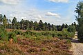
 Fox Way, Shackleford Heath.jpg 3,000 × 1,995; 2.03 MB
-
 Fox Way, Shackleford, pond at Lydling farm.jpg 3,000 × 1,995; 1.44 MB
-
 Puttenham, Fox Way approaching Puttenham.jpg 2,500 × 1,667; 772 KB
-
 Shere, The Fox Way crossing Dark Lane.jpg 3,000 × 1,995; 2.66 MB
-
 The Fox Way sign.jpg 1,242 × 1,267; 331 KB
-
 The Fox Way, Clandon Downs - geograph.org.uk - 992340.jpg 640 × 480; 122 KB
-
 The Tillingbourne Brewery, Shere, Surrey.jpg 2,500 × 1,618; 876 KB
-
 West Clandon, Hazelhurst Farm, old barn.jpg 3,000 × 1,936; 1.75 MB
-
 Worsfold Gates on the Wey Navigation - geograph.org.uk - 60668.jpg 640 × 427; 115 KB


