Category:Territorial evolution of Greece
Jump to navigation
Jump to search
Countries of Europe: Belgium · Estonia · Finland · France‡ · Germany · Greece · Italy · Latvia · Lithuania · Luxembourg · Poland · Romania · San Marino · Spain‡ · Switzerland · Ukraine · United Kingdom
‡: partly located in Europe
‡: partly located in Europe
Media in category "Territorial evolution of Greece"
The following 40 files are in this category, out of 40 total.
-
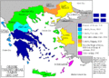
 ExpansionofModernGreece.png 2,464 × 1,964; 503 KB
-
 GreciaAComienxzosDelSigloXX.svg 856 × 1,058; 987 KB
-
 Greece and the Aegean (Times Survey Atlas of the World 1922).jpg 901 × 715; 313 KB
-
 Greece1830DE.png 1,400 × 1,400; 102 KB
-
 Greece1830EL.png 1,400 × 1,400; 123 KB
-
 Greek history from 1832-ar.png 868 × 624; 93 KB
-
 Greek history from 1832.GIF 868 × 624; 29 KB
-
 Greekhistory el.gif 868 × 624; 118 KB
-
 Greekhistory-zh-classical.png 868 × 624; 23 KB
-
 Grècia - Evolucions territòrialas.png 1,052 × 932; 267 KB
-
 Ionia within Greece (1919).svg 728 × 614; 126 KB
-
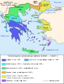
 La expansión territorial de Grecia (1832-1947).PNG 457 × 599; 64 KB
-
 Map Greece expansion 1832-1947 ja.jpg 2,000 × 2,621; 399 KB
-
 Map Greece expansion 1832-1947 ja.svg 2,000 × 2,621; 3.37 MB
-
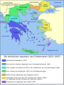
 Map Greece expansion 1832-1947-ar.svg 730 × 959; 573 KB
-
 Map Greece expansion 1832-1947-cs-2.svg 734 × 962; 111 KB
-
 Map Greece expansion 1832-1947-da.svg 734 × 962; 113 KB
-
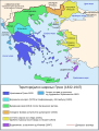
 Map Greece expansion 1832-1947-el.svg 734 × 962; 119 KB
-
 Map Greece expansion 1832-1947-en.svg 730 × 959; 469 KB
-
 Map Greece expansion 1832-1947-es.svg 734 × 962; 981 KB
-
 Map Greece expansion 1832-1947-eu.png 457 × 599; 87 KB
-
 Map Greece expansion 1832-1947-fr.svg 734 × 962; 475 KB
-
 Map Greece expansion 1832-1947-he.svg 734 × 623; 132 KB
-
 Map Greece expansion 1832-1947-HE.svg 512 × 670; 165 KB
-
 Map Greece expansion 1832-1947-hr.svg 730 × 959; 100 KB
-
 Map Greece expansion 1832-1947-hu.svg 734 × 962; 111 KB
-
 Map Greece expansion 1832-1947-it.svg 734 × 962; 88 KB
-
 Map Greece expansion 1832-1947-mk.svg 730 × 959; 98 KB
-
 Map Greece expansion 1832-1947-nl.svg 734 × 962; 56 KB
-
 Map Greece expansion 1832-1947-sr.svg 734 × 962; 120 KB
-
 Map Greece expansion 1832-1947-zhcn.svg 734 × 962; 109 KB
-
 Map Greece expansion 1832-1947Version2-de.png 990 × 836; 262 KB
-
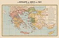 Royaume de Grece 1832-1921 Expansion (Kingdom of Greece Map Detail).jpg 4,003 × 2,592; 4.64 MB
-
 Territorial Evolution of the Modern Greek State (additional information).png 3,143 × 1,943; 1.25 MB
-
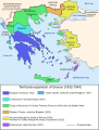
 Territorial Evolution of the Modern Greek State.png 2,932 × 1,943; 970 KB
-
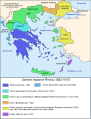
 Territorial Expansion of Greece from 1832–1947.gif 868 × 624; 49 KB
-
 Επέκταση Ελλάδας 1832-1947.svg 734 × 962; 107 KB
-
 Зростання території Греції у XIX-XX ст.ст.jpeg 457 × 599; 80 KB
-

-
 מפת יוון המודרנית היסטוריה.PNG 300 × 321; 54 KB


.jpg)


.svg)
.PNG)


.jpg)
.png)


