Category:Temblor Range
Jump to navigation
Jump to search
mountain range in California  | |||||
| Upload media | |||||
| Instance of | |||||
|---|---|---|---|---|---|
| Location | California, Pacific States Region | ||||
| Mountain range | |||||
| Elevation above sea level |
| ||||
 | |||||
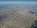
English: The Temblor Range — a low mountain range of the eastern-inner California Coast Ranges System, in central California.
- They run in a northwest-southeasterly direction along the borders of Kern County and San Luis Obispo County. The highest point is McKittrick Summit at 4,331 ft (1,320 m).
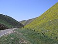
- The California interior chaparral and woodlands and grasslands habitats cover the mountains.
- The name of the range is from the Spanish word for "earthquake". The :San Andreas Fault (earthquake fault) is runs parallel to the range at the base of its western slope, on the eastern side of the Carrizo Plain — and is often more active—studied here.
Subcategories
This category has only the following subcategory.
G
Media in category "Temblor Range"
The following 15 files are in this category, out of 15 total.
-
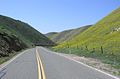 Hwy58TemblorRange.jpg 1,590 × 1,052; 512 KB
-
 McKittrickOilFieldGeologicCrossSection.png 615 × 166; 56 KB
-
 Of99-14 4a a.pdf 4,602 × 6,750; 8.72 MB
-
 Pholad borings.jpg 2,400 × 2,251; 1.66 MB
-
 Small oil field near Reward, Calif.jpg 2,753 × 1,628; 1.33 MB
-
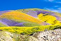 Superbloom at Carrizo 2017.jpg 2,048 × 1,401; 526 KB
-
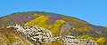 Temblor Range Summer.jpg 3,037 × 1,280; 1.27 MB
-
 Temblor Range, California (20959888414).jpg 4,000 × 3,000; 2.24 MB
-
 Temblor Range, California (21394605330).jpg 4,000 × 3,000; 2.34 MB
-
 Temblor Range, California (21394623740).jpg 4,000 × 3,000; 2.73 MB
-
 Temblor Range, California (21394633650).jpg 4,000 × 3,000; 2.41 MB
-
 Temblor Range, California (21394649620).jpg 4,000 × 3,000; 2.43 MB
-
 Temblor Range, California (21556474726).jpg 4,000 × 3,000; 2.8 MB
-
 TemblorMountainsSpringtime.jpg 1,600 × 1,200; 596 KB
-
 TemblorsNearMaricopa.jpg 3,456 × 2,592; 2.17 MB


.jpg)
.jpg)
.jpg)
.jpg)
.jpg)
.jpg)

Categories:
- California Coast Ranges
- Geography of Kern County, California
- Geography of San Luis Obispo County, California
- Mountain ranges of Southern California
- Mountain ranges of Northern California
- California State Route 58
- Geology of California
- San Joaquin Valley
- California Interior Chaparral and Woodlands Ecoregion (One Earth)