Category:Te Akau
Jump to navigation
Jump to search
Te Akau is a rural district on the west coast of the Waikato District, running northwards from northern shores of Whaingaroa Harbour (Raglan Harbour).
Media in category "Te Akau"
The following 27 files are in this category, out of 27 total.
-
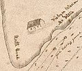 1836 mission station.jpg 1,666 × 1,444; 507 KB
-
 1905 Teams ready to start the day's work on Te Akau station.jpg 1,000 × 547; 238 KB
-
 1910 Te Akau Homestead on Darrows Station, Te Akau.jpg 6,253 × 4,445; 13.02 MB
-

-

-
 From South Head Trig Point to the Waitakere Ranges.jpg 6,859 × 3,344; 6.59 MB
-

-

-

-
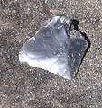 Obsidian near Te Kaha Point.jpg 450 × 476; 104 KB
-
 Ocean Beach Rd, Raglan 3297, New Zealand - panoramio.jpg 1,600 × 960; 473 KB
-
 Pakawau Rock, Raglan Harbour, 1910 - Photograph taken by Gilmour Brothers (17715849783).jpg 4,672 × 6,380; 2.85 MB
-

-

-
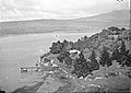
 Raglan from Te Akau Wharf, 1910 - Photograph taken by Gilmour Brothers (21613806206).jpg 6,461 × 4,752; 3.02 MB
-
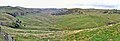 Raglan Limestone crags from Te Akau Coast Rd.jpg 3,769 × 1,280; 1.54 MB
-
 Rock formation on the coast at Raglan. ATLIB 294752.png 5,116 × 3,704; 14.64 MB
-

-

-
 Sand dune lake Te Horea 2007-2017.jpg 2,522 × 826; 603 KB
-

-
 Shell midden near Te Kaha Pt.jpg 4,000 × 3,000; 4.18 MB
-

-

-
 Tokanui Rocks, Raglan Harbour, 1910 - Photograph taken by Gilmour Brothers (21017395934).jpg 6,448 × 4,702; 2.81 MB
-
 Tokatoka Bay, Raglan Harbour, 1910 - Photograph taken by Gilmour Brothers (20985948464).jpg 6,402 × 4,710; 3.63 MB
-
 Waitangirua Bay, Raglan, 1910 - Photograph taken by Gilmour Brothers (21662030865).jpg 6,442 × 4,716; 2.16 MB


_north_of_Raglan_-_Photograph_taken_by_Gilmour_Brothers_(21617252131).jpg)
.jpg)

.jpg)
.jpg)
,_near_Raglan_-_Photograph_taken_by_Gilmour_Brothers_(21584251506).jpg)


.jpg)
.jpg)
.jpg)
.jpg)

.jpg)
.jpg)
,_near_Raglan_-_Photograph_taken_by_Gilmour_Brothers_(21095128119).jpg)

.jpg)
.jpg)
.jpg)
.jpg)
.jpg)