Category:Tawstock
Jump to navigation
Jump to search
village in Devon, England, UK  | |||||
| Upload media | |||||
| Instance of | |||||
|---|---|---|---|---|---|
| Location | North Devon, Devon, South West England, England | ||||
 | |||||
Subcategories
This category has the following 13 subcategories, out of 13 total.
C
E
- Eastacombe, Tawstock (1 F)
- Ensis, Devon (1 F)
H
- Harracott (1 F)
- Hiscott, Devon (2 F)
N
- Newbridge Bridge, Devon (6 F)
- North Devon Crematorium (5 F)
P
- Pill railway bridge (Devon) (6 F)
- Pristacott, Devon (2 F)
T
- Tawstock Tower (5 F)
Media in category "Tawstock"
The following 200 files are in this category, out of 691 total.
(previous page) (next page)-
 A 319 bus in Gratton Way waits for a rising bollard to lower - geograph.org.uk - 5673611.jpg 6,000 × 4,000; 5.81 MB
-

-
 A bridge on the road between Hiscott ^ Pristacott - geograph.org.uk - 3416191.jpg 1,600 × 1,063; 721 KB
-
 A bridge over a stream between Pristacott and Hiscott - geograph.org.uk - 3416204.jpg 1,600 × 1,200; 871 KB
-
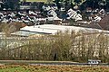
 A bridge over a stream which leads to Langham Lake - geograph.org.uk - 3416179.jpg 1,600 × 1,063; 833 KB
-
 A bridge over a stream which leads to Langham Lake - geograph.org.uk - 3416182.jpg 1,600 × 1,200; 663 KB
-
 A bridge over a stream which leads to Langham Lake - geograph.org.uk - 3416216.jpg 1,600 × 1,063; 636 KB
-
 A damp afternoon at Sainsbury's - geograph.org.uk - 5240967.jpg 1,469 × 1,102; 430 KB
-
 A dedicated bus lane on Sticklepath Hill - geograph.org.uk - 5351378.jpg 4,582 × 3,273; 5.13 MB
-
 A dedicated bus lane under construction on Sticklepath Hill - geograph.org.uk - 5351376.jpg 2,048 × 1,536; 1.98 MB
-
 A distant view of Roundswell forty minutes after sunrise - geograph.org.uk - 5239986.jpg 6,000 × 4,000; 4.27 MB
-
 A disused pumping station near Lake - geograph.org.uk - 5714971.jpg 6,000 × 4,000; 5.48 MB
-

-
 A footbridge over the River Taw at Chapelton - geograph.org.uk - 3419779.jpg 1,600 × 1,063; 732 KB
-
 A footbridge over the River Taw at Chapelton - geograph.org.uk - 3419787.jpg 1,600 × 1,063; 674 KB
-
 A footpath leading to Old Sticklepath Hill - geograph.org.uk - 5714953.jpg 6,000 × 4,000; 5.2 MB
-
-
 A mini roundabout on Sticklepath Hill - geograph.org.uk - 5351374.jpg 3,771 × 2,694; 5.15 MB
-
 A mini roundabout under construction on Sticklepath Hill - geograph.org.uk - 5351373.jpg 2,048 × 1,536; 2.45 MB
-
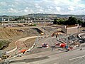
 A new cycle footpath over the A39 at Roundswell - geograph.org.uk - 5480480.jpg 6,000 × 4,000; 4.94 MB
-

-

-

-
 A refuelling station in Gratton Way - geograph.org.uk - 5673627.jpg 6,000 × 4,000; 4.21 MB
-
 A residential development at Roundswell - geograph.org.uk - 5673233.jpg 5,957 × 2,655; 5.48 MB
-
 A residential development at Roundswell - geograph.org.uk - 5673237.jpg 6,000 × 4,000; 4.78 MB
-
 A residential development at Roundswell - geograph.org.uk - 5673252.jpg 5,502 × 2,466; 4.25 MB
-
 A residential development at Roundswell - geograph.org.uk - 5673254.jpg 6,000 × 4,000; 4.92 MB
-
 A road junction at East ^ West Hildrew - geograph.org.uk - 3421061.jpg 1,600 × 1,063; 591 KB
-
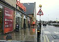 A soaking wet Sunday at Sainsbury's Supermarket - geograph.org.uk - 3332955.jpg 1,600 × 1,143; 355 KB
-
 A telephone beside a stream at Lake - geograph.org.uk - 5714960.jpg 6,000 × 4,000; 4.42 MB
-
 A view from the weighbridge at South West Metals - geograph.org.uk - 6322765.jpg 3,918 × 2,799; 3.98 MB
-

-
-

-

-
 A works yard used by Western Power Distribution - geograph.org.uk - 5673243.jpg 6,000 × 4,000; 4.64 MB
-
 A Yeti travelling west on the A3125 at Sticklepath - geograph.org.uk - 5703267.jpg 3,143 × 2,245; 4.68 MB
-
 A361 in cutting near Sticklepath - geograph.org.uk - 3441764.jpg 1,024 × 511; 93 KB
-
 A361 north bound - geograph.org.uk - 3127055.jpg 640 × 480; 54 KB
-
 A361 north bound - geograph.org.uk - 3127058.jpg 640 × 480; 60 KB
-
 A361 westbound - geograph.org.uk - 3127042.jpg 640 × 480; 54 KB
-
 A377 at Chapelton Cross - geograph.org.uk - 6148454.jpg 4,279 × 2,398; 1.27 MB
-
 A377 heading north - geograph.org.uk - 5635713.jpg 2,198 × 1,457; 1.26 MB
-
 A377 on Newbridge Causeway - geograph.org.uk - 5635706.jpg 1,024 × 626; 150 KB
-
 A39 eastbound - geograph.org.uk - 3289458.jpg 640 × 480; 56 KB
-
 A39, Roundswell - geograph.org.uk - 3289444.jpg 640 × 480; 48 KB
-
 A39, Roundswell - geograph.org.uk - 3289449.jpg 640 × 480; 48 KB
-

-
 Approaching Lake from the North - geograph.org.uk - 5714956.jpg 6,000 × 4,000; 4.91 MB
-

-
 Approaching Langham Bridge from the south - geograph.org.uk - 3441359.jpg 1,024 × 768; 163 KB
-
 Approaching Roundswell Roundabout on the A39 from the east - geograph.org.uk - 3968567.jpg 2,368 × 1,776; 2.65 MB
-

-

-

-
 Ashford, North Devon - geograph.org.uk - 1589685.jpg 640 × 481; 55 KB
-
 Autumn colour by the A377 - geograph.org.uk - 2143541.jpg 640 × 480; 105 KB
-
 B3232 at Stonyland Bridge - geograph.org.uk - 601134.jpg 640 × 476; 53 KB
-
 B3232 in Rowden Thorn - geograph.org.uk - 3442247.jpg 1,024 × 768; 157 KB
-
 Balls and stars - geograph.org.uk - 661607.jpg 464 × 640; 90 KB
-
 Barnstaple , A361 ^ Signpost - geograph.org.uk - 3359326.jpg 4,288 × 2,848; 4.72 MB
-
 Barnstaple , BP Petrol Station - geograph.org.uk - 3359322.jpg 4,288 × 2,848; 6.55 MB
-
 Barnstaple , Footpath - geograph.org.uk - 6146360.jpg 6,000 × 4,000; 7.67 MB
-
 Barnstaple , Sticklepath Court - geograph.org.uk - 6146366.jpg 6,000 × 4,000; 6.86 MB
-
 Barnstaple , The A3125 - geograph.org.uk - 3359325.jpg 4,214 × 2,730; 2.82 MB
-
 Barnstaple , The A361 - geograph.org.uk - 2512453.jpg 4,274 × 2,826; 3.73 MB
-
 Barnstaple , The A361 - geograph.org.uk - 6146343.jpg 6,000 × 4,000; 7.39 MB
-
 Barnstaple college from the rear. - geograph.org.uk - 1364299.jpg 640 × 427; 49 KB
-
 Barnstaple Station Car park in 2005 - geograph.org.uk - 4801424.jpg 2,021 × 1,516; 650 KB
-
 Barnstaple Station Car park in 2013 - geograph.org.uk - 4801427.jpg 4,288 × 2,848; 3.09 MB
-
 Barnstaple viewed from the mast at Maidenford - geograph.org.uk - 2921936.jpg 2,144 × 1,424; 2.12 MB
-
 Barnstaple, aerial 2018 - geograph.org.uk - 5952525.jpg 640 × 427; 101 KB
-
 Barnstaple, the River Taw and Trinity Church - geograph.org.uk - 2825594.jpg 4,288 × 2,848; 3.25 MB
-

-
 Bishop's Tawton, aerial 2018 - geograph.org.uk - 5952412.jpg 800 × 533; 125 KB
-
 Boggy field and woodland south-east of Collabear Corner - geograph.org.uk - 4720270.jpg 1,600 × 1,068; 1.13 MB
-
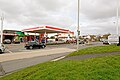
 BP petrol station, Roundwell Services - geograph.org.uk - 5073075.jpg 1,024 × 751; 143 KB
-
 Bramble Walk, Bickington - geograph.org.uk - 5265924.jpg 1,350 × 900; 875 KB
-
 Brannam Business Park - geograph.org.uk - 5299417.jpg 2,558 × 1,659; 723 KB
-
 Brannam's factory shop - geograph.org.uk - 661600.jpg 640 × 323; 51 KB
-
 Bridge near Heccaton and field beyond - geograph.org.uk - 4719947.jpg 1,600 × 1,600; 453 KB
-
 Bridge south-west of Tawstock - geograph.org.uk - 4720021.jpg 1,202 × 1,600; 1.58 MB
-
 Broadgate House, a luxury bed and breakfast in Pilton - geograph.org.uk - 5265377.jpg 6,000 × 4,000; 5.14 MB
-
 Brynsworthy Environment Centre near Barnstaple - geograph.org.uk - 6176464.jpg 4,616 × 3,297; 5.83 MB
-
 Bustley Bridge - geograph.org.uk - 6150002.jpg 4,288 × 2,435; 1.65 MB
-
 Bustley Bridge - geograph.org.uk - 6150089.jpg 4,288 × 2,848; 2.22 MB
-
 Bustley Bridge as seen from downstream - geograph.org.uk - 3416149.jpg 1,600 × 1,063; 776 KB
-
 Bustley Bridge Cross - geograph.org.uk - 6150084.jpg 4,288 × 2,848; 1.31 MB
-
 Bustley Bridge on a stream which leads to Langham Lake - geograph.org.uk - 3416143.jpg 1,600 × 1,063; 777 KB
-
 Bustley Bridge on a stream which leads to Langham Lake - geograph.org.uk - 3416145.jpg 1,600 × 1,063; 799 KB
-
 By the lane to Stonyland - geograph.org.uk - 600986.jpg 640 × 480; 114 KB
-
 Byway from Heccaton to Merrydale Cross - geograph.org.uk - 4719975.jpg 1,600 × 1,200; 1.55 MB
-
 Byway to Heccaton from Merrydale Cross - geograph.org.uk - 4719979.jpg 1,600 × 1,200; 1.04 MB
-
 Cattle near St John's Chapel - geograph.org.uk - 601155.jpg 640 × 474; 91 KB
-
 Cattle near Tennacott - geograph.org.uk - 600240.jpg 640 × 437; 57 KB
-
 Causeway over Pill Farm - geograph.org.uk - 3441760.jpg 1,024 × 768; 105 KB
-
 Ceiling, St Peter's church, Tawstock - geograph.org.uk - 6325454.jpg 4,288 × 2,848; 567 KB
-
 Cereal crop west of Hollick - geograph.org.uk - 6150336.jpg 4,288 × 2,848; 1.47 MB
-
 Chapelton , Chapelton Barton - geograph.org.uk - 6147044.jpg 6,000 × 4,000; 7.88 MB
-
 Chapelton , Chapelton Railway Station - geograph.org.uk - 4115961.jpg 4,288 × 2,848; 6.13 MB
-
 Chapelton , Grassy Field - geograph.org.uk - 4115956.jpg 4,288 × 2,848; 6.28 MB
-
 Chapelton , Grassy Field - geograph.org.uk - 6147042.jpg 6,000 × 4,000; 7.54 MB
-
 Chapelton , Langham Lake ^ A377 - geograph.org.uk - 4115960.jpg 4,288 × 2,848; 6.05 MB
-
 Chapelton , Railway Line - geograph.org.uk - 4115943.jpg 4,288 × 2,848; 6.39 MB
-
 Chapelton , Railway Line - geograph.org.uk - 4115951.jpg 2,848 × 4,288; 6.65 MB
-
 Chapelton , Railway Line - geograph.org.uk - 6147043.jpg 4,000 × 6,000; 7.79 MB
-
 Chapelton , Railway Line - geograph.org.uk - 6147046.jpg 6,000 × 4,000; 7.7 MB
-
 Chapelton , The A377 - geograph.org.uk - 4115952.jpg 4,288 × 2,848; 5.31 MB
-
 Chapelton , The A377 - geograph.org.uk - 6147047.jpg 6,000 × 4,000; 7.37 MB
-
 Chapelton railway station, Devon - geograph.org.uk - 4568175.jpg 1,600 × 1,200; 446 KB
-
 Chapelton railway station, Devon - geograph.org.uk - 4568183.jpg 1,600 × 1,200; 555 KB
-
 Charlacott - geograph.org.uk - 599146.jpg 640 × 480; 76 KB
-
 Charlacott Cross - geograph.org.uk - 4108120.jpg 640 × 480; 44 KB
-
 Charlacott Cross - geograph.org.uk - 600972.jpg 640 × 480; 67 KB
-
 Codden Hill from near Tawstock.jpg 4,000 × 3,000; 2.54 MB
-
-
 Collabear Corner - geograph.org.uk - 6325047.jpg 4,288 × 2,848; 1.82 MB
-
 Collabear Cross - geograph.org.uk - 6324822.jpg 3,264 × 1,832; 1.14 MB
-
 Collabear Farm (geograph 6324839).jpg 3,125 × 1,717; 1.01 MB
-
 Collabear Farm - geograph.org.uk - 6150845.jpg 2,831 × 1,566; 725 KB
-
 Combe Cross near Heccaton - geograph.org.uk - 4719960.jpg 1,600 × 1,600; 1.37 MB
-
 Comber's Cross - geograph.org.uk - 6325989.jpg 3,991 × 2,149; 1.31 MB
-
 CorffeTawstockDevon.JPG 4,608 × 3,456; 4.56 MB
-
 Cornflower Close, Bickington - geograph.org.uk - 5265388.jpg 1,735 × 1,156; 1.37 MB
-
 Cottages at Harracott - geograph.org.uk - 6323130.jpg 1,815 × 2,965; 481 KB
-
 Countryside above the Taw - geograph.org.uk - 6325903.jpg 4,070 × 2,417; 1.63 MB
-
 Countryside near Sideham - geograph.org.uk - 6324212.jpg 4,288 × 2,848; 2.28 MB
-
 Crossroads at Harepie Copse - geograph.org.uk - 4719997.jpg 1,160 × 1,600; 1.26 MB
-
 Crossroads near Harepie - geograph.org.uk - 6324031.jpg 4,261 × 2,714; 2 MB
-
 Crossroads, Harracott (geograph 6150725).jpg 3,997 × 2,671; 1.04 MB
-
 Drive from church, Tawstock - geograph.org.uk - 6151200.jpg 3,735 × 2,807; 1.65 MB
-
 East ^ West Hildrew - geograph.org.uk - 3421065.jpg 1,600 × 1,063; 666 KB
-
 East ^ West Hildrew - geograph.org.uk - 3421072.jpg 1,600 × 1,063; 542 KB
-
 Eastacombe Evangelical Chapel - geograph.org.uk - 4720282.jpg 1,200 × 1,600; 1.11 MB
-
 Eastacombe Evangelical Chapel - geograph.org.uk - 6176466.jpg 5,472 × 3,648; 5.25 MB
-
 Eastacombe Evangelical Chapel - geograph.org.uk - 6176467.jpg 5,472 × 3,648; 4.47 MB
-
 Eastacombe Evangelical Chapel - geograph.org.uk - 6176469.jpg 5,472 × 3,648; 5.67 MB
-
 Eastacombe Evangelical Chapel and the hamlet around it - geograph.org.uk - 4720285.jpg 1,600 × 1,200; 1.15 MB
-

-
 End of church car park, Tawstock - geograph.org.uk - 6325502.jpg 4,197 × 2,736; 2.23 MB
-
 Ensis Cross - geograph.org.uk - 6149768.jpg 2,678 × 4,010; 1.68 MB
-
 Ensis Cross - geograph.org.uk - 6149776.jpg 4,288 × 2,848; 1.82 MB
-
 Entrance to Rags - geograph.org.uk - 6324579.jpg 4,271 × 2,189; 1.33 MB
-
 Farm buildings, Bustley View - geograph.org.uk - 6149852.jpg 3,185 × 2,130; 1.14 MB
-
 Farmland by Comber's Cross - geograph.org.uk - 6325977.jpg 3,740 × 2,310; 1.79 MB
-
 Farmland by Merrydale Cross - geograph.org.uk - 6323843.jpg 4,288 × 2,848; 2.23 MB
-
 Farmland east of Hildrew - geograph.org.uk - 6149241.jpg 4,288 × 2,848; 1.48 MB
-
 Farmland near Rooks Farm - geograph.org.uk - 6150260.jpg 4,288 × 2,848; 2.07 MB
-
 Farmland near Sideham - geograph.org.uk - 6324022.jpg 4,288 × 2,848; 2.74 MB
-
 Farmland north of Collabear - geograph.org.uk - 6324904.jpg 4,288 × 2,848; 1.68 MB
-
 Farmland west of Chapelton - geograph.org.uk - 6148547.jpg 4,152 × 2,207; 1.65 MB
-
 Farmland west of Chapelton - geograph.org.uk - 6148610.jpg 3,510 × 2,180; 1.03 MB
-
 Farmland, Ensis - geograph.org.uk - 6149781.jpg 4,288 × 2,848; 1.55 MB
-
 Field access track near Hiscott - geograph.org.uk - 668604.jpg 640 × 503; 130 KB
-
 Field access track, Bustley Copse - geograph.org.uk - 6149961.jpg 4,288 × 2,848; 2.36 MB
-
 Field and wood near Fire Beacon Cross - geograph.org.uk - 6324093.jpg 4,277 × 2,361; 2.33 MB
-
 Field at Combe Cross - geograph.org.uk - 4719963.jpg 1,600 × 1,200; 1.17 MB
-
 Field at Rowden Thorn - geograph.org.uk - 600209.jpg 640 × 480; 49 KB
-
 Field by Comber's Cross - geograph.org.uk - 6325980.jpg 4,253 × 2,654; 2.02 MB
-
 Field by Merrydale Cross - geograph.org.uk - 6323720.jpg 3,709 × 2,337; 1.69 MB
-
 Field by Merrydale Cross - geograph.org.uk - 6323855.jpg 3,845 × 2,154; 1.2 MB
-
 Field near Ensis - geograph.org.uk - 6149862.jpg 4,288 × 2,848; 1.55 MB
-
 Field near Harracott - geograph.org.uk - 6323145.jpg 4,010 × 2,700; 1.93 MB
-
 Field near Hildrew - geograph.org.uk - 6149429.jpg 4,288 × 2,848; 2.23 MB
-
 Field near Hildrew - geograph.org.uk - 6149441.jpg 4,247 × 2,708; 2.24 MB
-
 Field near Merrydale Cross - geograph.org.uk - 6323155.jpg 4,288 × 2,848; 1.59 MB
-
 Field near Pristacott - geograph.org.uk - 600720.jpg 640 × 480; 103 KB
-
 Field near Rags - geograph.org.uk - 6324657.jpg 3,332 × 1,740; 804 KB
-
 Field near Yelland - geograph.org.uk - 6324025.jpg 3,527 × 2,496; 1.68 MB
-
 Field near Yelland - geograph.org.uk - 6324026.jpg 3,902 × 2,536; 1.48 MB
-
 Field north of Charlacott Cross - geograph.org.uk - 600995.jpg 640 × 480; 62 KB
-

-
 Field west of Chapelton - geograph.org.uk - 6148581.jpg 4,288 × 2,848; 2.72 MB
-
 Field west of Chapelton - geograph.org.uk - 6148805.jpg 3,363 × 2,029; 1.15 MB
-
 Field, Ensis - geograph.org.uk - 6149760.jpg 4,288 × 2,848; 2.22 MB
-
 Field, Tawstock - geograph.org.uk - 6325607.jpg 4,288 × 2,848; 1.61 MB
-
 Fields above the Taw valley - geograph.org.uk - 6325890.jpg 4,288 × 2,848; 1.51 MB
-
 Fields above Upcott Farm - geograph.org.uk - 661580.jpg 640 × 480; 116 KB
-
 Fields south-east of the road to Linscott - geograph.org.uk - 4720011.jpg 1,600 × 1,200; 1.39 MB
-
 Fire Beacon Cross - geograph.org.uk - 4107799.jpg 640 × 480; 95 KB
-
 Fire Beacon Cross - geograph.org.uk - 4107804.jpg 640 × 406; 79 KB
-
 Fire Beacon Cross - geograph.org.uk - 6324158.jpg 3,777 × 2,280; 1.29 MB
-
 Fire Beacon Cross road junction - geograph.org.uk - 4719999.jpg 1,600 × 1,200; 1.18 MB
-
 Footbridge across the River Taw - geograph.org.uk - 668516.jpg 480 × 640; 113 KB
-
 Ford on Tawstock Stream - geograph.org.uk - 6325040.jpg 4,288 × 2,848; 2.29 MB
-
 Former tollhouse by A377 north of Chapelton - geograph.org.uk - 3441623.jpg 1,024 × 768; 164 KB
-
 Fremington, Rooty Cross - geograph.org.uk - 535243.jpg 640 × 427; 143 KB
-

-
 Gatehouse to Tawstock Court - geograph.org.uk - 6325328.jpg 2,043 × 2,928; 580 KB
-
 Gatehouse to Tawstock Court - geograph.org.uk - 6325558.jpg 1,832 × 3,264; 872 KB
-
 Grass field, Chapelton Cross - geograph.org.uk - 6148461.jpg 4,288 × 2,848; 1.74 MB
-
 Grass field, Chapelton Cross - geograph.org.uk - 6148468.jpg 4,288 × 2,848; 1.6 MB
-
 Grass triangle, Chapelton Cross - geograph.org.uk - 6148325.jpg 4,004 × 2,323; 1.33 MB
-
 Graveyard of Eastacombe Evangelical Chapel - geograph.org.uk - 4720278.jpg 1,600 × 1,200; 1.14 MB
-
 Green lane from Merrydale Cross - geograph.org.uk - 6323717.jpg 4,288 × 2,848; 2.82 MB
-
 Green Lane, Sideham - geograph.org.uk - 6323891.jpg 4,288 × 2,848; 1.64 MB
-
 Green Lane, Sideham - geograph.org.uk - 6323906.jpg 1,811 × 1,165; 363 KB
-
 Green, Hildrew - geograph.org.uk - 6149634.jpg 4,288 × 2,848; 1.61 MB
-
 Hare Pie Cross - geograph.org.uk - 4107772.jpg 640 × 480; 154 KB


.jpg)


.jpg)


