Category:Tamborine National Park
national park in Australia  | |||||
| Upload media | |||||
| Instance of | |||||
|---|---|---|---|---|---|
| Location | Queensland, AUS | ||||
| Operator |
| ||||
| IUCN protected areas category | |||||
| Inception |
| ||||
| Area |
| ||||
| Elevation above sea level |
| ||||
| official website | |||||
 | |||||
Tamborine National Park is located in the Gold Coast hinterland and is a part of the Scenic Rim Regional Council of South East Queensland, Australia, 45 km (28 mi) south of Brisbane.
It covers 11.60 km² on the plateau of Tamborine Mountain and around its foothills. The plateau is 8 km (5.0 mi) long, 5 km (3.1 mi) wide and rises to an altitude of 525 m (1,722 ft). The elevation of the plateau keeps the temperature down a little in summer although December to April is also the wettest time to visit. Winter is drier but also cooler.
The protected area is scattered across 14 separate reserves which make up the National Park, interspersed with villages. There are a number of picnic areas as well as scenic drives and many bushwalks to lookouts, gorges, cliffs, waterfalls, rainforest]areas, wet eucalypt forest, open forest and woodlands.
Subcategories
This category has only the following subcategory.
F
Media in category "Tamborine National Park"
The following 48 files are in this category, out of 48 total.
-
 A Lace Monitor in Tamborine National Park, Cedar Creek Falls, Queensland, Australia.jpg 5,184 × 3,456; 5.21 MB
-
 Beauty In Death.png 5,184 × 3,456; 31.4 MB
-
 Beauty In Small Things.png 5,184 × 3,456; 25.03 MB
-
 Cedar Creek Falls in Tamborine National Park 2.jpg 2,048 × 1,536; 2.35 MB
-
 Cedar Creek Falls in Tamborine National Park.jpg 2,048 × 1,536; 2.17 MB
-
 Curtis Falls - Flickr - PaulBalfe.jpg 5,115 × 3,654; 16.98 MB
-
 Curtis Falls.jpg 800 × 1,066; 467 KB
-
 Dead King Of Forest.png 2,160 × 3,840; 15.33 MB
-
 Deep Inside The Fairy Forest.png 4,032 × 2,268; 19.37 MB
-
 DSC sdf.jpg 4,928 × 3,264; 4.71 MB
-
 Eucalyptus grandis 2.jpg 768 × 1,024; 435 KB
-
 Flower Family.png 5,184 × 3,456; 27.51 MB
-
 Golden Dewdrop.png 3,456 × 5,184; 18.16 MB
-
 In the rainforest - Flickr - Tatters ✾.jpg 925 × 695; 500 KB
-
 Kookaburra in Tamborine National Park.jpg 4,032 × 3,024; 4.24 MB
-
 Laughing Kookaburra, Tamborine Mountain 005.jpg 1,355 × 2,697; 1.46 MB
-
 Look what's blooming.png 5,184 × 3,456; 20.62 MB
-
 Love With The Stone.png 2,268 × 4,032; 19.78 MB
-
 Mickey Mouse Plant.png 5,184 × 3,456; 25.18 MB
-
 Mt. Tamborine NP Rainforest Tree - panoramio.jpg 3,264 × 2,448; 5.49 MB
-
 Mt. Tamborine Rainforest - panoramio.jpg 3,264 × 2,448; 5.34 MB
-
 Mushroom Palace.png 5,184 × 3,456; 23.59 MB
-
 Mushrooms On The Tree.png 5,184 × 3,456; 22.67 MB
-
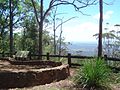
 Picnic area The Knoll Tamborine Mountain.JPG 1,536 × 2,048; 941 KB
-
 Sunset on Tamborine Mountain (14340528786).jpg 3,600 × 1,518; 4.17 MB
-
 Sunset romance on Tamborine Mountain (14383787163).jpg 2,400 × 3,600; 4.32 MB
-
 Tamborine Mountain Antiques (14177216849).jpg 3,264 × 2,448; 3.85 MB
-
 Tamborine Mountain markets (14360387431).jpg 3,872 × 2,592; 4.54 MB
-
 Tamborine Mountain Town (A) Dec 2013.jpg 5,507 × 3,387; 6.92 MB
-
 Tamborine Mountain Town (B) Dec 2013.jpg 5,416 × 3,195; 6.77 MB
-
 Tamborine Rainforest Skywalk (14177284310).jpg 600 × 450; 78 KB
-
 The Knoll Lookout Tamborine Mountain.JPG 2,048 × 1,536; 640 KB
-
 The Knoll picnic area Tamborine Mountain.JPG 2,048 × 1,536; 928 KB
-
 Timborine National Park (25 04 2016).jpg 3,648 × 2,736; 3.84 MB
-
 Timborine National Park (Curtis Falls 01).jpg 3,648 × 2,736; 3.53 MB
-
 Timborine National Park (Curtis Falls 02).jpg 2,736 × 3,648; 4.02 MB
-
 Timborine National Park (Curtis Falls 03).jpg 2,298 × 3,064; 3.22 MB
-
 Timborine National Park 2 (25 04 2016).jpg 3,648 × 2,736; 3.5 MB
-
 Timborine National Park 3 (25 04 2016).jpg 3,648 × 2,736; 3.25 MB
-
 Timborine National Park 4 (25 04 2016).jpg 2,736 × 3,648; 4.38 MB
-
 Timborine National Park 5 (25 04 2016).jpg 3,648 × 2,736; 3.67 MB
-
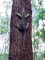 Tree Goanna on Eucalyptus.png 2,448 × 3,264; 10.79 MB
-
 Twisted Tree.png 2,448 × 3,264; 16.57 MB
-
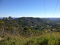
 View north from The Knoll Tamborine Mountain.JPG 2,048 × 1,536; 510 KB
-
 View south from Needham Road in Luscombe, Queensland 2.jpg 3,264 × 2,448; 3.79 MB
-
 Witches Falls Cottages (5798830070).jpg 3,872 × 2,592; 4.17 MB
-
 Witches Falls Section - Tamborine National Park (3814181882).jpg 3,841 × 2,586; 2.01 MB
-
 Wongawallan, Queensland 06.JPG 3,264 × 2,448; 3.42 MB


.jpg)
.jpg)
.jpg)
.jpg)
_Dec_2013.jpg)
_Dec_2013.jpg)
.jpg)


.jpg)
.jpg)
.jpg)
.jpg)
.jpg)
.jpg)
.jpg)
.jpg)


.jpg)
.jpg)
