Category:Taller de Cartografía
Jump to navigation
Jump to search
English: This category shows maps that have been made or improved in the Spanish Taller de Cartografía (Map Lab). You can propose maps to improve as well.
Español: Esta categoría contiene los mapas elaborados o mejorados por el Taller de Cartografía de la Wikipedia en español. Usted puede proponer mapas para su realización o mejora.
As of 2024/04/10, there are 150 files in Category:Taller de Cartografía.
Template: {{Taller de Cartografía}}
![]()
English: This category shows maps that have been made or improved in the Spanish Taller de Cartografía (Map Lab). You can propose maps to improve as well.
Español: Esta categoría contiene los mapas elaborados o mejorados por el Taller de Cartografía de la Wikipedia en español. Usted puede proponer mapas para su realización o mejora.
Français : Cette galerie a été créée ou améliorée dans le Taller de Cartografía (Atelier cartographique Espagne). Vous pouvez également y proposer des cartes à améliorer.
Pages in category "Taller de Cartografía"
This category contains only the following page.
Media in category "Taller de Cartografía"
The following 150 files are in this category, out of 150 total.
-
 Aguas territoriales Alianza Pacífico.svg 800 × 400; 694 KB
-
 Aguas territoriales CARICOM.svg 800 × 400; 696 KB
-
 Aguas territoriales Comunidad andina.svg 800 × 400; 694 KB
-
 Aguas territoriales MERCOSUR.svg 800 × 400; 694 KB
-
 Aguas territoriales OEA.svg 800 × 400; 695 KB
-
 Aguas territoriales SICA.svg 800 × 400; 695 KB
-
 Aguasterritoriales CELAC.svg 800 × 400; 695 KB
-
 Aguasterritoriales UNASUR.svg 800 × 400; 694 KB
-
 Albacete-loc.svg 512 × 473; 301 KB
-
 Alicante-loc.svg 2,134 × 2,157; 275 KB
-
 Almería (municipio)-loc.svg 512 × 516; 1.72 MB
-
 Andalucía-loc.svg 512 × 345; 1.22 MB
-
 Aragón-loc-Comarca de Zaragoza.svg 512 × 647; 611 KB
-
 Aragón-loc.svg 1,981 × 2,504; 609 KB
-
 Araquil-loc.svg 512 × 280; 142 KB
-
 Arenas de San Pedro.svg 512 × 340; 306 KB
-
 Astorga-loc.svg 512 × 297; 489 KB
-
 Asturias-loc.svg 512 × 378; 219 KB
-
 Autopista española AP-15-loc.svg 512 × 407; 3.45 MB
-
 Autopista española AP-66-loc.svg 512 × 407; 3.82 MB
-
 Ávila-loc.svg 512 × 459; 521 KB
-
 Badajoz-loc.svg 512 × 386; 373 KB
-
 Baja California (1824 location map scheme).svg 500 × 475; 565 KB
-
 Baja Navarra-Pirineos Atlánticos.svg 512 × 331; 439 KB
-
 Barcelona-loc.svg 512 × 527; 377 KB
-
 Baztán-loc.svg 512 × 616; 955 KB
-
 Burgos-loc.svg 512 × 643; 661 KB
-
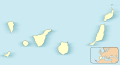 Canarias-loc.svg 512 × 277; 3.09 MB
-
 Cantabria-loc.svg 512 × 365; 190 KB
-
 Carreteras de Beas de Segura.svg 512 × 338; 305 KB
-
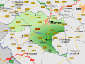 Carreteras de Martos.svg 512 × 387; 542 KB
-
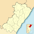 Castellón-loc.svg 2,259 × 2,265; 250 KB
-
 Castilla y León-loc.svg 512 × 401; 1.76 MB
-
 Castilla-La Mancha-loc.svg 512 × 517; 876 KB
-
 CatalunyaLoc.svg 2,786 × 2,501; 320 KB
-
 Cistierna.svg 512 × 606; 251 KB
-
 Ciudad Real-loc.svg 512 × 354; 351 KB
-
 Cizur-loc.svg 512 × 428; 544 KB
-
 Comarca de Zaragoza-Loc.svg 512 × 553; 96 KB
-
 Comarcas de Aragón.svg 512 × 648; 998 KB
-
 Comunidad Valenciana-loc.svg 1,296 × 1,760; 986 KB
-
 Cuenca-loc.svg 512 × 455; 398 KB
-
 Cáceres-loc.svg 512 × 373; 378 KB
-
 Cádiz-loc.svg 512 × 580; 338 KB
-
 Córdoba-loc.svg 512 × 655; 345 KB
-
 España-Canarias-loc.svg 512 × 462; 919 KB
-
 EspañaLoc.svg 3,300 × 1,885; 1.9 MB
-
 Estados Unidos loc.svg 512 × 358; 650 KB
-
 Extremadura-loc.svg 512 × 552; 530 KB
-
 Fabero.svg 512 × 385; 329 KB
-
 Galar-loc.svg 512 × 623; 680 KB
-
 Galicia-loc.svg 512 × 553; 602 KB
-
 Gerona-loc.svg 3,037 × 2,192; 351 KB
-
 Granada-loc-Valle del Zabalí.svg 512 × 452; 490 KB
-
 Granada-loc.svg 512 × 452; 490 KB
-
 Guadalajara-loc.svg 512 × 390; 435 KB
-
 Guipúzcoa-loc.svg 512 × 388; 161 KB
-
 Hilfe Geotools Beispiel 2.svg 454 × 230; 105 KB
-
 Huelva-loc.svg 512 × 669; 459 KB
-
 Huerta de Rey.svg 512 × 460; 129 KB
-
 Huesca-loc.svg 512 × 634; 686 KB
-
 Jaén-loc.svg 512 × 374; 429 KB
-
 La Bañeza.svg 512 × 405; 249 KB
-
 La Coruña-loc.svg 512 × 527; 399 KB
-
 La Rioja-loc.svg 512 × 352; 146 KB
-
 La Robla.svg 512 × 275; 194 KB
-
 Labort-Pirineos Atlánticos.svg 512 × 331; 451 KB
-
 Larráun-loc.svg 512 × 576; 1.09 MB
-
 Las Palmas-Loc.svg 512 × 453; 95 KB
-
 León-loc-La Bañeza.svg 512 × 385; 626 KB
-
 León-loc.svg 512 × 385; 562 KB
-
 León.svg 512 × 508; 907 KB
-
 Localización de Parque Natural Urquiola.svg 512 × 397; 2.4 MB
-
 Localización Sanlúcar de Barrameda.svg 512 × 311; 378 KB
-
 LocAlmería.svg 512 × 559; 300 KB
-
 LocBaleares.svg 512 × 345; 104 KB
-
 Loja-loc.svg 512 × 619; 93 KB
-
 Lugo-loc.svg 512 × 764; 314 KB
-
 Lérida-loc 3.svg 512 × 665; 386 KB
-
 Lérida-loc.svg 512 × 665; 378 KB
-
 Madrid-loc.svg 512 × 553; 239 KB
-
 Mapa físico de Navarra.svg 930 × 1,018; 7.56 MB
-
 Matos-loc.svg 512 × 387; 100 KB
-
 Municipio de Madrid-Loc.svg 512 × 573; 760 KB
-
 Murcia-loc.svg 512 × 562; 86 KB
-
 Murias de Paredes.svg 512 × 447; 393 KB
-
 Málaga-loc.svg 512 × 343; 308 KB
-
 Navarra-loc-Baztán.svg 512 × 538; 415 KB
-
 Navarra-loc-Larraún.svg 512 × 538; 415 KB
-
 Navarra-loc.svg 512 × 538; 415 KB
-
 Níjar-loc.svg 512 × 469; 347 KB
-
 Olóriz-loc.svg 512 × 423; 423 KB
-
 Orense-loc.svg 512 × 352; 311 KB
-
 Palacios de la Valduerna.svg 512 × 503; 232 KB
-
 Palencia-loc.svg 512 × 717; 461 KB
-
 País Vasco-loc.svg 512 × 401; 315 KB
-
 Political divisions of Mexico 1836 (location map scheme).svg 649 × 617; 451 KB
-
 Ponferrada.svg 512 × 381; 1.75 MB
-
 Poniente-loc.svg 512 × 299; 110 KB
-
 Pontevedra-loc.svg 512 × 601; 338 KB
-
 Riello.svg 512 × 481; 521 KB
-
 Roquetas de Mar loc.svg 512 × 568; 331 KB
-
 Sahagún.svg 512 × 492; 340 KB
-
 Salamanca-loc.svg 512 × 383; 597 KB
-
 Sangüesa-loc.svg 512 × 402; 677 KB
-
 Santa Cruz de Tenerife-loc.svg 512 × 406; 1.78 MB
-
 Segovia-loc.svg 512 × 429; 477 KB
-
 Sevilla-loc.svg 512 × 486; 357 KB
-
 Sierra de Segura-loc.svg 512 × 652; 130 KB
-
 Solá-Pirineos Atlánticos.svg 512 × 331; 442 KB
-
 Soria-loc.svg 512 × 441; 473 KB
-
 Spain 2 location map.svg 3,300 × 1,885; 1.77 MB
-
 Spain Andalusia location map.svg 512 × 345; 1.22 MB
-
 Spain Aragon location map.svg 512 × 647; 564 KB
-
 Spain Aragón location map relief.png 1,705 × 2,154; 3.78 MB
-
 Spain Cantabria location map.svg 512 × 364; 168 KB
-
 Spain Castile and León location map.svg 512 × 401; 1.71 MB
-
 Spain Castile and León relieve location map.jpg 674 × 524; 559 KB
-
 Spain Castile and León relieve location map.png 2,697 × 2,110; 5.54 MB
-
 Spain Castile-La Mancha location map.svg 512 × 517; 825 KB
-
 Spain Castile-La Mancha relief map.png 2,167 × 2,189; 5.05 MB
-
 Spain complete location map.svg 512 × 462; 1.04 MB
-
 Spain Extremadura location map.svg 512 × 552; 465 KB
-
 Spain Galicia location map.svg 512 × 553; 576 KB
-
 Spain La Rioja location map.svg 512 × 352; 147 KB
-
 Spain La Rioja relief map.png 773 × 532; 493 KB
-
 Spain León relief map.png 1,272 × 957; 1.34 MB
-
 Spain Lleida localion map.svg 512 × 665; 386 KB
-
 Spain Madrid location map.svg 512 × 553; 199 KB
-
 Spain Madrid relief map.png 801 × 863; 766 KB
-
 Spain Murcia location map.svg 512 × 562; 87 KB
-
 Spain Navarre location map.svg 512 × 538; 571 KB
-
 Spain Navarre relieve.png 2,414 × 2,551; 3.5 MB
-
 Spain Valencian Community location map.svg 512 × 695; 538 KB
-
 Tarragona-loc.svg 512 × 487; 310 KB
-
 Teruel-loc.svg 512 × 444; 817 KB
-
 Toledo-loc.svg 512 × 299; 411 KB
-
 Urquiola-loc.svg 512 × 489; 680 KB
-
 Valencia de Don Juan.svg 512 × 436; 133 KB
-
 Valencia-loc.svg 2,003 × 2,195; 443 KB
-
 Valladolid-loc.svg 512 × 535; 500 KB
-
 Valle de Egüés-loc.svg 512 × 456; 408 KB
-
 Valle de Zalabí-loc.svg 512 × 293; 56 KB
-
 Villablino.svg 512 × 363; 735 KB
-
 Villada.svg 512 × 459; 103 KB
-
 Villafranca del Bierzo.svg 512 × 620; 710 KB
-
 Vizcaya-loc.svg 512 × 331; 185 KB
-
 Zamora-loc.svg 512 × 425; 505 KB
-
 Zaragoza-loc.svg 512 × 434; 1.11 MB
-
 Álava-loc.svg 512 × 465; 193 KB


-loc.svg)


.svg)


.svg)


