Category:System maps of defunct U.S. railroads
Jump to navigation
Jump to search
Subcategories
This category has the following 13 subcategories, out of 13 total.
B
- Baltimore and Ohio Railroad maps (88 F)
C
- Maps of Conrail (10 F)
M
- Maps of the Erie Railroad (20 F)
N
P
S
Media in category "System maps of defunct U.S. railroads"
The following 87 files are in this category, out of 87 total.
-
 1923 MEC.jpg 954 × 1,213; 456 KB
-
 AroostookValleyRailroadMap.png 1,306 × 2,212; 205 KB
-
 Baltimore & Harrisburg Rwy map.jpg 1,244 × 1,001; 261 KB
-
 Bridgton&SacoRiver RRmap.png 1,244 × 1,944; 363 KB
-
 C&S RR map.jpg 1,024 × 768; 184 KB
-
 Camas Prairie RR map.jpg 900 × 576; 236 KB
-
 Central-ny 1913 interurban.jpg 761 × 645; 576 KB
-
 Chicago and Alton Railroad system map (1918).svg 1,120 × 640; 1.52 MB
-
 Chicago, Peoria and St. Louis Railroad system map (1918).svg 1,400 × 800; 499 KB
-
 Cincinnati Northern Railroad system map (1918).svg 1,120 × 640; 6.41 MB
-
 Cincinnati, Jackson and Mackinaw Railway system map (1897).svg 1,120 × 640; 713 KB
-
 Cincinnati, Lebanon and Northern Railway map (1918) with terrain.png 2,986 × 1,706; 961 KB
-
 Cleveland, Cincinnati, Chicago and St. Louis Railway system map (1918).svg 1,120 × 640; 6.57 MB
-
 Conrail FSP Chessie.jpg 2,133 × 1,461; 377 KB
-
 Conrail FSP D&H SOU.jpg 575 × 1,463; 112 KB
-
 Conrail FSP Freight Lines Map 1975.jpg 10,188 × 7,337; 5.55 MB
-
 Conrail FSP Freight Lines Map 1975.pdf 5,170 × 3,750; 2.47 MB
-
 Conrail FSP Freight Lines Map 1975.svg 9,927 × 7,200; 1,013 KB
-
 Conrail FSP N&W.jpg 2,130 × 1,452; 293 KB
-
 Conrail FSP short lines.jpg 1,129 × 1,048; 167 KB
-
 Conrail FSP.jpg 1,850 × 1,407; 317 KB
-
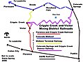 Cripple Creek, Victor Mining District Railroads Map.jpg 800 × 600; 153 KB
-
 Detroit united railway map-1904.PNG 613 × 890; 430 KB
-
 Detroit, Toledo and Ironton Railroad system map (1918).svg 1,120 × 640; 1.26 MB
-
 Easton and Amboy Railroad.svg 400 × 400; 276 KB
-
 Franklin&MeganticRRmap.png 1,223 × 2,070; 319 KB
-
 FranklinSomerset&KennebecRailwayMap.png 1,566 × 1,926; 1.39 MB
-
 Granite Railway map section.png 461 × 510; 65 KB
-
 Granite Railway map.png 8,184 × 6,590; 1.03 MB
-
 Jersey City Newark and Western Railway.svg 400 × 400; 278 KB
-
 L&NE on US map cropped.png 300 × 227; 9 KB
-
 L&NE on US map.png 5,912 × 4,003; 1.85 MB
-
 Lake Erie and Western Railroad system map (1918).svg 1,120 × 640; 6.44 MB
-
 Lake Shore and Michigan Southern Railway system map (1914).svg 1,120 × 640; 6.54 MB
-
 Large-scale-detailed-old-map-exhibiting-the-several-pacific-railroads-1883.jpg 10,030 × 6,250; 33.15 MB
-
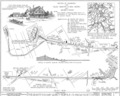
 Lehigh Valley Jersey City Terminal.png 800 × 600; 282 KB
-
 Lehigh Valley Railroad System Map.svg 800 × 600; 447 KB
-
 Lehigh Valley Terminal Railway.svg 400 × 400; 313 KB
-
 LO&S RR map 1895.jpg 960 × 720; 205 KB
-
 Ma and Pa RR map.png 1,088 × 1,181; 772 KB
-
 Map of Florence & Cripple Creek Railroad.gif 400 × 400; 15 KB
-
 MEC Rockland Branch Map 1920.jpg 1,696 × 636; 341 KB
-
 Michigan Central Railroad system map (1918).svg 1,120 × 640; 6.5 MB
-
 Missouri, Kansas and Texas Railway system map (1918).svg 1,120 × 640; 328 KB
-
 MonsonL2.png 743 × 1,926; 308 KB
-
 System Index Map - DPLA - 3f54be646bab7fdd232de0204b13162c.jpg 3,292 × 5,100; 6.3 MB
-
 MSTL Map.png 1,038 × 933; 275 KB
-
 Mtgretna.png 1,944 × 1,029; 395 KB
-
 Newark and Passaic Railway.svg 400 × 400; 256 KB
-
 Newark and Roselle Railway.svg 400 × 400; 290 KB
-
 Newark Railway.svg 400 × 400; 296 KB
-
 Norfolk Southern Railway (old).svg 995 × 549; 41 KB
-
 Norwich and Worcester map.jpg 792 × 550; 138 KB
-
 NYSW Historical NJ and PA.svg 800 × 600; 675 KB
-
 NYSW Wilkes-Barre and Eastern.svg 800 × 600; 731 KB
-
 NYWB-Map.jpg 476 × 1,265; 265 KB
-
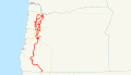 Oregon and California Railroad system map (1918).svg 1,400 × 800; 1.09 MB
-
 Oregon Eastern Railway system map.svg 1,400 × 800; 732 KB
-
 P&W System Map - May 1907.jpg 1,731 × 516; 253 KB
-
 P&WV map.svg 414 × 213; 27 KB
-
 PacificCoastRailwayMap.png 707 × 1,290; 73 KB
-
 Peoria and Eastern Railway system map (1918).svg 1,120 × 640; 6.4 MB
-
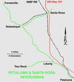 Petaluma&SantaRosaRailroadMap.png 1,387 × 1,532; 140 KB
-
 Pittsburgh and Lake Erie Railroad system map (1918).svg 1,120 × 640; 6.43 MB
-
 PortlandTerminalCompanyMap.png 1,360 × 1,720; 366 KB
-
 PRSL on US map cropped.png 150 × 161; 7 KB
-
 PRSL on US map.png 5,912 × 4,003; 1.85 MB
-
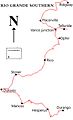 Rio Grande Southern - Map of mainline.jpg 500 × 819; 80 KB
-
 Roselle and South Plainfield Railroad.svg 400 × 400; 240 KB
-
 RW&O eastern divisions, 1889.jpg 539 × 651; 426 KB
-
 RW&O system map 1889.jpg 949 × 884; 871 KB
-
 Seaboard Air Line RR main lines 1950.gif 582 × 710; 125 KB
-
 Shore Line map.JPG 2,013 × 1,983; 624 KB
-
 SilverCityPinosAltos&MogollonRailroadMap.png 979 × 1,514; 172 KB
-
 Silverton Northern map.gif 500 × 482; 18 KB
-
 Silverton Railroad map.gif 500 × 482; 23 KB
-
 Silverton, Gladstone & Northerly map.gif 500 × 482; 15 KB
-
 SNE map.png 696 × 880; 502 KB
-
 SouthPacificCoastRailroadMap.png 1,196 × 1,667; 120 KB
-
 SR&RLv1.png 1,432 × 1,751; 530 KB
-
 St. Louis Southwestern Railway system map (1918).svg 1,120 × 640; 2.06 MB
-
 St. Louis-San Francisco Railway system map (1918).svg 1,400 × 800; 505 KB
-
 The Commercial and financial chronicle (1906) (14595387818).jpg 4,180 × 2,576; 1.88 MB
-
 Toledo, Cincinnati and St. Louis Railroad system map (1884).svg 1,120 × 640; 1.44 MB
-
 Toledo, St. Louis and Western Railroad system map (1918).svg 1,120 × 640; 1.52 MB
-
 Western Maryland Railway 1950s.svg 990 × 765; 42 KB
-
 Wwf-karte.png 462 × 510; 474 KB


.svg)
.svg)
.svg)
.svg)
_with_terrain.png)
.svg)


.svg)


.svg)
.svg)


.svg)
.svg)


.svg)


.svg)


.svg)

.svg)


.svg)
.svg)
_(14595387818).jpg)
.svg)
.svg)

