Category:Synagogue, Enschede
Jump to navigation
Jump to search
| Object location | | View all coordinates using: OpenStreetMap |
|---|
 | |||||
| Upload media | |||||
| Instance of | |||||
|---|---|---|---|---|---|
| Location | Enschede, Overijssel, Netherlands | ||||
| Street address |
| ||||
| Located on street |
| ||||
| Architect | |||||
| Heritage designation |
| ||||
| Inception |
| ||||
 | |||||
|
This is a category about rijksmonument number 510624
|
| Address |
|
Subcategories
This category has the following 4 subcategories, out of 4 total.
Media in category "Synagogue, Enschede"
The following 99 files are in this category, out of 99 total.
-

-

-
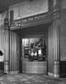
 BimaSynagogeEnschede.jpg 400 × 300; 22 KB
-
 Close-up van de Heilige Arke - Enschede - 20071315 - RCE.jpg 964 × 1,200; 239 KB
-
 De achterzijde van de synagoge te Enschede - Enschede - 20071311 - RCE.jpg 953 × 1,200; 271 KB
-

-

-

-

-

-

-
 De Heilige Arke in de synagoge te Enschede - Enschede - 20338387 - RCE.jpg 1,194 × 1,200; 264 KB
-
 De raadskamer van de synagoge te Enschede - Enschede - 20338379 - RCE.jpg 1,193 × 1,200; 260 KB
-
 De raadskamer van de synagoge te Enschede - Enschede - 20338380 - RCE.jpg 1,188 × 1,200; 260 KB
-

-

-
 Drie glas in loodramen in de synagoge te Enschede - Enschede - 20338408 - RCE.jpg 1,191 × 1,200; 223 KB
-
 Drie glas in loodramen in de synagoge te Enschede - Enschede - 20338409 - RCE.jpg 1,200 × 1,198; 178 KB
-
 Drie glas in loodramen in de synagoge te Enschede - Enschede - 20338410 - RCE.jpg 1,200 × 1,200; 180 KB
-
 Drie glas in loodramen in de synagoge te Enschede - Enschede - 20338412 - RCE.jpg 1,200 × 1,200; 154 KB
-
 Drie glas in loodramen in de synagoge van Enschede - Enschede - 20338411 - RCE.jpg 1,200 × 1,200; 165 KB
-
 Drie glas in loodramen van de synagoge te Enschede - Enschede - 20338413 - RCE.jpg 1,200 × 1,200; 131 KB
-
 Enschede Synagoge Ingang.jpg 2,816 × 2,112; 2.56 MB
-
 Enschede Synagoge zijkant.jpg 2,816 × 2,112; 2.4 MB
-
 Enschede, Synagoge, Interieur.jpg 6,941 × 3,762; 21.65 MB
-
 Exterieur voorzijde - Enschede - 20071310 - RCE.jpg 1,200 × 953; 237 KB
-

-

-
 Gedenksteen in de hal van de synagoge te Enschede - Enschede - 20338388 - RCE.jpg 1,191 × 1,200; 182 KB
-
-
 Glas in loodraam in de synagoge te Enschede - Enschede - 20338397 - RCE.jpg 1,200 × 1,200; 199 KB
-
 Glas in loodraam in de synagoge te Enschede - Enschede - 20338398 - RCE.jpg 1,200 × 1,200; 181 KB
-
 Glas in loodraam in de synagoge te Enschede - Enschede - 20338399 - RCE.jpg 1,200 × 1,200; 159 KB
-
 Glas in loodraam in de synagoge te Enschede - Enschede - 20338400 - RCE.jpg 1,200 × 1,200; 171 KB
-
 Glas in loodraam in de synagoge te Enschede - Enschede - 20338402 - RCE.jpg 1,200 × 1,200; 172 KB
-
 Glas in loodraam in de synagoge te Enschede - Enschede - 20338404 - RCE.jpg 1,191 × 1,200; 350 KB
-
 Glas in loodraam in de synagoge te Enschede - Enschede - 20338406 - RCE.jpg 1,200 × 1,168; 346 KB
-
 Glas in loodraam in de synagoge te Enschede - Enschede - 20338416 - RCE.jpg 1,200 × 1,200; 146 KB
-
 Glas in loodraam in de synagoge te Enschede - Enschede - 20338421 - RCE.jpg 1,200 × 1,200; 203 KB
-
 Glas in loodraam in de synagoge te Enschede - Enschede - 20338422 - RCE.jpg 1,200 × 1,200; 206 KB
-

-

-
 Glas in loodraam van de synagoge te Enschede - Enschede - 20338390 - RCE.jpg 1,200 × 1,200; 179 KB
-
 Glas in loodraam van de synagoge te Enschede - Enschede - 20338415 - RCE.jpg 1,200 × 1,200; 147 KB
-
 Hal en trappenhuis van de synagoge te Enschede - Enschede - 20338377 - RCE.jpg 1,183 × 1,200; 209 KB
-
 Hal en trappenhuis van de synagoge te Enschede - Enschede - 20338378 - RCE.jpg 1,185 × 1,200; 219 KB
-
 Hal van de synagoge te Enschede met gedenksteen - Enschede - 20338376 - RCE.jpg 1,200 × 1,197; 226 KB
-

-

-
 Het mikwe (ritueel bad) van de synagoge te Enschede - Enschede - 20338383 - RCE.jpg 1,190 × 1,200; 236 KB
-
 Het mikwe (ritueel bad) van de synagoge te Enschede - Enschede - 20338384 - RCE.jpg 1,195 × 1,200; 240 KB
-
 Interieur - Enschede - 20071312 - RCE.jpg 1,200 × 951; 243 KB
-
 Interieur - Enschede - 20071313 - RCE.jpg 1,200 × 953; 270 KB
-
 Interieur - Enschede - 20071318 - RCE.jpg 947 × 1,200; 225 KB
-
 Interieur - Enschede - 20071319 - RCE.jpg 1,200 × 947; 252 KB
-

-

-
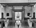
 INTERIEUR, OVERZICHT NAAR ARKE - Enschede - 20262147 - RCE.jpg 1,200 × 848; 202 KB
-
 Klok in de raadskamer van de synagoge te Enschede - Enschede - 20338386 - RCE.jpg 1,193 × 1,200; 229 KB
-
 Lessenaar en de Heilige Arke van de synagoge te Enschede - Enschede - 20338436 - RCE.jpg 1,192 × 1,200; 263 KB
-

-

-

-

-

-

-
 RM510624 - Enschede - Prinsestraat 14.jpg 3,264 × 2,448; 2.11 MB
-
 SL374554.jpg 3,072 × 2,304; 3.34 MB
-

-

-
 Synagoge - Synagogue (4440287673).jpg 1,280 × 975; 183 KB
-
 Synagoge - Synagogue (4440288995).jpg 1,280 × 978; 208 KB
-
 Synagoge Enschede interieur.jpg 368 × 500; 31 KB
-
 Synagoge Enschede, Detail.jpg 4,824 × 2,956; 2.04 MB
-
 Synagoge Enschede, Overzicht.jpg 5,138 × 3,434; 2 MB
-
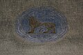
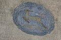 Synagoge Enschede, Plafond, Hert.jpg 5,184 × 3,456; 9.29 MB
-
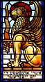
 Synagoge Enschede, Plafond, Leeuw.jpg 5,184 × 3,456; 8.85 MB
-
 Synagoge Enschede, Plafond, Schip.jpg 5,184 × 3,456; 7.91 MB
-
 Synagoge Enschede, Venster met Griffioen.jpg 2,472 × 4,440; 1.61 MB
-
 Synagoge Enschede, Venster, Gevleugelde leeuw.jpg 2,336 × 4,280; 1.58 MB
-
 Synagoge Enschede.jpg 589 × 399; 44 KB
-
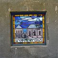
 Synagoge, Enschede, Mozaiek.jpg 3,452 × 3,132; 2.89 MB
-
 Synagogue-Enschede.JPG 2,272 × 1,704; 730 KB
-
 Twee glas in loodramen in de synagoge te Enschede - Enschede - 20338391 - RCE.jpg 1,194 × 1,200; 222 KB
-
 Twee glas in loodramen in de synagoge te Enschede - Enschede - 20338393 - RCE.jpg 1,200 × 1,200; 183 KB
-
 Twee glas in loodramen in de synagoge te Enschede - Enschede - 20338394 - RCE.jpg 1,200 × 1,200; 193 KB
-
 Twee glas in loodramen in de synagoge te Enschede - Enschede - 20338419 - RCE.jpg 1,200 × 1,200; 224 KB
-
 Twee glas in loodramen in de synagoge te Enschede - Enschede - 20338420 - RCE.jpg 1,200 × 1,200; 214 KB
-
 Twee glas in loodramen in de synagoge te Enschede - Enschede - 20338423 - RCE.jpg 1,199 × 1,200; 196 KB
-
 Twee glas in loodramen in de synagoge te Enschede - Enschede - 20407074 - RCE.jpg 1,200 × 1,200; 200 KB
-

-

-

-

-

-
 Woonhuis met terras bij de synagoge te Enschede - Enschede - 20338368 - RCE.jpg 950 × 1,200; 284 KB
-

-

-


_in_het_voormalige_schoolgebouw_van_de_synagoge_te_Enschede_-_Enschede_-_20338382_-_RCE.jpg)

_-_Enschede_-_20338437_-_RCE.jpg)
_gefotografeerd_in_de_richting_van_de_vrouwengalerij,_tijdens_de_restauratie_-_Enschede_-_20338434_-_RCE.jpg)

_-_Enschede_-_20338433_-_RCE.jpg)


_en_geopende_Heilige_Arke_-_Enschede_-_20338440_-_RCE.jpg)
_in_het_voormalige_schoolgebouw_bij_de_synagoge_van_Enschede_-_Enschede_-_20338381_-_RCE.jpg)


_van_de_synagoge_te_Enschede_-_Enschede_-_20338383_-_RCE.jpg)
_van_de_synagoge_te_Enschede_-_Enschede_-_20338384_-_RCE.jpg)


,_zitbanken_en_Heilige_Arke_-_Enschede_-_20071317_-_RCE.jpg)


_van_de_synagoge_te_Enschede_-_Enschede_-_20338373_-_RCE.jpg)
_en_op_de_achtergrond_de_Heilige_Arke_-_Enschede_-_20338370_-_RCE.jpg)


.jpg)
.jpg)


