Category:Synagogendenkmal Rödelheim
Jump to navigation
Jump to search
| Object location | | View all coordinates using: OpenStreetMap |
|---|
 | |||||
| Upload media | |||||
| Instance of | |||||
|---|---|---|---|---|---|
| Location | Frankfurt, Darmstadt Government Region, Hesse, Germany | ||||
 | |||||
Media in category "Synagogendenkmal Rödelheim"
The following 8 files are in this category, out of 8 total.
-
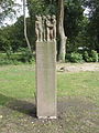
 FFM-Roedelheim Synagogen-Gedenkstele 01.jpg 1,368 × 1,824; 1.8 MB
-
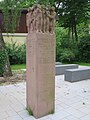
 FFM-Roedelheim Synagogen-Gedenkstele 02.jpg 1,368 × 1,824; 1.98 MB
-
 Rödelheim, Synagogendenkmal.JPG 2,848 × 4,288; 6.46 MB
-
 Synagogengedenkstätte Rödelheim 1.JPG 4,000 × 3,000; 4.08 MB
-
 Synagogengedenkstätte Rödelheim 2.JPG 4,000 × 3,000; 4.49 MB
-
 Synagogengedenkstätte Rödelheim 3.JPG 3,000 × 4,000; 3.69 MB
-
 Synagogengedenkstätte Rödelheim 4.JPG 4,000 × 3,000; 4.5 MB
-
 Synagogengedenkstätte Rödelheim 5.JPG 4,000 × 3,000; 5.18 MB


