Category:Swannington, Leicestershire
Jump to navigation
Jump to search
English: Swannington is a former mining village in Leicestershire, England. It was a terminus of the early (1832) Leicester and Swannington Railway that was built to carry away its pits' output.
village and civil parish in North West Leicestershire, UK | |||||
| Upload media | |||||
| Instance of | |||||
|---|---|---|---|---|---|
| Location | North West Leicestershire, Leicestershire, East Midlands, England | ||||
 | |||||
Media in category "Swannington, Leicestershire"
The following 121 files are in this category, out of 121 total.
-
 Arable land west of Thringstone - geograph.org.uk - 1536530.jpg 640 × 480; 149 KB
-
 Barns at KC Farm - geograph.org.uk - 4034809.jpg 1,280 × 858; 416 KB
-
-
 Bull's Head House - geograph.org.uk - 4594618.jpg 1,200 × 900; 261 KB
-
 Calcutta Pit - geograph.org.uk - 2958218.jpg 640 × 423; 226 KB
-
 Calcutta Pit - geograph.org.uk - 2958221.jpg 640 × 405; 253 KB
-
 Calcutta Pit - geograph.org.uk - 2958222.jpg 640 × 402; 225 KB
-
 Calcutta Pit - geograph.org.uk - 2958225.jpg 640 × 424; 243 KB
-
 Calcutta Pit Engine House - geograph.org.uk - 4034805.jpg 1,280 × 960; 317 KB
-
 Calcutta Pit from Church Hill - geograph.org.uk - 4034818.jpg 1,280 × 951; 410 KB
-
 Calcutta Pit headstocks - geograph.org.uk - 4034806.jpg 960 × 1,280; 314 KB
-
 Calvary at Mount St Bernard Abbey - geograph.org.uk - 369795.jpg 480 × 640; 92 KB
-
 Church Hill - geograph.org.uk - 1536069.jpg 640 × 480; 134 KB
-
 Church Hill, Peggs Green - geograph.org.uk - 2086826.jpg 640 × 480; 83 KB
-
 Church Lane bridge, Swannington - geograph.org.uk - 2022086.jpg 640 × 480; 136 KB
-
 Coleorton No. 2 Colliery - geograph.org.uk - 2958237.jpg 640 × 424; 351 KB
-
 Coleorton No. 2 Colliery - geograph.org.uk - 2958240.jpg 640 × 424; 347 KB
-
 Coleorton No. 2 Colliery - geograph.org.uk - 2958243.jpg 424 × 640; 348 KB
-
 Coleorton No. 2 Colliery - geograph.org.uk - 2958244.jpg 640 × 424; 341 KB
-
 Coleorton No. 2 Colliery - geograph.org.uk - 2958247.jpg 640 × 424; 353 KB
-
 Coleorton No. 2 Colliery - geograph.org.uk - 2958250.jpg 640 × 424; 323 KB
-
 Coleorton No. 2 Colliery - geograph.org.uk - 3445325.jpg 640 × 424; 334 KB
-

-

-
 Filling station on A512 - geograph.org.uk - 3195893.jpg 1,024 × 768; 567 KB
-
 Flooded trackbed of the former Coleorton Railway - geograph.org.uk - 4427425.jpg 1,200 × 900; 308 KB
-
 Former Bell Pit - Swannington - geograph.org.uk - 2958273.jpg 640 × 424; 351 KB
-

-
 Future Forest - geograph.org.uk - 2958291.jpg 640 × 424; 247 KB
-
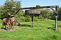
 Gin horse - geograph.org.uk - 4034831.jpg 1,280 × 921; 243 KB
-
 Gorse Field - geograph.org.uk - 2958267.jpg 640 × 424; 328 KB
-
 Gorse Field - geograph.org.uk - 2958275.jpg 640 × 424; 265 KB
-
 Gorse Field Mines - geograph.org.uk - 2958277.jpg 640 × 424; 324 KB
-

-
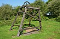
 Horse Gin - Swannington - geograph.org.uk - 2958280.jpg 640 × 424; 235 KB
-
 Horse Gin - Swannington - geograph.org.uk - 2958283.jpg 640 × 424; 300 KB
-
 Hough Mill - Brake Wheel - geograph.org.uk - 3445281.jpg 640 × 424; 271 KB
-
 Hough Mill - Brake Wheel - geograph.org.uk - 3445289.jpg 640 × 424; 259 KB
-
 Hough Mill - Cap Mechanism - geograph.org.uk - 3445286.jpg 640 × 424; 246 KB
-
 Hough Mill - Dust Floor - geograph.org.uk - 3445275.jpg 640 × 424; 251 KB
-
 Hough Mill - Dust Floor - geograph.org.uk - 3445277.jpg 640 × 424; 233 KB
-
 Hough Mill - geograph.org.uk - 2958258.jpg 424 × 640; 275 KB
-
 Hough Mill - geograph.org.uk - 2958259.jpg 640 × 424; 200 KB
-
 Hough Mill - geograph.org.uk - 2958284.jpg 640 × 423; 306 KB
-
 Hough Mill - geograph.org.uk - 2958287.jpg 437 × 640; 277 KB
-
 Hough Mill - geograph.org.uk - 2958288.jpg 640 × 424; 250 KB
-
 Hough Mill - geograph.org.uk - 2958289.jpg 424 × 640; 248 KB
-
 Hough Mill - geograph.org.uk - 3445264.jpg 424 × 640; 227 KB
-
 Hough Mill - geograph.org.uk - 3445266.jpg 640 × 424; 217 KB
-
 Hough Mill - Governor - geograph.org.uk - 3445298.jpg 424 × 640; 241 KB
-
 Hough Mill - Governor - geograph.org.uk - 3445320.jpg 424 × 640; 230 KB
-
 Hough Mill - Spur wheel and governor - geograph.org.uk - 3445293.jpg 640 × 424; 252 KB
-
 Hough Mill - Stone Nut - geograph.org.uk - 3445316.jpg 424 × 640; 233 KB
-
 Hough Mill - Stones - geograph.org.uk - 3445302.jpg 640 × 424; 254 KB
-
 Hough Mill - Tentering equipment - geograph.org.uk - 3445310.jpg 640 × 424; 250 KB
-
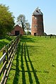
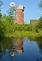
 Hough Mill, Swannington - geograph.org.uk - 4034820.jpg 1,280 × 903; 301 KB
-
 Hough Mill, Swannington - geograph.org.uk - 4034824.jpg 960 × 1,280; 492 KB
-
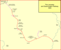 Leicester and Swannington Railway 1833.png 1,298 × 1,076; 59 KB
-
 Leicester to Swannington Railway - geograph.org.uk - 2958293.jpg 640 × 424; 350 KB
-
 Leicester to Swannington Railway - geograph.org.uk - 2958295.jpg 640 × 424; 359 KB
-
 Leicester to Swannington Railway - geograph.org.uk - 2958296.jpg 640 × 424; 354 KB
-
 Leicester to Swannington Railway - geograph.org.uk - 2958297.jpg 640 × 424; 359 KB
-
 Leicester to Swannington Railway - geograph.org.uk - 2958299.jpg 640 × 424; 353 KB
-
 Leicester to Swannington Railway - geograph.org.uk - 2958300.jpg 640 × 424; 356 KB
-
 Leicester to Swannington Railway - geograph.org.uk - 2958301.jpg 640 × 424; 368 KB
-
 Leicester to Swannington Railway - geograph.org.uk - 2958302.jpg 640 × 424; 352 KB
-
 Leicester to Swannington Railway - geograph.org.uk - 2958303.jpg 640 × 424; 356 KB
-
 Leicester to Swannington Railway - geograph.org.uk - 2958304.jpg 640 × 424; 313 KB
-
 Leicester to Swannington Railway - geograph.org.uk - 2958321.jpg 640 × 424; 313 KB
-
 Level crossing at Hough Hill - geograph.org.uk - 2086114.jpg 640 × 480; 73 KB
-
 Looking down the Swannington Incline - geograph.org.uk - 4551312.jpg 640 × 427; 121 KB
-
 L^S converted steam winch - geograph.org.uk - 2958317.jpg 640 × 424; 319 KB
-
 Meadow at Swannington Common - geograph.org.uk - 1535995.jpg 640 × 480; 131 KB
-
 Old chapel, Swannington - geograph.org.uk - 2022305.jpg 640 × 480; 79 KB
-
 Path into Grace Dieu Wood - geograph.org.uk - 239875.jpg 480 × 640; 143 KB
-
 Potato Lane bridge, Swannington - geograph.org.uk - 2022099.jpg 640 × 480; 134 KB
-
 Replica horse gin and headstocks - geograph.org.uk - 4034827.jpg 1,280 × 960; 273 KB
-
 Seat at Poachers Corner - geograph.org.uk - 239881.jpg 640 × 397; 137 KB
-
 Shared path at Hoo Ash roundabout - geograph.org.uk - 4541555.jpg 1,600 × 1,198; 1.21 MB
-
 Shirl's Roadside Cafe ^ Layby - geograph.org.uk - 3946187.jpg 1,894 × 1,757; 1.2 MB
-
 St. George's Church, Swannington - geograph.org.uk - 4427394.jpg 1,200 × 900; 148 KB
-
 Swannington Incline - geograph.org.uk - 2958305.jpg 640 × 424; 341 KB
-
 Swannington Incline - geograph.org.uk - 2958307.jpg 640 × 424; 334 KB
-
 Swannington Incline - geograph.org.uk - 2958308.jpg 640 × 424; 342 KB
-
 Swannington Incline - geograph.org.uk - 2958311.jpg 640 × 424; 330 KB
-
 Swannington Incline Winder - geograph.org.uk - 2958319.jpg 640 × 424; 308 KB
-
 Swannington village sign - geograph.org.uk - 2022340.jpg 640 × 480; 84 KB
-
 SwnningtonIncline01.jpg 1,000 × 692; 131 KB
-
 Talbot House Farmhouse and Treborough Cottage - geograph.org.uk - 4034808.jpg 1,280 × 848; 272 KB
-
 The former Fountain Inn - geograph.org.uk - 4594556.jpg 1,200 × 900; 377 KB
-
 The Robin Hood - geograph.org.uk - 4592373.jpg 2,553 × 1,764; 1.31 MB
-
 The top of Swannington Incline - geograph.org.uk - 1982705.jpg 640 × 480; 150 KB
-

-
 View from Redhill Lane - geograph.org.uk - 2958224.jpg 640 × 424; 247 KB
-
 View from winding house to Spring Lane - geograph.org.uk - 1982656.jpg 640 × 480; 108 KB
-
 View up Swannington Incline - geograph.org.uk - 2022325.jpg 640 × 480; 161 KB
-
 Village pump. Swannington - geograph.org.uk - 2022106.jpg 640 × 480; 130 KB
-
 Abbey Road - geograph.org.uk - 461818.jpg 640 × 573; 118 KB
-
 Abbey Road towards Shepshed - geograph.org.uk - 233429.jpg 640 × 480; 66 KB
-
 Country Road - geograph.org.uk - 192309.jpg 640 × 480; 74 KB
-
 Fields - geograph.org.uk - 239884.jpg 640 × 480; 104 KB
-
 Ivanhoe Way - geograph.org.uk - 239878.jpg 640 × 480; 81 KB
-
 Leicester Road near Whitwick - geograph.org.uk - 462095.jpg 553 × 640; 132 KB
-
 Leicester Road, Whitwick - geograph.org.uk - 462073.jpg 640 × 353; 69 KB
-
 Limby Hall Lane - geograph.org.uk - 192313.jpg 640 × 480; 74 KB
-
 Milking the cows - geograph.org.uk - 461967.jpg 640 × 548; 125 KB
-
 Mount Saint Bernard's Abbey - geograph.org.uk - 239894.jpg 640 × 453; 75 KB
-
 New Inn at Pegg's Green - geograph.org.uk - 28062.jpg 640 × 480; 99 KB
-
 Oaks Road near Whitwick - geograph.org.uk - 461972.jpg 640 × 478; 117 KB
-
 Poachers Corner - geograph.org.uk - 239880.jpg 640 × 480; 73 KB
-
 Redhill Farm - geograph.org.uk - 245227.jpg 640 × 363; 38 KB
-
 Rural Scene in Leicestershire - geograph.org.uk - 192310.jpg 640 × 415; 72 KB
-
 Rural traffic island - geograph.org.uk - 239876.jpg 640 × 480; 97 KB
-
 Street furniture - geograph.org.uk - 240100.jpg 640 × 480; 128 KB
-
 Swannymote Road - geograph.org.uk - 239885.jpg 640 × 480; 78 KB
-
 The A511 heading towards Bardon - geograph.org.uk - 321016.jpg 640 × 480; 92 KB
-
 The Forest Rock Hotel, Leicester Road - geograph.org.uk - 461810.jpg 640 × 390; 108 KB
-
 Warren Hills - geograph.org.uk - 233430.jpg 640 × 403; 56 KB
-
 Warren Hills Road near Agar Nook - geograph.org.uk - 461800.jpg 578 × 640; 169 KB
-
 Whitwick Colliery Winding Wheel - geograph.org.uk - 245234.jpg 640 × 427; 47 KB
-
 Woodland in Whitwick - geograph.org.uk - 462082.jpg 640 × 480; 160 KB


