Category:Sussex Ouse Valley Way
Jump to navigation
Jump to search
long-distance footpath in East and West Sussex, England  | |||||
| Upload media | |||||
| Instance of |
| ||||
|---|---|---|---|---|---|
| Location | South East England, England | ||||
| Has use | |||||
| Length |
| ||||
| Different from | |||||
| Partially coincident with | |||||
 | |||||
The Sussex Ouse Valley Way is a 42–mile long-distance footpath which closely follows the route of the Sussex Ouse, in West Sussex, England.

Media in category "Sussex Ouse Valley Way"
The following 39 files are in this category, out of 39 total.
-
 Church at Rodmell - geograph.org.uk - 1072351.jpg 640 × 480; 86 KB
-
 Ducks at Nymans Gardens - geograph.org.uk - 1072015.jpg 640 × 480; 103 KB
-

-
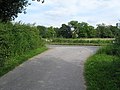
 Footpath junction - geograph.org.uk - 1754955.jpg 640 × 428; 178 KB
-
 Footpath to Newhaven - geograph.org.uk - 1583485.jpg 640 × 480; 82 KB
-
 Fork in the road - geograph.org.uk - 26818.jpg 640 × 480; 109 KB
-
 Great Bentley farm - geograph.org.uk - 26820.jpg 640 × 480; 94 KB
-
 Hangman's Acre near Lindfield - geograph.org.uk - 1348026.jpg 640 × 480; 79 KB
-
 Harvey's Brewery at Lewes - geograph.org.uk - 1072248.jpg 640 × 480; 74 KB
-
 Nymans Garden, redwood trees in the woodland.jpg 2,250 × 3,000; 3.9 MB
-
 Nymans woodland, trees by the stream.jpg 3,500 × 2,625; 3.36 MB
-
-
 Old Road through Barcombe Mills - geograph.org.uk - 1611236.jpg 480 × 640; 148 KB
-

-
 Pond with ducks near Sidnye Farm - geograph.org.uk - 1072020.jpg 640 × 480; 112 KB
-
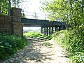
 Primmerswood Bridge - geograph.org.uk - 1610963.jpg 640 × 480; 112 KB
-

-

-

-

-
 Southease River Ouse south.JPG 3,264 × 2,448; 2.08 MB
-
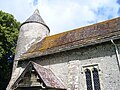 St Peter's church at Southease - geograph.org.uk - 1072486.jpg 640 × 480; 116 KB
-
 Start of the Sussex Ouse Valley Way - geograph.org.uk - 841572.jpg 640 × 353; 95 KB
-
 Sussex Ouse Valley Way - geograph.org.uk - 1039345.jpg 640 × 480; 146 KB
-
 Sussex Ouse Valley Way - geograph.org.uk - 1611026.jpg 640 × 480; 98 KB
-
 Sussex Ouse Valley Way - geograph.org.uk - 1616412.jpg 640 × 480; 78 KB
-

-
-

-

-

-
 Sussex Ouse Valley Way, Wickham Wood, approaching Copyfold Lane.jpg 4,000 × 2,660; 5.07 MB
-

-

-
 Toll bridge fees at Barcombe Mills - geograph.org.uk - 1072217.jpg 640 × 566; 114 KB
-
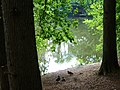
 Un-named lake - geograph.org.uk - 1133291.jpg 640 × 480; 109 KB
-
 Vanguard Way-Ouse Valley Walk - geograph.org.uk - 1583467.jpg 480 × 640; 79 KB
-
 Vanguard Way-Ouse Valley Walk - geograph.org.uk - 1583477.jpg 640 × 480; 67 KB
-
 Weir - geograph.org.uk - 1046610.jpg 640 × 480; 117 KB


