Category:Summits of Gwynedd
Jump to navigation
Jump to search
Subcategories
This category has the following 3 subcategories, out of 3 total.
P
- Penygadair (34 F)
S
- Summit area of Mynydd Nodol (3 F)
Media in category "Summits of Gwynedd"
The following 200 files are in this category, out of 209 total.
(previous page) (next page)-

-
 A fairly convincing false summit - geograph.org.uk - 835433.jpg 640 × 480; 101 KB
-

-
 A sheep on guard - geograph.org.uk - 406235.jpg 640 × 480; 80 KB
-
 Allt Fawr summit - geograph.org.uk - 6606.jpg 640 × 419; 60 KB
-
 Allt-fawr summit - geograph.org.uk - 693691.jpg 640 × 480; 62 KB
-
 Approaching the Summit of Elidir Fawr - geograph.org.uk - 226984.jpg 640 × 480; 62 KB
-

-
 Bera Bach summit - geograph.org.uk - 205450.jpg 640 × 427; 88 KB
-
 Cairn at the summit of Pen Y Cil - geograph.org.uk - 62561.jpg 640 × 480; 70 KB
-
 Carnedd Dafydd Summit Cairn - geograph.org.uk - 205548.jpg 640 × 427; 71 KB
-
 Carnedd Llewelyn main summit cairn - geograph.org.uk - 205453.jpg 640 × 427; 81 KB
-
 Carnedd y Ddelw - geograph.org.uk - 62481.jpg 640 × 480; 92 KB
-
 Carnedd Y Filiast Summit - geograph.org.uk - 580777.jpg 640 × 427; 91 KB
-
 Carreg y Diocyn - geograph.org.uk - 372187.jpg 640 × 480; 77 KB
-
 Cnicht - geograph.org.uk - 500547.jpg 640 × 480; 85 KB
-

-
 Craig y Ganllwyd. - geograph.org.uk - 398238.jpg 640 × 480; 121 KB
-
 Craiglaseithin - geograph.org.uk - 445510.jpg 640 × 480; 98 KB
-
 Diffwys - geograph.org.uk - 76541.jpg 629 × 335; 46 KB
-
 Drosgl summit cairn - geograph.org.uk - 205444.jpg 640 × 427; 64 KB
-
 Elidir Fawr - geograph.org.uk - 488786.jpg 640 × 480; 105 KB
-
 Elidir Fawr summit Cairn shelter - geograph.org.uk - 648339.jpg 640 × 427; 55 KB
-

-
 Foel Boeth - geograph.org.uk - 378976.jpg 640 × 480; 70 KB
-
 Foel Fras - geograph.org.uk - 63614.jpg 640 × 480; 124 KB
-
 Foel Fras from Garnedd Uchaf Summit - geograph.org.uk - 223074.jpg 640 × 427; 73 KB
-
 Foel Fras summit Trig pillar - geograph.org.uk - 205536.jpg 640 × 427; 93 KB
-
 Foel Goch - geograph.org.uk - 416279.jpg 640 × 480; 104 KB
-
 Foel Goch summit - geograph.org.uk - 647069.jpg 640 × 480; 82 KB
-
 Foel Grach - geograph.org.uk - 63618.jpg 640 × 480; 130 KB
-
 Gallt y Daren - geograph.org.uk - 378973.jpg 640 × 480; 84 KB
-
 Gallt Yr Ogof summit cairn - geograph.org.uk - 196636.jpg 640 × 427; 77 KB
-
 Garnedd Fawr - geograph.org.uk - 396520.jpg 640 × 480; 86 KB
-

-
 Garnedd Uchaf summit - geograph.org.uk - 205529.jpg 640 × 427; 95 KB
-
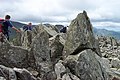
 Glyder Fach - geograph.org.uk - 703254.jpg 1,000 × 664; 338 KB
-
 Glyder Fawr summit - geograph.org.uk - 1626462.jpg 480 × 640; 56 KB
-

-
 Llechog Summit - geograph.org.uk - 837297.jpg 640 × 427; 82 KB
-
 Lliwedd - geograph.org.uk - 126722.jpg 458 × 640; 80 KB
-
 Llwytmor summit cairn in the mist - geograph.org.uk - 533331.jpg 640 × 480; 68 KB
-

-

-

-
 Manod Mawr - summit plateau - geograph.org.uk - 1112456.jpg 427 × 640; 52 KB
-
 Manod Mawr summit view - geograph.org.uk - 211216.jpg 640 × 381; 286 KB
-
 Moel Ddu - geograph.org.uk - 53789.jpg 640 × 415; 72 KB
-
 Moel Eilio towards Glyders - geograph.org.uk - 334342.jpg 640 × 480; 82 KB
-

-
 Moel Llyfnant - geograph.org.uk - 383927.jpg 640 × 480; 82 KB
-
 Moel Oernant summit - geograph.org.uk - 444916.jpg 640 × 480; 87 KB
-
 Moel yr Ogof Summit Cairn - geograph.org.uk - 648302.jpg 640 × 427; 43 KB
-
 Mynydd Glan Llyn y Forwyn. - geograph.org.uk - 398312.jpg 640 × 480; 124 KB
-

-
 Nuttall bagging. - geograph.org.uk - 542352.jpg 640 × 480; 68 KB
-
 Penygadair - Cadair Idris Summit - geograph.org.uk - 52724.jpg 640 × 286; 79 KB
-
 Penygadair - geograph.org.uk - 1426938.jpg 640 × 425; 64 KB
-
 Rhinog Fach summit - geograph.org.uk - 803533.jpg 640 × 480; 88 KB
-
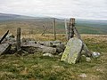
 Shelter on the summit of Gyrn - geograph.org.uk - 430274.jpg 640 × 480; 82 KB
-
 Snowdon from the Crib y Ddysgl Path - geograph.org.uk - 222498.jpg 556 × 312; 21 KB
-
 Stone Shelter on Y Foel Goch - geograph.org.uk - 222904.jpg 640 × 427; 70 KB
-
 Stone Summit Shelter on Carnedd Dafydd - geograph.org.uk - 222991.jpg 640 × 427; 120 KB
-
 Summit area of Moel-yr-hydd - geograph.org.uk - 1251765.jpg 640 × 480; 56 KB
-
 Summit cairn of Moelwyn Bach - geograph.org.uk - 353242.jpg 640 × 480; 138 KB
-
 Summit crags, Mynydd Graig Goch - geograph.org.uk - 196674.jpg 640 × 480; 145 KB
-
 Summit of Aran Benllyn - geograph.org.uk - 1418428.jpg 640 × 480; 88 KB
-
 Summit of Carnedd Dafydd. - geograph.org.uk - 7484.jpg 640 × 408; 64 KB
-
 Summit of Carnedd Llewelyn. - geograph.org.uk - 7487.jpg 640 × 420; 58 KB
-
 Summit of Diffwys - geograph.org.uk - 1238630.jpg 640 × 429; 52 KB
-
 Summit of Mynydd Perfedd - geograph.org.uk - 8193.jpg 480 × 640; 56 KB
-

-
 Summit of Rhobell Fawr - geograph.org.uk - 910.jpg 640 × 480; 43 KB
-
 Summit of Y Llethr - geograph.org.uk - 883847.jpg 640 × 480; 136 KB
-
 Summit of Y Llethr - geograph.org.uk - 883860.jpg 640 × 480; 137 KB
-
 Summit Rhinog Fach - geograph.org.uk - 36834.jpg 640 × 480; 105 KB
-
 Summit rocks, Allt Fawr. - geograph.org.uk - 680976.jpg 640 × 480; 82 KB
-
 Summit rocks, Rhobell-y-big - geograph.org.uk - 478792.jpg 640 × 480; 77 KB
-
 Summit shelter on Y Garn - geograph.org.uk - 403514.jpg 640 × 480; 88 KB
-
 Summit, Yr Aran - geograph.org.uk - 36612.jpg 640 × 451; 76 KB
-
 The rocky summit of Foel-fras - geograph.org.uk - 835234.jpg 640 × 480; 104 KB
-

-
 The rocky summit of Llwytmor - geograph.org.uk - 835448.jpg 640 × 480; 94 KB
-

-

-

-
 The summit cairn of Llwytmor Bach - geograph.org.uk - 935040.jpg 640 × 480; 73 KB
-
 The summit cairn-shelter on Drum - geograph.org.uk - 835123.jpg 640 × 480; 82 KB
-
 The Summit of Bera Bach - geograph.org.uk - 223102.jpg 640 × 427; 75 KB
-
 The summit of Diffwys - geograph.org.uk - 1101384.jpg 640 × 480; 77 KB
-

-

-
 The summit of Foel Grach - geograph.org.uk - 515268.jpg 640 × 480; 91 KB
-
 The summit of Mynydd Perfedd - geograph.org.uk - 543161.jpg 640 × 426; 134 KB
-
 The summit of Y Garn - geograph.org.uk - 543077.jpg 640 × 426; 122 KB
-
 The Summit of Yr Orsedd - geograph.org.uk - 221564.jpg 640 × 480; 50 KB
-
 The Summit Plateau of Moel Hebog - geograph.org.uk - 234338.jpg 640 × 480; 119 KB
-
 The summit ridge of Penygadair - geograph.org.uk - 370964.jpg 640 × 480; 60 KB
-

-
 The summit shelter on Gyrn - geograph.org.uk - 804806.jpg 640 × 480; 91 KB
-
 The summit wall of Mynydd Tal-y-mignedd - geograph.org.uk - 1502842.jpg 640 × 480; 101 KB
-
 The western slope of Gyrn from its summit - geograph.org.uk - 430780.jpg 640 × 480; 101 KB
-
-
 Y Foel Goch summit - geograph.org.uk - 193229.jpg 640 × 375; 87 KB
-
 Y Garn summit - geograph.org.uk - 1329336.jpg 640 × 480; 102 KB
-
 Y Garn Summit - geograph.org.uk - 65787.jpg 640 × 480; 62 KB
-
 Y Garn. - geograph.org.uk - 136899.jpg 640 × 422; 80 KB
-
 Y Llethr, summit cairn - geograph.org.uk - 754709.jpg 640 × 480; 43 KB
-
 Yr Aryg - geograph.org.uk - 63622.jpg 640 × 480; 108 KB
-
 Yr Eifl summit - geograph.org.uk - 297750.jpg 428 × 640; 65 KB
-
 Yr Elen summit - geograph.org.uk - 192566.jpg 640 × 600; 123 KB
-
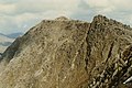
 Yr Elen summit and east ridge - geograph.org.uk - 192548.jpg 574 × 640; 111 KB
-
 Yr Wyddfa from Yr Aran summit - geograph.org.uk - 1449607.jpg 640 × 389; 38 KB
-
 A foggy Y Garn summit - geograph.org.uk - 455870.jpg 640 × 480; 53 KB
-

-
 A Minor Height - geograph.org.uk - 595366.jpg 640 × 480; 84 KB
-
 Above Cwm Cneifion - geograph.org.uk - 244884.jpg 640 × 480; 95 KB
-
 Almost there - geograph.org.uk - 412859.jpg 640 × 480; 86 KB
-

-

-

-
 Approaching the summit of Gyrn Goch - geograph.org.uk - 344131.jpg 640 × 480; 109 KB
-
 Approaching the summit of Mynydd y Gwaith - geograph.org.uk - 700760.jpg 640 × 480; 102 KB
-
 Aran Fawddwy summit - geograph.org.uk - 1013572.jpg 640 × 426; 35 KB
-
 Bera Bach from the summit of Yr Aryg - geograph.org.uk - 223079.jpg 640 × 427; 64 KB
-
 Bera Mawr - geograph.org.uk - 64041.jpg 640 × 480; 89 KB
-
 Bera Mawr from Bera Bach Summit - geograph.org.uk - 223110.jpg 640 × 427; 60 KB
-
 Bera Mawr from the Summit of Yr Aryg - geograph.org.uk - 223084.jpg 640 × 427; 50 KB
-
 Bera Mawr summit - geograph.org.uk - 205446.jpg 640 × 427; 101 KB
-
 Bwlch Mawr - geograph.org.uk - 249445.jpg 640 × 303; 39 KB
-
 Cairn shelter on summit of Mynydd Perfydd - geograph.org.uk - 543166.jpg 640 × 426; 130 KB
-
 Carnedd y Filiast - geograph.org.uk - 273408.jpg 640 × 480; 135 KB
-
 Clogwyn Mawr Summit - geograph.org.uk - 654101.jpg 640 × 480; 93 KB
-
 Craig Aberserw. - geograph.org.uk - 390737.jpg 640 × 480; 113 KB
-
 Craig Cau summit - geograph.org.uk - 657789.jpg 800 × 600; 268 KB
-
 Craig y Castell, summit. - geograph.org.uk - 49663.jpg 640 × 397; 57 KB
-
 Craig y Gwynt summit - geograph.org.uk - 185715.jpg 640 × 479; 59 KB
-
 Craig-y-garn summit - geograph.org.uk - 234074.jpg 640 × 480; 81 KB
-
 Craiglwyn from Craig Wen Summit - geograph.org.uk - 223782.jpg 640 × 427; 84 KB
-
 Dduallt summit - geograph.org.uk - 6804.jpg 640 × 414; 72 KB
-

-
 Drosgl - geograph.org.uk - 64431.jpg 640 × 480; 84 KB
-
 Drosgl from Bera Bach Summit - geograph.org.uk - 223114.jpg 640 × 427; 46 KB
-
 Erw y Ddafad-ddu - geograph.org.uk - 1427006.jpg 640 × 425; 195 KB
-
 Foel Cwm Sian Llwyd - geograph.org.uk - 65440.jpg 640 × 480; 93 KB
-
 Foel Fras from the Summit of Yr Aryg - geograph.org.uk - 223090.jpg 640 × 427; 67 KB
-
 Foel Goch - geograph.org.uk - 488529.jpg 640 × 480; 65 KB
-
 Foel Goch Summit Cairn - geograph.org.uk - 648335.jpg 640 × 427; 83 KB
-
 Garn Fach. - geograph.org.uk - 398307.jpg 640 × 480; 118 KB
-
 Garnedd Uchaf - geograph.org.uk - 63616.jpg 640 × 480; 126 KB
-

-
-
 Gyrn Ddu - geograph.org.uk - 157536.jpg 640 × 417; 73 KB
-
 Gyrn Wigau - geograph.org.uk - 64435.jpg 640 × 480; 87 KB
-
 Gyrn Wigiau true summit - geograph.org.uk - 205442.jpg 640 × 427; 45 KB
-
-
 Llwytmor - geograph.org.uk - 63611.jpg 640 × 480; 117 KB
-
 Llwytmor Bach summit cairn - geograph.org.uk - 533334.jpg 640 × 480; 119 KB
-
 Llwytmor from Foel Fras Summit - geograph.org.uk - 223127.jpg 640 × 427; 68 KB
-
 Llwytmor from Yr Aryg Summit - geograph.org.uk - 223087.jpg 640 × 427; 63 KB
-
-

-

-
 Moel Emoel - geograph.org.uk - 396465.jpg 640 × 480; 75 KB
-
 Moel Lefn - geograph.org.uk - 58551.jpg 640 × 480; 84 KB
-
 Moel Tryfan - geograph.org.uk - 293839.jpg 640 × 480; 59 KB
-
 Moel yr Ogof - geograph.org.uk - 58538.jpg 640 × 480; 85 KB
-
 Moelfre summit - geograph.org.uk - 525274.jpg 640 × 480; 104 KB
-
 Moelwyn Bach summit - geograph.org.uk - 60597.jpg 640 × 480; 101 KB
-
 Nearing the summit - geograph.org.uk - 681585.jpg 640 × 480; 86 KB
-
 On Top of Cader Idris. - geograph.org.uk - 116858.jpg 640 × 274; 82 KB
-
 Pared y Cefn hir - geograph.org.uk - 594617.jpg 640 × 480; 110 KB
-
 Pen y Brynfforchog - geograph.org.uk - 422157.jpg 640 × 480; 97 KB
-
 Pen yr Ole Wen Summit Plateau - geograph.org.uk - 222982.jpg 640 × 427; 66 KB
-
 Point 304. - geograph.org.uk - 616775.jpg 640 × 441; 54 KB
-
 Summit cairn - geograph.org.uk - 551862.jpg 640 × 480; 84 KB
-
 Summit Cairn of Mynydd Perfedd - geograph.org.uk - 580782.jpg 640 × 427; 79 KB
-
 Summit of Diffwys - geograph.org.uk - 42008.jpg 640 × 480; 77 KB
-
 Summit of Galt y Daren in mist - geograph.org.uk - 650197.jpg 640 × 480; 41 KB
-
 Summit of Glasgwm - geograph.org.uk - 650223.jpg 640 × 480; 64 KB
-
 Summit of Mynydd Cedris - geograph.org.uk - 393007.jpg 640 × 480; 103 KB
-

-
 Summit of Mynydd Nodol - geograph.org.uk - 297893.jpg 640 × 480; 78 KB
-
 Summit of Pen yr Allt Uchaf - geograph.org.uk - 652033.jpg 640 × 480; 104 KB
-

-

-
 The summit cairn of Gyrn Goch - geograph.org.uk - 344139.jpg 640 × 480; 65 KB
-
 The summit cairn on Tre'r Ceiri - geograph.org.uk - 708346.jpg 640 × 480; 54 KB
-
 The Summit of Craig Wen - geograph.org.uk - 654128.jpg 640 × 480; 70 KB
-
 The Summit of Derlwyn - geograph.org.uk - 244425.jpg 640 × 310; 40 KB
-
 The Summit of Foel Goch - geograph.org.uk - 226145.jpg 640 × 480; 79 KB
-
 The summit of Foel Hafod-fynydd - geograph.org.uk - 652127.jpg 640 × 480; 89 KB
-
 The summit of Gwaun y Llwyni - geograph.org.uk - 652090.jpg 640 × 480; 103 KB
-
 The summit of Moel Rhiwen - geograph.org.uk - 453474.jpg 640 × 480; 72 KB
-
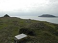
 The summit of Mynydd Anelog - geograph.org.uk - 605779.jpg 640 × 480; 63 KB
-

-

-
 The summit pillars of Bera Mawr - geograph.org.uk - 233278.jpg 640 × 480; 71 KB
-
 The summit plateau of Cefn Du - geograph.org.uk - 303685.jpg 640 × 480; 61 KB
-
 The summit plateau of Gyrn Goch - geograph.org.uk - 344533.jpg 640 × 480; 53 KB


_-_geograph.org.uk_-_82105.jpg)


_-_geograph.org.uk_-_234373.jpg)


