Category:Streets in Lyng, Norfolk
Jump to navigation
Jump to search
Subcategories
This category has the following 6 subcategories, out of 6 total.
F
- Farman Close, Lyng (1 F)
H
- Hase's Lane (8 F)
P
- Port Row (1 F)
R
- Rectory Road, Lyng (1 F)
S
T
- The Common, Lyng (4 F)
Media in category "Streets in Lyng, Norfolk"
The following 18 files are in this category, out of 18 total.
-
 Cart sheds at Lyng House - geograph.org.uk - 4279473.jpg 640 × 480; 103 KB
-
 Elsing Road, Lyng - geograph.org.uk - 2236676.jpg 640 × 480; 131 KB
-
 Farman Close, Lyng - geograph.org.uk - 2236682.jpg 640 × 480; 90 KB
-
 Hases Lane Lyng Easthaugh - geograph.org.uk - 4279524.jpg 640 × 480; 97 KB
-
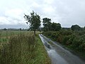 Rural road near Primrose Green - geograph.org.uk - 5541244.jpg 640 × 480; 65 KB
-
 Slashed hedges at Primrose Green - geograph.org.uk - 4279470.jpg 640 × 480; 134 KB
-
 The Old Smithy Lyng.JPG 3,264 × 2,448; 1.99 MB
-

-
 A Road And A Drain - geograph.org.uk - 274734.jpg 640 × 480; 97 KB
-
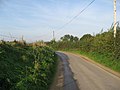
 Hockering Green Road - geograph.org.uk - 274745.jpg 640 × 480; 100 KB
-
 Sweeping Curves - geograph.org.uk - 296235.jpg 640 × 480; 71 KB
-
 The Road From Lyng - geograph.org.uk - 274724.jpg 640 × 480; 96 KB
-
 The Road To Easthaugh - geograph.org.uk - 274704.jpg 640 × 480; 96 KB
-
 The Road To Elsing - geograph.org.uk - 275307.jpg 640 × 480; 98 KB
-
 The Road To Hockering - geograph.org.uk - 296190.jpg 640 × 480; 81 KB
-
 The Road To Lyng - geograph.org.uk - 296198.jpg 640 × 480; 106 KB
-
 The Road To Sparham - geograph.org.uk - 296195.jpg 640 × 480; 80 KB
-
 The Road To Willows Farm - geograph.org.uk - 296227.jpg 640 × 480; 99 KB


