Category:Streets in Ashburton, Devon
Jump to navigation
Jump to search
Subcategories
This category has the following 3 subcategories, out of 3 total.
E
N
W
Media in category "Streets in Ashburton, Devon"
The following 24 files are in this category, out of 24 total.
-
 Ashburton, Kingsbridge Lane - geograph.org.uk - 833265.jpg 640 × 427; 150 KB
-
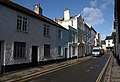
 Ashburton, St Lawrence Lane - geograph.org.uk - 1779538.jpg 640 × 480; 73 KB
-

-
 Church Path, Ashburton - geograph.org.uk - 1083271.jpg 640 × 480; 81 KB
-
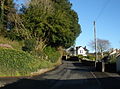
 Dartmoor lodge, Ashburton - geograph.org.uk - 14681.jpg 636 × 356; 83 KB
-
 Dolbeare Road, Ashburton - geograph.org.uk - 1200932.jpg 640 × 480; 83 KB
-
 Houses on Roborough Lane - geograph.org.uk - 2892641.jpg 1,024 × 768; 196 KB
-
 Houses, St Lawrence Lane, Ashburton (geograph 3700168).jpg 2,000 × 1,437; 687 KB
-
 Kingsbridge Lane, Ashburton - geograph.org.uk - 1202562.jpg 406 × 640; 48 KB
-
 Modernising the Town Centre, Ashburton.jpg 640 × 367; 105 KB
-
 Roborough Lane, Ashburton - geograph.org.uk - 1202703.jpg 480 × 640; 48 KB
-
 Service station, Ashburton - geograph.org.uk - 1082242.jpg 640 × 377; 65 KB
-
 St Lawrence Lane (geograph 3981821).jpg 4,912 × 3,264; 4.5 MB
-
 St Lawrence Lane, Ashburton (geograph 4847478).jpg 2,000 × 1,333; 1.85 MB
-
 St Lawrence Lane, Ashburton - geograph.org.uk - 1201867.jpg 640 × 480; 65 KB
-
 St Lawrence Lane, Ashburton - geograph.org.uk - 1202393.jpg 640 × 621; 81 KB
-
 St Lawrence Lane, Ashburton - geograph.org.uk - 1202405.jpg 640 × 439; 67 KB
-
 Telephone box, Ashburton - geograph.org.uk - 1309004.jpg 640 × 480; 112 KB
-
 View down St Lawrence Lane (geograph 3981817).jpg 4,912 × 3,264; 4.56 MB
-
 Western Road, Ashburton - geograph.org.uk - 1068624.jpg 640 × 472; 108 KB
-

-
 Whistley Hill, Ashburton - geograph.org.uk - 1201070.jpg 480 × 640; 73 KB
-
 Whistley Hill, Ashburton - geograph.org.uk - 1201305.jpg 640 × 480; 85 KB
-
 Woodland Road, Ashburton (geograph 3293260).jpg 1,024 × 768; 247 KB


.jpg)


.jpg)
.jpg)


.jpg)


.jpg)