Category:Street signs in the Royal Borough of Kingston upon Thames
Jump to navigation
Jump to search

Media in category "Street signs in the Royal Borough of Kingston upon Thames"
The following 18 files are in this category, out of 18 total.
-
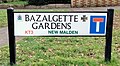 Bazalgette Gardens, New Malden. Street sign.jpg 3,653 × 2,005; 1.55 MB
-
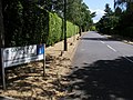 Coombe Wood Road - geograph.org.uk - 879520.jpg 640 × 480; 106 KB
-
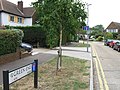
 Firman Close, New Malden, London.jpg 1,820 × 1,067; 735 KB
-
 Former Cooper Car Company works - Ivey House Hollyfield Road Surbiton (4).jpg 2,000 × 1,500; 700 KB
-
 Green End, Hook - geograph.org.uk - 1983344.jpg 640 × 480; 104 KB
-
 Hawkhurst Gardens, Hook - geograph.org.uk - 1983353.jpg 640 × 480; 100 KB
-
 Kingston St John01.JPG 1,780 × 1,334; 596 KB
-
 Ladderstile Ride - geograph.org.uk - 1273597.jpg 640 × 480; 187 KB
-
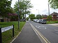
 Ladderstile Ride KT2. (8151056260).jpg 3,648 × 2,736; 2.43 MB
-
 London Sept 2013 Warren George Rd.JPG 3,072 × 2,304; 1.31 MB
-
 Looking into Cranborne Avenue - geograph.org.uk - 4319473.jpg 800 × 463; 96 KB
-
 Looking south on Princes Avenue - geograph.org.uk - 4320390.jpg 800 × 533; 116 KB
-
-
 Marston Avenue road name sign - geograph.org.uk - 5999712.jpg 1,920 × 1,280; 1.81 MB
-
 Nipper Alley sign.jpg 4,032 × 3,024; 2.41 MB
-

-
 Rosemary Gardens, Hook - geograph.org.uk - 1983366.jpg 640 × 480; 80 KB
-
 Westbury Road - geograph.org.uk - 3092161.jpg 4,288 × 3,216; 3.53 MB


.jpg)


.jpg)


.jpg)

