Category:Streams in the Metropolitan Borough of Wigan
Jump to navigation
Jump to search
Subcategories
This category has only the following subcategory.
B
Media in category "Streams in the Metropolitan Borough of Wigan"
The following 40 files are in this category, out of 40 total.
-
 Bedford Brook - geograph.org.uk - 2325449.jpg 640 × 480; 318 KB
-
 Billy Pit Brook - geograph.org.uk - 5489699.jpg 640 × 480; 625 KB
-

-
 Bridge Over Hey Brook - geograph.org.uk - 2866595.jpg 640 × 480; 444 KB
-
 Bridge over Pennington Brook - geograph.org.uk - 2369105.jpg 1,280 × 960; 987 KB
-

-
 Bridge over stream, Fairhurst Lane - geograph.org.uk - 1832567.jpg 816 × 612; 174 KB
-
 Brook in The Valley, Atherton - geograph.org.uk - 89077.jpg 480 × 640; 187 KB
-
 Brook near Crooke - geograph.org.uk - 3334960.jpg 480 × 640; 154 KB
-
 Brook running under Hough Lane - geograph.org.uk - 98721.jpg 480 × 640; 148 KB
-
 Chanters Brook alongside Blacksmiths Fold - geograph.org.uk - 3405421.jpg 1,024 × 768; 218 KB
-
 Chanters Brook alongside Bolton Old Road - geograph.org.uk - 3405457.jpg 1,024 × 768; 234 KB
-
 Chanters Brook dropping down to Blacksmiths Fold - geograph.org.uk - 3405413.jpg 1,024 × 768; 222 KB
-
 Close Brook and culvert - geograph.org.uk - 1737617.jpg 2,816 × 2,112; 1.86 MB
-
 Footbridge over Bradley Brook - geograph.org.uk - 4591033.jpg 768 × 1,024; 333 KB
-
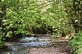
 Hey Brook - geograph.org.uk - 3355373.jpg 768 × 1,024; 260 KB
-
 Hey Brook - geograph.org.uk - 5111369.jpg 5,184 × 2,607; 1.73 MB
-
 Hey Brook - geograph.org.uk - 5111378.jpg 5,141 × 3,104; 1.97 MB
-
 Hindsford Brook - geograph.org.uk - 2975422.jpg 640 × 480; 460 KB
-
 Ince Brook - geograph.org.uk - 94129.jpg 426 × 640; 166 KB
-
 Lee Hall Brook - geograph.org.uk - 2236446.jpg 640 × 480; 339 KB
-
 Millingford Brook - geograph.org.uk - 1102064.jpg 640 × 426; 127 KB
-
 Millingford Brook - geograph.org.uk - 4041369.jpg 3,456 × 4,608; 6.37 MB
-
 Millingford Brook flowing under Town Bridge, Ashton-in-Makerfield.jpg 4,482 × 2,985; 14.15 MB
-
 Moss Brook - geograph.org.uk - 55611.jpg 640 × 480; 111 KB
-
 Nan Holes Brook - geograph.org.uk - 2866639.jpg 640 × 480; 433 KB
-
 Old Mill Brook - geograph.org.uk - 691973.jpg 480 × 640; 75 KB
-
 Old Mill Brook - geograph.org.uk - 691983.jpg 480 × 640; 148 KB
-
 Old Mill Brook near Tyldesley - geograph.org.uk - 118693.jpg 640 × 480; 142 KB
-
 Pennington Brook - geograph.org.uk - 3355791.jpg 900 × 1,200; 436 KB
-
 Pennington Brook - geograph.org.uk - 52061.jpg 640 × 480; 64 KB
-
 Pennington Brook - geograph.org.uk - 55601.jpg 640 × 480; 95 KB
-
 Pennington Brook, Leigh - geograph.org.uk - 2654014.jpg 640 × 480; 99 KB
-
 Smithy Brook - geograph.org.uk - 1838080.jpg 4,592 × 3,056; 6.69 MB
-
 Smithy Brook at Pemberton Road - geograph.org.uk - 5224655.jpg 1,024 × 768; 607 KB
-
 Stream from Bedford Bridge - geograph.org.uk - 1848409.jpg 4,224 × 3,168; 2.2 MB
-
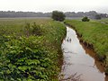
 Stream near East Lancs Road - geograph.org.uk - 1092337.jpg 480 × 640; 111 KB
-

-
 The brook at the end of Park Lane - geograph.org.uk - 2636793.jpg 3,774 × 2,965; 6.78 MB
-
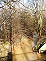
 Footbridge near to Lake in Barton Clough - geograph.org.uk - 754707.jpg 640 × 479; 111 KB


