Category:Streams in Salzburg (state)
Jump to navigation
Jump to search
Deutsch: Bäche im Bundesland Salzburg
Subcategories
This category has the following 59 subcategories, out of 59 total.
!
A
B
- Berndorferbach (3 F)
- Buchweißbach (2 F)
E
- Ellmaubach (2 F)
F
- Forstaubach (3 F)
- Fritzbach (2 F)
- Fuscher Ache (10 F)
G
- Glasbach (Salzach) (3 F)
- Griesbach (Taugl, Hintersee) (2 F)
H
- Habach (river) (5 F)
- Harhamer Bach (5 F)
K
- Kehlbach (Salzach) (2 F)
- Kertererbach (1 F)
- Kleinarler Bach (1 F)
- Kothbach (Salzach) (4 F)
L
- Lettensauerbach (3 F)
M
- Moosbach (Loferbach) (2 F)
N
O
P
R
- Rainbach (4 F)
- Reitbach (Salzach) (7 F)
- Rothbach (Pladenbach) (4 F)
S
- Schönbach (Wallersee) (2 F)
- Siglitzbach (7 F)
- Spatzeigraben (12 F)
- Spumbach (3 F)
T
- Torrenerache (18 F)
U
W
- Wallerbach (6 F)
- Wengerbach (2 F)
- Wiesengraben (Obertrumersee) (1 F)
Media in category "Streams in Salzburg (state)"
The following 31 files are in this category, out of 31 total.
-
 1552 - Zell am See.JPG 2,736 × 3,648; 2.63 MB
-
 Adnet - Schwemmbach - 2020 08 11-1.jpg 3,188 × 4,782; 3.8 MB
-
 Adnet - Schwemmbach - 2020 08 11-2.jpg 3,456 × 5,184; 5.75 MB
-
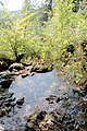
 Antheringer Bach.jpg 1,600 × 960; 576 KB
-
 Böckstein Anlaufbach Furkationszone 01.jpg 6,000 × 4,000; 17.48 MB
-
 Böckstein Hörkarbach-Wasserfall 01.jpg 4,000 × 6,000; 16.88 MB
-
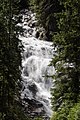 Böckstein Hörkarbach-Wasserfall 02.jpg 3,742 × 5,613; 14.02 MB
-
 Böckstein Hörkarbach-Wasserfall 03.jpg 6,000 × 4,000; 14.77 MB
-
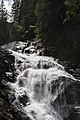 Böckstein Hörkarbach-Wasserfall 04.jpg 3,675 × 5,512; 9.83 MB
-
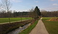
 Eugendorf vs Henndorf.JPG 640 × 480; 128 KB
-
 Färbertorgasse 1 Hallein, Antlessbach.jpg 4,000 × 3,000; 8.65 MB
-
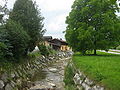
 Henndorf (Flusse).JPG 480 × 640; 118 KB
-
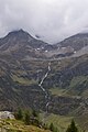
 Hintergöriach - panoramio (1).jpg 6,954 × 2,682; 5.35 MB
-
 Hintergöriach - panoramio (6).jpg 1,924 × 5,724; 2.1 MB
-
 Hintergöriach - panoramio (9).jpg 2,368 × 3,200; 2.45 MB
-
 Krallerbach 3.jpg 1,920 × 1,440; 740 KB
-
 Leoganger Ache Hutten.JPG 3,554 × 2,372; 5.43 MB
-
 Lettenbach.JPG 4,000 × 3,000; 2.6 MB
-
 Murbrecher near Grüneggalm.jpg 2,700 × 2,110; 4.67 MB
-
 Rußbach westlich vom Pass Gschütt, 1.jpeg 3,600 × 2,400; 4.75 MB
-
 Schlapperebenbach.jpg 1,365 × 2,048; 963 KB
-
 Schmittenbach Franz-Josef-Straße.JPG 2,999 × 2,031; 3.38 MB
-
 Seisenbergklamm01.jpg 1,536 × 2,048; 968 KB
-
 Seisenbergklamm02.jpg 1,536 × 2,048; 1.05 MB
-
 Sportgastein 3212.jpg 3,456 × 5,184; 13.61 MB
-
 Steinbach-Schneizlreuth.jpg 400 × 300; 114 KB
-
 THALGAU (Flusse).JPG 640 × 480; 83 KB
-
 Thumersbach village, part of Zell am See in 2011 (3).JPG 4,752 × 3,168; 7.79 MB
-
 Thumersbach village, part of Zell am See in 2011 (5).JPG 4,752 × 3,168; 5.76 MB
-
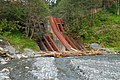
 Wildbachverbauung DSC 0106w.jpg 2,896 × 1,944; 4.7 MB
-
 Wildbachverbauung-DSC 0042w.jpg 2,865 × 1,912; 3.41 MB


.JPG)
.jpg)


.JPG)
.JPG)
.JPG)


.jpg)
.jpg)