Category:Stowey-Sutton
Jump to navigation
Jump to search
English: Stowey-Sutton is a civil parish in the Bath and North East Somerset District of Somerset, England within the Chew Valley. The parish contains the villages of Stowey and Bishop Sutton and has a population of 1,222.
civil parish in Somerset, United Kingdom  | |||||
| Upload media | |||||
| Instance of | |||||
|---|---|---|---|---|---|
| Location | Bath and North East Somerset, Somerset, South West England, England | ||||
 | |||||
Subcategories
This category has the following 4 subcategories, out of 4 total.
Media in category "Stowey-Sutton"
The following 182 files are in this category, out of 182 total.
-
 'Lakeside' - geograph.org.uk - 4854469.jpg 2,304 × 1,704; 1.66 MB
-
 'Lakeview' - geograph.org.uk - 4867675.jpg 2,304 × 1,704; 1.32 MB
-
 'Summerleaze' - geograph.org.uk - 4867787.jpg 2,304 × 1,704; 1.4 MB
-

-

-

-

-
 2010 , Wheat field near Folly Farm - geograph.org.uk - 1931818.jpg 800 × 587; 174 KB
-
 2012 , A368 approaching Sutton Wick - geograph.org.uk - 3118295.jpg 4,037 × 2,740; 4.36 MB
-
 2012 , A368 entering Sutton Wick - geograph.org.uk - 3098268.jpg 3,666 × 2,577; 3.15 MB
-
 2012 , Barelegs Brake from the bottom of Sutton Hill - geograph.org.uk - 2897118.jpg 4,752 × 3,168; 6.07 MB
-
 2012 , Barn on Burledge Hill - geograph.org.uk - 3102532.jpg 4,752 × 3,168; 4.74 MB
-
 2012 , Down Barelegs Brake to the Chew Valley Lake - geograph.org.uk - 2871732.jpg 4,000 × 2,456; 3.22 MB
-
 2012 , Farmhouse seen from Sutton Hill - geograph.org.uk - 2871746.jpg 4,752 × 3,168; 5.36 MB
-
 2012 , Gold's Cross on the minor road to Chew Magna - geograph.org.uk - 2897164.jpg 4,752 × 3,168; 6.81 MB
-
 2012 , Harvested wheatfield - geograph.org.uk - 3101035.jpg 4,719 × 2,941; 5.81 MB
-
 2012 , House at the head of Barelegs Brake - geograph.org.uk - 2897049.jpg 3,692 × 2,265; 2.95 MB
-
 2012 , Minor road near Gold's Cross - geograph.org.uk - 2897140.jpg 3,088 × 2,564; 3.71 MB
-
 2012 , Minor road to Bishop Sutton - geograph.org.uk - 3107044.jpg 2,983 × 2,473; 3.28 MB
-
 2012 , North east from Sutton Hill - geograph.org.uk - 2897071.jpg 4,212 × 3,142; 5.55 MB
-
 2012 , Pasture north of Bonhill Road - geograph.org.uk - 3104380.jpg 3,036 × 2,292; 2.79 MB
-
 2012 , Road past Stowey Cottage - geograph.org.uk - 2872006.jpg 3,559 × 2,637; 4.91 MB
-
 2012 , Stowey Road crossing the head of Barelegs Brake - geograph.org.uk - 2896082.jpg 3,848 × 2,038; 2.64 MB
-
 2012 , Stowey Road heading west toward White Cross - geograph.org.uk - 2896097.jpg 3,399 × 2,467; 4.72 MB
-
 2012 , Sutton Hill Road - going down - geograph.org.uk - 2897062.jpg 2,938 × 4,080; 6.65 MB
-
 2012 , T'other side the hedge - geograph.org.uk - 3100860.jpg 4,485 × 2,902; 6.31 MB
-
 2012 , Track on Burledge Common - geograph.org.uk - 3102503.jpg 3,672 × 2,720; 5.13 MB
-
 A busy path - geograph.org.uk - 4868560.jpg 2,304 × 1,704; 1.79 MB
-
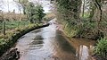 A ford in flood after heavy February rains - geograph.org.uk - 4824331.jpg 3,648 × 2,048; 2.54 MB
-
 A stream by the church - geograph.org.uk - 4871029.jpg 1,704 × 2,304; 1.53 MB
-
 Above Poole Farm - geograph.org.uk - 4868456.jpg 2,304 × 1,704; 1.75 MB
-
 Access Land from Hillside - geograph.org.uk - 4868496.jpg 1,704 × 2,304; 1.65 MB
-
 Across the Barelogs - geograph.org.uk - 4868523.jpg 2,304 × 1,704; 1.64 MB
-
 Across the Hollow Brook - geograph.org.uk - 4854453.jpg 2,304 × 1,704; 1.72 MB
-
 Ancient Oak Tree at Folly Farm - geograph.org.uk - 988414.jpg 640 × 480; 128 KB
-
 Around Wick Green Copse - geograph.org.uk - 4855160.jpg 2,304 × 1,704; 1.62 MB
-
 Ascending Burledge Hill - geograph.org.uk - 4868447.jpg 1,704 × 2,304; 2.62 MB
-
 At the end of a hard life - geograph.org.uk - 4867783.jpg 2,304 × 1,704; 1.59 MB
-
 Back to the village roads - geograph.org.uk - 4868445.jpg 2,304 × 1,704; 1.71 MB
-
 Barelegs Brake, near Stowey - geograph.org.uk - 1123173.jpg 640 × 480; 111 KB
-
 Birdwatchers view - geograph.org.uk - 4284874.jpg 3,264 × 2,448; 2.16 MB
-
 Bishop Sutton Methodist church - geograph.org.uk - 4870879.jpg 2,304 × 1,704; 1.46 MB
-
 Bishop Sutton Mill - geograph.org.uk - 4870939.jpg 2,304 × 1,704; 1.8 MB
-
 Bishop Sutton School - geograph.org.uk - 4869470.jpg 2,304 × 1,704; 1.5 MB
-
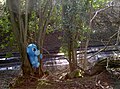 Blue creature in the trees - geograph.org.uk - 4855200.jpg 2,304 × 1,704; 1.67 MB
-
 Broad Wood - geograph.org.uk - 2167807.jpg 3,072 × 2,304; 2.84 MB
-
 Burledge Hill Access Land - geograph.org.uk - 4868463.jpg 1,704 × 2,304; 1.63 MB
-
 By order of the Manor House - geograph.org.uk - 4869456.jpg 1,704 × 2,304; 2 MB
-
 By Sutton Hill Road - geograph.org.uk - 4868587.jpg 2,304 × 1,704; 1.67 MB
-
 Charcoal burning at Folly Farm - geograph.org.uk - 988418.jpg 640 × 480; 83 KB
-
 Chew Valley Lake from Denny Island - geograph.org.uk - 4068814.jpg 4,608 × 3,456; 3.39 MB
-
 Close to the church - geograph.org.uk - 4870958.jpg 1,704 × 2,304; 2.05 MB
-
 Damaged by Storm - geograph.org.uk - 4854459.jpg 2,304 × 1,704; 1.64 MB
-
 Dangerous trees and branches - geograph.org.uk - 4854462.jpg 2,304 × 1,704; 1.75 MB
-
 Denny Island - geograph.org.uk - 4068828.jpg 4,608 × 3,456; 3.47 MB
-
 Denny Island from the bird hide - geograph.org.uk - 4284879.jpg 3,264 × 2,448; 2.39 MB
-
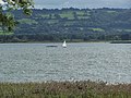 Dinghy on Lake - geograph.org.uk - 2853003.jpg 2,576 × 1,932; 1.3 MB
-

-

-
 Direction Sign - Signpost on the A368 at Stowey - geograph.org.uk - 6069082.jpg 1,715 × 1,186; 135 KB
-
 Double posts - geograph.org.uk - 4868451.jpg 1,704 × 2,304; 2.01 MB
-
 Dry today - geograph.org.uk - 1959386.jpg 2,296 × 1,475; 1.42 MB
-
 Either way around Burledge Hill - geograph.org.uk - 4868485.jpg 2,304 × 1,704; 1.7 MB
-
 Entrance to Chew Valley Fruit Farm - geograph.org.uk - 1959377.jpg 2,304 × 1,704; 1.68 MB
-
-
 Fallen trees on Denny Island - geograph.org.uk - 4068819.jpg 3,456 × 4,608; 5.68 MB
-
 Field edge boundary on Burledge Common - geograph.org.uk - 2167262.jpg 3,072 × 2,304; 4.23 MB
-
 Field west of Whitegates - geograph.org.uk - 4854472.jpg 2,304 × 1,704; 1.64 MB
-
 Fields near Bishop Sutton - geograph.org.uk - 5787608.jpg 1,600 × 900; 141 KB
-
 Flush bracket - geograph.org.uk - 1957624.jpg 1,704 × 2,304; 2.19 MB
-
 Folly Farm Centre - geograph.org.uk - 6116288.jpg 4,608 × 3,456; 7.24 MB
-
 Folly Farmhouse - geograph.org.uk - 988434.jpg 480 × 640; 105 KB
-
 Footbridge over the pond - geograph.org.uk - 4868568.jpg 2,304 × 1,704; 1.71 MB
-
 Footpath to the football - geograph.org.uk - 4868439.jpg 1,704 × 2,304; 1.48 MB
-
 Ford at Stowey Brook - geograph.org.uk - 4972542.jpg 3,000 × 2,000; 1.73 MB
-
 Ford at Sutton Court - geograph.org.uk - 4972526.jpg 3,000 × 2,000; 1.72 MB
-
 Ford, Stowey - geograph.org.uk - 6116299.jpg 2,592 × 4,608; 7.21 MB
-
 Former quarry-mineworkings on Burledge Hill - geograph.org.uk - 2167775.jpg 3,072 × 2,304; 4.26 MB
-
 From Hollow Brook - geograph.org.uk - 4854457.jpg 2,304 × 1,704; 1.7 MB
-
 Gate in the fencing - geograph.org.uk - 4868449.jpg 2,304 × 1,704; 1.73 MB
-
 Grazing cattle in pasture - geograph.org.uk - 2167784.jpg 3,072 × 2,304; 3.97 MB
-
 Ham Lane - geograph.org.uk - 4854473.jpg 2,304 × 1,704; 1.82 MB
-
 Hillside spring above Stowey House - geograph.org.uk - 4824349.jpg 3,648 × 2,048; 2.77 MB
-
 History went straight on - geograph.org.uk - 4855192.jpg 1,704 × 2,304; 2.29 MB
-
 Holding up the traffic - geograph.org.uk - 4867801.jpg 1,704 × 2,304; 1.72 MB
-
 Holy Trinity benchmark - geograph.org.uk - 4870974.jpg 1,704 × 2,304; 2.04 MB
-
 Leaving Access Land - geograph.org.uk - 4868459.jpg 1,704 × 2,304; 1.51 MB
-
 Livestock in field - geograph.org.uk - 4868444.jpg 2,304 × 1,704; 1.74 MB
-
 Lumps and bumps - geograph.org.uk - 4868474.jpg 2,304 × 1,704; 1.79 MB
-
 Meadowland at Folly Farm - geograph.org.uk - 987175.jpg 640 × 480; 110 KB
-
 Measuring its length upon the ground - geograph.org.uk - 4868520.jpg 1,704 × 2,304; 2.45 MB
-
 Methodism in Bishop Sutton - geograph.org.uk - 4870889.jpg 2,304 × 1,704; 1.65 MB
-
 Millstone upright - geograph.org.uk - 4870902.jpg 1,704 × 2,304; 2.14 MB
-
 Mirroring the directions - geograph.org.uk - 4867790.jpg 2,304 × 1,704; 1.26 MB
-
 Misty lake - geograph.org.uk - 4801413.jpg 2,304 × 1,704; 1.03 MB
-
 Nanny Hurn's Lane, near Stowey - geograph.org.uk - 1123148.jpg 640 × 480; 138 KB
-
 Neglected stile - geograph.org.uk - 4855148.jpg 2,304 × 1,704; 1.69 MB
-
 No Public Access. No Dogs. - geograph.org.uk - 4855207.jpg 2,304 × 1,704; 1.78 MB
-
 No turning circle^ - geograph.org.uk - 4855210.jpg 2,304 × 1,704; 1.64 MB
-
 North end of Nanny Hurn's Lane - geograph.org.uk - 2009985.jpg 2,592 × 1,944; 1.54 MB
-
 North Hill Meadow at Folly Farm - geograph.org.uk - 988426.jpg 640 × 480; 72 KB
-

-
 Oak tree in pasture with grazing cattle - geograph.org.uk - 2167780.jpg 3,072 × 2,304; 3.53 MB
-
 Off Sutton Hill Road - geograph.org.uk - 4868501.jpg 1,704 × 2,304; 2.07 MB
-
 Old cats crossing - geograph.org.uk - 4868578.jpg 1,704 × 2,304; 1.87 MB
-

-

-

-
-
 Old Pit Garage - geograph.org.uk - 4867768.jpg 2,304 × 1,704; 1.48 MB
-
 Old tree, Folly Farm - geograph.org.uk - 6116293.jpg 3,000 × 2,250; 5.14 MB
-
 On Sutton Hill - geograph.org.uk - 2665758.jpg 2,592 × 1,944; 1.97 MB
-
 On the Bittern Trail by Chew Valley Lake - geograph.org.uk - 2662334.jpg 2,592 × 1,944; 1.87 MB
-
 Over-wintering^ - geograph.org.uk - 4869461.jpg 2,304 × 1,704; 1.64 MB
-
 Overgrown or dried up^ - geograph.org.uk - 4868571.jpg 2,304 × 1,704; 1.81 MB
-
 Path by Vine House - geograph.org.uk - 4868593.jpg 2,304 × 1,704; 1.61 MB
-
 Plank bridge across a small stream - geograph.org.uk - 2167789.jpg 3,072 × 2,304; 4.61 MB
-
 Praying for salvation - geograph.org.uk - 4870885.jpg 1,704 × 2,304; 1.93 MB
-
 Primroses in the sunshine - geograph.org.uk - 4868481.jpg 2,304 × 1,704; 1.69 MB
-
 Ram station - geograph.org.uk - 4868528.jpg 1,704 × 2,304; 1.96 MB
-
 Reminder of the past - geograph.org.uk - 4870907.jpg 2,304 × 1,704; 1.68 MB
-
 Road closure warning - geograph.org.uk - 2539188.jpg 640 × 480; 198 KB
-
 Road junction, near Stowey - geograph.org.uk - 1123127.jpg 640 × 480; 115 KB
-
 Round Hill North East Somerset - geograph.org.uk - 4080886.jpg 3,648 × 2,736; 4.42 MB
-
 Royal bus stop - geograph.org.uk - 4867700.jpg 2,304 × 1,704; 1.58 MB
-
 Running the line - geograph.org.uk - 3960250.jpg 2,304 × 1,704; 1.39 MB
-
 Rusty at the bottom - geograph.org.uk - 4868505.jpg 1,704 × 2,304; 2.46 MB
-
 Saddle point between Castle Wood and Broad Wood - geograph.org.uk - 2167801.jpg 3,072 × 2,304; 3.34 MB
-
 Scrub woodland on Burledge Hill - geograph.org.uk - 2665724.jpg 2,592 × 1,944; 2.16 MB
-
-
 Scrub woodland on the North slope of Burledge Hill - geograph.org.uk - 2167763.jpg 3,072 × 2,304; 3.58 MB
-

-
 Signpost at crossroads - geograph.org.uk - 2167925.jpg 3,072 × 2,304; 2.71 MB
-
 Signs to pony and trap country pub - geograph.org.uk - 4080881.jpg 3,648 × 2,736; 4.38 MB
-
 Small stream - geograph.org.uk - 2167793.jpg 3,072 × 2,304; 5.25 MB
-
 Smaller door for smaller congregations - geograph.org.uk - 4870994.jpg 1,704 × 2,304; 1.77 MB
-
 Something for all - geograph.org.uk - 4867780.jpg 2,304 × 1,704; 1.61 MB
-
 St Nicholas and the Blessed Virgin Mary nave - geograph.org.uk - 4871003.jpg 2,304 × 1,704; 1.67 MB
-
 Stair turret - geograph.org.uk - 4871013.jpg 1,704 × 2,304; 1.68 MB
-
 Step-over gate - geograph.org.uk - 4868510.jpg 2,304 × 1,704; 1.55 MB
-
 Stopped work for now - geograph.org.uk - 4870976.jpg 2,304 × 1,704; 1.08 MB
-
 Stowey House Farm - geograph.org.uk - 4870992.jpg 2,304 × 1,704; 1.73 MB
-
 Stream bed in Cinderlands Brake - geograph.org.uk - 2167896.jpg 3,072 × 2,304; 4.25 MB
-
 Stubble field by Round Hill - geograph.org.uk - 2017061.jpg 640 × 480; 99 KB
-
 Sun and mist - geograph.org.uk - 4801420.jpg 2,304 × 1,704; 1,012 KB
-
 Sutton Court Ford - geograph.org.uk - 4972505.jpg 3,000 × 2,000; 1.83 MB
-
 Sutton Spice - geograph.org.uk - 4867704.jpg 2,304 × 1,704; 1.68 MB
-
 Terraced hillside in dry valley - geograph.org.uk - 2167845.jpg 3,072 × 2,304; 3.78 MB
-

-
 The end of a road - geograph.org.uk - 4854451.jpg 2,304 × 1,704; 1.7 MB
-
 The end of the Byway - geograph.org.uk - 2682689.jpg 2,592 × 1,944; 1.77 MB
-
 The lake in the haze - geograph.org.uk - 4868455.jpg 2,304 × 1,704; 963 KB
-
 The newer mark - geograph.org.uk - 4871024.jpg 2,304 × 1,704; 1.78 MB
-
 The ram on Barelogs Brake - geograph.org.uk - 4868532.jpg 2,304 × 1,704; 1.58 MB
-
 The stream draining out of Sutton Court Estate - geograph.org.uk - 4824345.jpg 2,048 × 3,648; 2.73 MB
-
 The stream flowing past Stowey Church - geograph.org.uk - 4824352.jpg 2,048 × 3,648; 2.43 MB
-
 The Sutton Spice restaurant, Bishop Sutton - geograph.org.uk - 5036426.jpg 1,600 × 1,200; 753 KB
-
 There's a game tonight - geograph.org.uk - 4867690.jpg 1,704 × 2,304; 1.49 MB
-
 To Barelogs Brake - geograph.org.uk - 4868515.jpg 2,304 × 1,704; 1.74 MB
-
 To the new estate - geograph.org.uk - 4869458.jpg 1,704 × 2,304; 2.34 MB
-
 To the sheep field - geograph.org.uk - 4868549.jpg 2,304 × 1,704; 1.67 MB
-
 Tower over Stowey - geograph.org.uk - 4871010.jpg 1,704 × 2,304; 1.51 MB
-
 Tree covered in mistletoe, Stowey - geograph.org.uk - 6116309.jpg 2,592 × 4,608; 6.72 MB
-
 Tree near Dowling's Wood - geograph.org.uk - 6116918.jpg 4,608 × 2,592; 7.45 MB
-
 Trig pillar on Burledge Hill, North Somerset - geograph.org.uk - 1957627.jpg 1,704 × 2,304; 1.16 MB
-
 Trig Point and view - Burledge Hill - geograph.org.uk - 5838977.jpg 2,048 × 1,536; 1.45 MB
-
 Turning left - geograph.org.uk - 4868443.jpg 2,304 × 1,704; 1.6 MB
-
 Useful sign - geograph.org.uk - 1957635.jpg 2,304 × 1,704; 1.64 MB
-
 Vegetation on Denny Island - geograph.org.uk - 3418159.jpg 2,448 × 3,264; 3.39 MB
-
 Vehicle barrier on Burledge Hill Byway - geograph.org.uk - 3468097.jpg 2,592 × 1,944; 1.96 MB
-
 View from...trig S2557 - geograph.org.uk - 1957630.jpg 2,304 × 1,704; 1.56 MB
-
 View over Folly Farm nature reserve - geograph.org.uk - 6116935.jpg 4,608 × 2,592; 4.95 MB
-
 Viewpoint at Chew Valley Lake - geograph.org.uk - 5964273.jpg 1,536 × 2,048; 1.68 MB
-
 Village street, Stowey - geograph.org.uk - 6116302.jpg 4,608 × 2,592; 5.53 MB
-
 Village vigilante - geograph.org.uk - 4868595.jpg 2,304 × 1,704; 1.74 MB
-
 Waiting for a break in the traffic^ - geograph.org.uk - 4868581.jpg 2,304 × 1,704; 1.48 MB
-
 Walk through the drive - geograph.org.uk - 4870894.jpg 2,304 × 1,704; 1.61 MB
-
 Wassailed and waiting - geograph.org.uk - 4854477.jpg 2,304 × 1,704; 1.57 MB
-
 Well used Byway - geograph.org.uk - 2682698.jpg 2,592 × 1,944; 1.49 MB
-
 West gargoyle - geograph.org.uk - 4870998.jpg 2,304 × 1,704; 1.79 MB
-
 Wick Road daffs - geograph.org.uk - 4867680.jpg 2,304 × 1,704; 1.67 MB
-
 Wooden eyes - geograph.org.uk - 4868536.jpg 2,304 × 1,704; 1.76 MB


