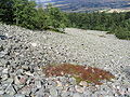
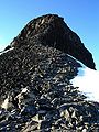
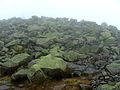
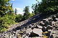
Category:Stone runs
Jump to navigation
Jump to search
rock landform, result of erosion caused by myriad freezing-thawing cycles (periglacial conditions)  | |||||
| Upload media | |||||
| Subclass of | |||||
|---|---|---|---|---|---|
| Different from | |||||
| |||||
Deutsch: Feldsteinstrom bzw. bei Findlingen: Findlingsstrom.
Media in category "Stone runs"
The following 48 files are in this category, out of 48 total.
-
 "Каменная река".jpg 1,440 × 1,080; 637 KB
-
 2018 Szrenica, Karkonosze, Sudety 05.jpg 4,842 × 3,174; 14.27 MB
-
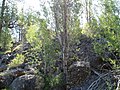 Birch Tree Grove and Cliff-Malheur (29672159836).jpg 2,272 × 1,704; 853 KB
-
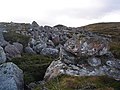 Boulder field - geograph.org.uk - 329318.jpg 640 × 480; 104 KB
-
 Boulders and whins - geograph.org.uk - 800955.jpg 640 × 427; 299 KB
-
 Circum Peak stone runs.jpg 753 × 978; 141 KB
-
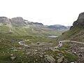
 Col d'Arsine torrent du Petit Tabuc.JPG 1,280 × 960; 578 KB
-
 Dovre snöhetta Istjörni IMG 8963.JPG 2,592 × 1,728; 1.28 MB
-
 Dyrskar0001.jpg 3,648 × 2,736; 2.58 MB
-
 Goloborze.jpg 1,024 × 768; 686 KB
-
 Gołoborze na Łysej Górze 4.jpg 2,560 × 1,440; 1.33 MB
-
 Gołoborze na Łysej Górze.jpg 4,160 × 2,336; 2.19 MB
-
 Kamenne more Vyhne 3.JPG 1,024 × 768; 166 KB
-
 Karnischer Hoehenweg.jpg 3,264 × 2,448; 3.75 MB
-
 Klapperstensfält vid Bergsjön, Örnsköldsvik.jpg 2,816 × 2,112; 3.83 MB
-
 Kleiner Gleichberg Hildburghausen Basaltfelder (1 von 4).jpg 3,872 × 2,592; 8.42 MB
-
 Kleiner Gleichberg Hildburghausen Gipfel (1 von 1).jpg 3,872 × 2,592; 6.15 MB
-
 Kyrkja01.jpg 1,536 × 2,048; 602 KB
-
 Lusen-Gipfel im Nebel.JPG 2,500 × 1,880; 1.79 MB
-
 Lysica 20080701 3630.jpg 2,707 × 1,800; 1.91 MB
-
 Manang site (15).JPG 2,896 × 1,936; 2.33 MB
-
 Midtronden 01.JPG 3,872 × 2,592; 3.71 MB
-
 Motten Motten Jagdhaus Hohe Kammer Basalt Outcrop.png 5,208 × 3,476; 33.28 MB
-
 Motten Motten Jagdhaus Hohe Kammer Cave.png 5,208 × 3,476; 30.94 MB
-
 Mount Rainier from Nisqually River near Cougar Rock campground 05.jpg 4,288 × 2,848; 5.8 MB
-
 Mountain Photography.jpg 2,048 × 1,536; 735 KB
-
 Mountain trails.JPG 4,608 × 3,456; 3.6 MB
-
 Periglaciarismo.jpg 640 × 480; 76 KB
-
 Rio de piedra 2.jpg 640 × 426; 126 KB
-
 Rio de Piedra.jpg 632 × 474; 87 KB
-
 Rivers of Langtang (6).JPG 2,048 × 1,536; 1.25 MB
-
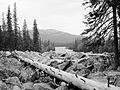
 Rock river or stone run (51062487138).jpg 6,000 × 3,376; 24.12 MB
-
 Sabigawa river dry riverbed.jpg 2,592 × 1,944; 2.11 MB
-
 Scree and boulders - geograph.org.uk - 200071.jpg 640 × 480; 155 KB
-
 Serras da Pampilhosa da Serra3.jpg 1,280 × 960; 410 KB
-
 Somoska-stone-sea.jpg 2,304 × 1,728; 1.63 MB
-
 Steinernes Meer am Plöckenstein -05.JPG 3,548 × 2,365; 4.15 MB
-
 Stone run Doboshanka.JPG 4,522 × 2,938; 10.98 MB
-
 Stone runs 01 (3444782873).jpg 2,560 × 1,920; 602 KB
-
 Stone runs 06 (3444786947).jpg 2,560 × 1,920; 2.58 MB
-
 Stone runs 07 (3444790015).jpg 2,560 × 1,920; 2.45 MB
-
 Stone sea - Šomoška.jpg 4,608 × 3,072; 3.52 MB
-
 Stone-run.JPG 3,360 × 2,240; 1.71 MB
-
 Suryakunda 05 Langtang National Park.jpg 4,928 × 3,264; 4.07 MB
-
 Weddell-stone-runs.jpg 753 × 978; 406 KB
-
 Scree and Boulders below Red Craig - geograph.org.uk - 392277.jpg 640 × 480; 126 KB
-
 Čížkovy kameny - a stone run on the west side P1010033kk.JPG 2,048 × 1,536; 661 KB
-
 Курумник (Зюраткуль, Южный Урал).jpg 3,648 × 2,432; 1.14 MB


.jpg)


.jpg)
.jpg)


.JPG)


.JPG)
.jpg)


.jpg)
.jpg)
.jpg)


.jpg)