Category:Stoke Bishop (ward)
Jump to navigation
Jump to search
electoral ward of the unitary authority of Bristol  | |||||
| Upload media | |||||
| Instance of |
| ||||
|---|---|---|---|---|---|
| Location | City of Bristol, South West England, England | ||||
| Different from | |||||
| |||||
Subcategories
This category has the following 5 subcategories, out of 5 total.
S
- Sea Mills Viaduct (38 F)
- Stoke Bishop War Memorial (6 F)
W
- Wills Hall (6 F)
Media in category "Stoke Bishop (ward)"
The following 158 files are in this category, out of 158 total.
-
 'A' Block, Hiatt Baker Hall, Stoke Bishop, Bristol - DSC05718.JPG 3,648 × 2,736; 3.54 MB
-
 'Two miles to Briſtol' - geograph.org.uk - 6216884.jpg 2,472 × 3,296; 3.4 MB
-
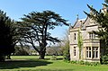 4951 Stoke Lodge house and cedar tree (8715381728).jpg 2,747 × 1,799; 3.46 MB
-
 A leaning benchmark on a boundary stone - geograph.org.uk - 6216905.jpg 3,296 × 2,472; 3.52 MB
-
 A little bit of Ladies Mile - geograph.org.uk - 6216869.jpg 3,296 × 2,472; 3.33 MB
-
 A wet day in the Avon Gorge - geograph.org.uk - 5565377.jpg 6,000 × 4,000; 4.05 MB
-
 A4 Portway below Clifton Downs - geograph.org.uk - 5818572.jpg 1,024 × 720; 163 KB
-
 A4 Portway northbound - geograph.org.uk - 5818552.jpg 1,024 × 761; 135 KB
-
 A4 Portway west of Sneyd Park - geograph.org.uk - 5818585.jpg 1,024 × 758; 118 KB
-
 At the top of Ladies Mile - geograph.org.uk - 6218845.jpg 2,472 × 3,296; 3.26 MB
-
 Autumn Light over the River Avon - geograph.org.uk - 5585551.jpg 3,264 × 2,448; 4.78 MB
-
 Autumn walk by the River Avon - geograph.org.uk - 5565336.jpg 6,000 × 4,000; 6.96 MB
-
 Avon Gorge - geograph.org.uk - 5881983.jpg 4,000 × 3,000; 4.04 MB
-
 Avon gorge dusk.jpg 2,306 × 3,591; 1.16 MB
-

-
 Avon signal.jpg 2,536 × 3,913; 1.78 MB
-
 Bell Barn Road, Sea Mills - geograph.org.uk - 6041596.jpg 4,288 × 3,216; 7.74 MB
-
 Benchmark on the Ladies Mile milestone - geograph.org.uk - 6216891.jpg 2,472 × 3,296; 3.48 MB
-
 Benchmark on Westbury Road - geograph.org.uk - 6216814.jpg 2,472 × 3,296; 3.39 MB
-
 Boundary stone on Ladies Mile - geograph.org.uk - 6216894.jpg 2,472 × 3,296; 3.41 MB
-
 Bridge over the River Trym, decorated - geograph.org.uk - 1705385.jpg 640 × 480; 128 KB
-
 Bristol cd 041004 kites.jpg 700 × 296; 236 KB
-
 Bristol Downs panorama.JPG 2,587 × 563; 345 KB
-
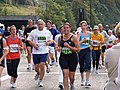 Bristol Half Marathon.jpg 2,272 × 1,704; 1.53 MB
-
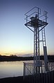
 Bristol MMB «40 Sea Mills signal station.jpg 2,400 × 1,600; 1.04 MB
-
 Bristol MMB «42 River Avon.jpg 2,400 × 1,600; 1.34 MB
-
 Bristol MMB «43 River Avon.jpg 2,400 × 1,600; 698 KB
-
 Bristol MMB «D9 River Trym.jpg 3,936 × 2,624; 2.54 MB
-
 Bristol MMB «E0 River Trym.jpg 3,936 × 2,624; 4.47 MB
-
 Bristol MMB «E1 River Trym.jpg 3,936 × 2,624; 4.91 MB
-
 Bristol MMB «E2 River Trym and A4 Portway.jpg 3,826 × 2,415; 4.26 MB
-
 Bristol MMB «E3 River Trym.jpg 3,865 × 2,541; 4.36 MB
-
 Bristol MMB «E4 River Trym.jpg 3,888 × 2,581; 4.8 MB
-
 Bristol MMB «E5 River Trym.jpg 2,624 × 3,936; 4.56 MB
-
 Bristol MMB «E6 River Trym.jpg 2,585 × 3,896; 4.02 MB
-
 Bristol MMB «E7 River Trym.jpg 3,258 × 2,064; 2.73 MB
-
 Bristol stokebishop.png 702 × 780; 149 KB
-
 Bumble, Clifton Downs - geograph.org.uk - 5724587.jpg 480 × 640; 71 KB
-
 Cafe and Changing Rooms, The Downs - geograph.org.uk - 5693075.jpg 640 × 480; 132 KB
-
 Cafe Retreat, The Downs - geograph.org.uk - 5693063.jpg 640 × 480; 95 KB
-
 Cheyne Road, Stoke Bishop - geograph.org.uk - 117949.jpg 480 × 640; 254 KB
-
 Churchill hall.JPG 604 × 453; 59 KB
-

-
 Class 22 NB Type 2 D63XX Near Sea Mills, Bristol c1964 (9922401484).jpg 5,602 × 3,673; 1.68 MB
-
 Clifton Down - geograph.org.uk - 5993046.jpg 4,270 × 2,735; 2.04 MB
-
 Clifton Down - geograph.org.uk - 5993266.jpg 4,213 × 2,235; 1.17 MB
-
 Clifton Down by Ladies' Mile - geograph.org.uk - 5992996.jpg 4,275 × 2,653; 1.49 MB
-
 Clifton Down by Stoke Road - geograph.org.uk - 6173265.jpg 1,892 × 1,236; 1.47 MB
-
 Clifton Suspension Bridge from downstream - geograph.org.uk - 5634961.jpg 1,024 × 768; 135 KB
-
 Coach, Durdham Down - geograph.org.uk - 5992923.jpg 3,000 × 1,878; 986 KB
-
 Coach, Durdham Down - geograph.org.uk - 5992942.jpg 4,235 × 2,486; 1.72 MB
-
 Coombe Lane at the junction of Canford Road - geograph.org.uk - 6170284.jpg 1,920 × 1,280; 1.31 MB
-
 Coombe Lane, Coombe Dingle - geograph.org.uk - 6174997.jpg 1,834 × 1,136; 994 KB
-
 Crossroads on Durdham Down - geograph.org.uk - 5909572.jpg 4,288 × 2,848; 2.04 MB
-
 Down to the Gully - geograph.org.uk - 6218080.jpg 2,472 × 3,296; 3.31 MB
-
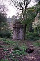 Downs air shaft 2.jpg 2,538 × 3,836; 2.6 MB
-
 Downs ventilation shaft (600px).jpg 600 × 951; 75 KB
-
 Drinking Fountain, Stoke Road - geograph.org.uk - 5692988.jpg 640 × 480; 87 KB
-
 Druid Road, Stoke Bishop, Bristol - geograph.org.uk - 6273133.jpg 2,592 × 1,944; 1.44 MB
-
 Druidhill.jpg 335 × 288; 165 KB
-
 Durdham Down (750px).jpg 729 × 485; 42 KB
-
 Durdham Down - geograph.org.uk - 5911359.jpg 2,562 × 4,170; 2.67 MB
-
 Durdham Down - geograph.org.uk - 5992913.jpg 4,199 × 2,759; 2.65 MB
-
 Durdham Down - geograph.org.uk - 5992979.jpg 4,288 × 2,848; 2.4 MB
-
 Durdham Down - geograph.org.uk - 5993269.jpg 4,268 × 2,505; 1.49 MB
-
 Durdham Down snowkite.jpg 2,592 × 3,888; 2.05 MB
-
 Entrance to Wills Hall, Parry's Lane, Stoke Bishop, Bristol - DSC05712.JPG 3,648 × 2,736; 3.58 MB
-
 George on the Downs - geograph.org.uk - 5911152.jpg 4,000 × 3,000; 2.49 MB
-
 Green space in Sea Mills - geograph.org.uk - 5564248.jpg 6,000 × 4,000; 6 MB
-
 Houses on Bell Barn Road, Stoke Bishop - geograph.org.uk - 6174998.jpg 1,824 × 1,114; 1.07 MB
-
 Hurdles for runners - geograph.org.uk - 6218091.jpg 3,296 × 2,472; 3.6 MB
-
 Insurance offices overlooking the Downs - geograph.org.uk - 6080256.jpg 1,024 × 683; 212 KB
-
 Ivywell Road, Stoke Bishop - geograph.org.uk - 1175300.jpg 640 × 427; 73 KB
-
 Junction of Church and Julian Roads - geograph.org.uk - 644996.jpg 640 × 430; 98 KB
-
 Ladies Mile Fountains Hill Clifton - geograph.org.uk - 5978596.jpg 640 × 480; 86 KB
-
 Ladies' Mile - geograph.org.uk - 5993257.jpg 4,288 × 2,848; 2.27 MB
-
 Mariners Drive, Stoke Bishop, Bristol - geograph.org.uk - 6273119.jpg 2,592 × 1,944; 1.39 MB
-
 Muddy creek at Sea Mills - geograph.org.uk - 5564285.jpg 6,000 × 4,000; 6.39 MB
-
 NCN 41 - Bristol to Pill cycle path - geograph.org.uk - 395736.jpg 480 × 640; 170 KB
-
 Ordnance Survey Cut Mark - geograph.org.uk - 5617542.jpg 536 × 640; 131 KB
-
 Outfall from The Gulley - geograph.org.uk - 5634955.jpg 1,024 × 768; 220 KB
-
 Overlooking the River Avon - geograph.org.uk - 6218830.jpg 3,296 × 2,472; 3.33 MB
-
 Parry's Lane, Bristol - geograph.org.uk - 5849742.jpg 2,592 × 1,944; 1.36 MB
-
 Parry's Lane, Stoke Bishop, Bristol - DSC05713.JPG 3,648 × 2,736; 3.51 MB
-
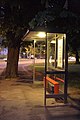 Parrys Lane bus stop.jpg 2,592 × 3,888; 4.49 MB
-
 Parrys Ln Saville Rd Jct.jpg 3,888 × 2,592; 3.69 MB
-
 Path by Ladies' Mile - geograph.org.uk - 5993262.jpg 2,848 × 4,288; 2.54 MB
-
 Path by the River Avon - geograph.org.uk - 5564312.jpg 6,000 × 4,000; 4.6 MB
-
 Path by the River Avon - geograph.org.uk - 5565301.jpg 6,000 × 4,000; 5.37 MB
-
 Path down to the gorge floor - geograph.org.uk - 6218100.jpg 3,296 × 2,472; 3.6 MB
-
 Path junction by the River Avon - geograph.org.uk - 5564351.jpg 6,000 × 4,000; 6.72 MB
-
 Paul Burns Photography on Shirehampton Road, Sea Mills - geograph.org.uk - 6170904.jpg 1,920 × 1,280; 1.28 MB
-
 Pavilion on Clifton Down - geograph.org.uk - 6170901.jpg 1,906 × 1,260; 1.46 MB
-
 Pembroke Road Joining A4176 Clifton - geograph.org.uk - 5978583.jpg 640 × 480; 74 KB
-
 Phone box on Julian Road, Stoke Bishop, Bristol - geograph.org.uk - 6216629.jpg 1,944 × 2,592; 2.01 MB
-
 Picnic table, Clifton Down - geograph.org.uk - 5993040.jpg 2,821 × 4,038; 2.11 MB
-
 Plenty of fresh air, plenty of exercises, no excuses^ - geograph.org.uk - 6218116.jpg 3,296 × 2,472; 3.43 MB
-
 Porter's Lodge, Goodeve Park, Hazelwood Road, Sneyd Park, Bristol - DSC05735.JPG 3,648 × 2,736; 3.62 MB
-
 Portway and SBL.jpg 2,600 × 3,776; 1.5 MB
-
 Portway and the River Avon - geograph.org.uk - 5565347.jpg 6,000 × 4,000; 4.29 MB
-
 River Avon East of Shirehampton Park - geograph.org.uk - 86875.jpg 640 × 480; 79 KB
-
 River Trym - geograph.org.uk - 5564221.jpg 6,000 × 4,000; 7.27 MB
-
 River Trym - geograph.org.uk - 6041607.jpg 4,288 × 3,216; 6.92 MB
-
 River Trym joining the Avon at Sea Mills.jpg 2,272 × 1,704; 1.42 MB
-
 Rivet on the kerbs on the Downs - geograph.org.uk - 6216862.jpg 3,296 × 2,472; 3.38 MB
-
 Rockfall protection in the Avon Gorge - geograph.org.uk - 5634959.jpg 1,024 × 768; 284 KB
-
 Sailing down the River Avon - geograph.org.uk - 6127342.jpg 2,592 × 1,944; 1.52 MB
-
 Sailing down the River Avon - geograph.org.uk - 6127362.jpg 2,592 × 1,944; 1.65 MB
-
 Saville Road Bristol.jpg 3,888 × 2,592; 3.42 MB
-
 Sea Mills Bristol Omnibus C8320 UHY360.jpg 1,824 × 1,368; 751 KB
-
 Sea Mills Lane - geograph.org.uk - 5564277.jpg 6,000 × 4,000; 7.63 MB
-
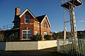
 Sea Mills railway station - geograph.org.uk - 5564290.jpg 6,000 × 4,000; 6.48 MB
-
 Seven Sisters daytime.jpg 3,902 × 2,548; 1.84 MB
-
 Seven Sisters snow sunset.jpg 3,888 × 2,592; 1.7 MB
-
 Seven Sisters sunrise.jpg 3,925 × 2,548; 2.15 MB
-
 Seven Sisters sunset 1.jpg 3,888 × 2,592; 1.52 MB
-
 Sheltering under the bushes - geograph.org.uk - 6216873.jpg 2,472 × 3,296; 3.44 MB
-
 Shops, Druid Hill, Stoke Bishop, Bristol - DSC05728.JPG 3,648 × 2,736; 3.45 MB
-
 Sneyd Park - GWR 166205 going to Severn Beach.JPG 1,366 × 910; 816 KB
-
 Steps at Bishops Knoll - geograph.org.uk - 5749887.jpg 1,536 × 2,048; 2.03 MB
-
 St Mary Magdalene Church - geograph.org.uk - 644992.jpg 640 × 484; 75 KB
-
 Stoke Bishop - First 32073 (KP51VZZ).JPG 1,366 × 910; 538 KB
-
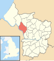 Stoke Bishop Bristol UK ward map.svg 1,138 × 1,266; 709 KB
-
 Stoke Bishop Parrys Lane - First 32098 (KP51WDD).JPG 1,366 × 1,024; 562 KB
-
 Stoke Bishop University Halls - First 33493 (YY67HAO).JPG 1,366 × 820; 492 KB
-
 Stoke Bishop Village Hall - geograph.org.uk - 6273127.jpg 2,592 × 1,944; 1.55 MB
-
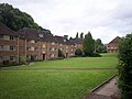
 Stoke Lodge, Bristol, from east.jpg 6,016 × 4,000; 5.86 MB
-
 Stoke Lodge, Bristol, from south-west.jpg 6,016 × 4,000; 5.26 MB
-
 Stones across Durdham Down - geograph.org.uk - 6216876.jpg 3,296 × 2,472; 3.68 MB
-
 Tellisford House and Trinmore, Clifton Down - geograph.org.uk - 5909536.jpg 3,739 × 2,375; 762 KB
-
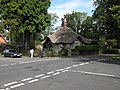 Thatched cottage in Sneyd Park - geograph.org.uk - 240425.jpg 640 × 480; 137 KB
-
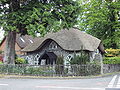 Thatched Cottage, Sneyd Park, Bristol - DSC05732.JPG 3,648 × 2,736; 3.51 MB
-
 The A4 in the Avon Gorge - geograph.org.uk - 5565362.jpg 6,000 × 4,000; 5.07 MB
-
 The Avon from Leigh Woods - geograph.org.uk - 6089564.jpg 4,000 × 3,000; 2.89 MB
-
 The Clifton Suspension Bridge - geograph.org.uk - 6013537.jpg 2,592 × 1,944; 1.02 MB
-
 The confluence of the Trym and Avon - geograph.org.uk - 5564300.jpg 6,000 × 4,000; 4.74 MB
-
 The Downs, Bristol - geograph.org.uk - 5693079.jpg 640 × 417; 79 KB
-
 The Mill House - geograph.org.uk - 6041599.jpg 4,288 × 3,216; 6.76 MB
-
 The Moon and Venus (1) - geograph.org.uk - 6013557.jpg 2,592 × 1,944; 1.37 MB
-
 The Moon and Venus (2) - geograph.org.uk - 6015062.jpg 2,592 × 1,944; 1.3 MB
-
 The Portway - geograph.org.uk - 6218065.jpg 2,472 × 3,296; 3.36 MB
-
 The River Avon - geograph.org.uk - 5565386.jpg 6,000 × 4,000; 7.41 MB
-
 The River Avon below Leigh Woods - geograph.org.uk - 5565318.jpg 6,000 × 4,000; 4.94 MB
-
 The River Trym at Sea Mills - geograph.org.uk - 5564262.jpg 6,000 × 4,000; 5.89 MB
-
 Tower Hirst - geograph.org.uk - 6218822.jpg 3,296 × 2,472; 2.81 MB
-
 Tree, Clifton Down - geograph.org.uk - 5993057.jpg 4,264 × 2,700; 1.59 MB
-
 Trees on Durdham Down - geograph.org.uk - 5992989.jpg 4,288 × 2,848; 1.58 MB
-
 Trinitycollegebristol.jpg 640 × 429; 84 KB
-
 Two boundary stones near Circular Road - geograph.org.uk - 6216833.jpg 3,296 × 2,472; 3.28 MB
-
 Two stones by Circular Road - geograph.org.uk - 6218840.jpg 3,296 × 2,472; 3.25 MB
-
 Ventilation tower, Clifton Down - geograph.org.uk - 5993071.jpg 4,288 × 2,848; 1.98 MB
-
 Ventilation tower, Clifton Down - geograph.org.uk - 5993075.jpg 4,288 × 2,848; 1.58 MB
-

-
 Walcombe Slade - geograph.org.uk - 5634577.jpg 800 × 600; 126 KB
-
 Water in, water out - geograph.org.uk - 6218834.jpg 3,296 × 2,472; 3.49 MB
-
 Water Tower Clifton Down - geograph.org.uk - 5978587.jpg 640 × 480; 104 KB
-
 Weathered boundary stone - geograph.org.uk - 6218842.jpg 2,472 × 3,296; 3.27 MB
-
 West Coombe - geograph.org.uk - 5849735.jpg 2,592 × 1,944; 1.87 MB


.jpg)


.jpg)
.jpg)


.jpg)


.jpg)


.JPG)

.JPG)
.JPG)


_-_geograph.org.uk_-_6013557.jpg)
_-_geograph.org.uk_-_6015062.jpg)


