Category:Stoke Bardolph
Jump to navigation
Jump to search
English: Stoke Bardolph is a village and civil parish in the Gedling district of Nottinghamshire. It is to the east of Nottingham, and on the west bank of the River Trent. Nearby places include Burton Joyce and Radcliffe on Trent.
village in United Kingdom .jpg) | |||||
| Upload media | |||||
| Instance of | |||||
|---|---|---|---|---|---|
| Location | Gedling, Nottinghamshire, East Midlands, England | ||||
 | |||||
Subcategories
This category has the following 4 subcategories, out of 4 total.
Media in category "Stoke Bardolph"
The following 163 files are in this category, out of 163 total.
-
 A stile on the Trent Valley Trail - geograph.org.uk - 1398115.jpg 640 × 428; 87 KB
-
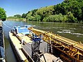
 Approaching Stoke Lock - geograph.org.uk - 5048814.jpg 800 × 600; 155 KB
-
 Approaching Stoke Lock and weir - geograph.org.uk - 5042763.jpg 2,110 × 1,498; 2.8 MB
-
 Below weir on River Trent at Stoke lock - geograph.org.uk - 5042768.jpg 3,072 × 1,728; 4.14 MB
-
 Black headed gulls and a bench - geograph.org.uk - 4292702.jpg 1,280 × 853; 383 KB
-
 Boat (seen better days) - geograph.org.uk - 1936857.jpg 640 × 480; 82 KB
-

-
 Building at recycling unit Nottingham - geograph.org.uk - 1850255.jpg 3,296 × 2,472; 1.88 MB
-
 Bus turning circle, Stoke Bardolph - geograph.org.uk - 5196351.jpg 1,024 × 768; 112 KB
-
 Car Park at Stoke Bardolph - geograph.org.uk - 1461961.jpg 640 × 479; 154 KB
-
 Cattle Grid - geograph.org.uk - 1760333.jpg 640 × 480; 98 KB
-

-
 Corner of The Deep Pit - geograph.org.uk - 1389741.jpg 640 × 479; 94 KB
-
 Cottage at Stoke Bardolph - geograph.org.uk - 1461770.jpg 640 × 479; 101 KB
-
 Cottages on Stoke Lane - geograph.org.uk - 1461746.jpg 640 × 479; 82 KB
-
 Cottages on Stoke Lane - geograph.org.uk - 1461750.jpg 640 × 479; 77 KB
-
 Crossing the bridge - geograph.org.uk - 2313294.jpg 4,000 × 3,000; 2.03 MB
-
 Crossing the Trent - geograph.org.uk - 3646054.jpg 1,200 × 890; 1,019 KB
-
 Cruising the River Trent at Stoke Lane - geograph.org.uk - 5048982.jpg 800 × 600; 182 KB
-
 Detail of the inspection boat - geograph.org.uk - 1461905.jpg 640 × 479; 80 KB
-
 Direction sign for Stoke Lock - geograph.org.uk - 5359591.jpg 1,280 × 1,280; 781 KB
-
 Distance marker - geograph.org.uk - 1461943.jpg 640 × 479; 111 KB
-
 Distance marker, 8 km - geograph.org.uk - 5042749.jpg 3,072 × 1,728; 5.75 MB
-
 Down river at Stoke lock on River Trent - geograph.org.uk - 5042770.jpg 3,072 × 1,728; 4.14 MB
-
 Farm road - geograph.org.uk - 1461747.jpg 479 × 640; 83 KB
-
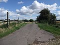
 Farm road south west of Stoke Bardolph (1) - geograph.org.uk - 5193955.jpg 1,024 × 768; 109 KB
-
 Farm road south west of Stoke Bardolph (2) - geograph.org.uk - 5193956.jpg 1,024 × 768; 124 KB
-
 Farm Row Cottages - geograph.org.uk - 1461782.jpg 640 × 479; 106 KB
-
 Farm track - geograph.org.uk - 1461727.jpg 640 × 479; 103 KB
-
 Farm track - geograph.org.uk - 1760360.jpg 640 × 480; 64 KB
-
 Farm track, Stoke Bardolph - geograph.org.uk - 1461731.jpg 479 × 640; 56 KB
-

-

-
 Field edge footpath near Netherfield Lagoons - geograph.org.uk - 5193941.jpg 1,024 × 768; 230 KB
-
 Field edge footpath south west of Stoke Bardolph - geograph.org.uk - 5196274.jpg 1,024 × 768; 156 KB
-
 Final effluent sampling point - geograph.org.uk - 1461721.jpg 640 × 479; 144 KB
-
 Finger post and stile - geograph.org.uk - 1191963.jpg 640 × 480; 55 KB
-
 Fisherman's car - geograph.org.uk - 1461922.jpg 640 × 479; 137 KB
-
 Fishing pegs - geograph.org.uk - 1461817.jpg 479 × 640; 147 KB
-
 Flood plain - geograph.org.uk - 1461948.jpg 640 × 479; 86 KB
-
 Footpath along dyke near Netherfield Lagoons - geograph.org.uk - 5193948.jpg 1,024 × 768; 192 KB
-

-
 Footpath at Stoke Bardolph - geograph.org.uk - 1461738.jpg 480 × 640; 92 KB
-
 Footpath to Stoke Bardolph (1) - geograph.org.uk - 5196291.jpg 1,024 × 768; 243 KB
-
 Footpath to Stoke Bardolph (2) - geograph.org.uk - 5196309.jpg 1,024 × 768; 175 KB
-
 Footpath to Stoke Bardolph - geograph.org.uk - 1389778.jpg 640 × 479; 114 KB
-
 Gate and path along the River Trent - geograph.org.uk - 4868074.jpg 800 × 649; 176 KB
-
 Hard to follow footpath west of Stoke Bardolph - geograph.org.uk - 5196335.jpg 1,024 × 768; 210 KB
-
 Heads down - geograph.org.uk - 5042784.jpg 3,072 × 1,728; 3.47 MB
-
 Hebb Farm House - geograph.org.uk - 1461761.jpg 640 × 479; 85 KB
-
 Inspection boat - geograph.org.uk - 1461900.jpg 475 × 640; 113 KB
-
 Inspection boat - geograph.org.uk - 1461913.jpg 640 × 479; 132 KB
-
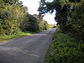
 Lane to Stoke Bardolph - geograph.org.uk - 5196314.jpg 1,024 × 768; 133 KB
-
 Lane towards Gedling (1) - geograph.org.uk - 5196325.jpg 1,024 × 768; 181 KB
-
 Lane towards Gedling (2) - geograph.org.uk - 5196341.jpg 1,024 × 768; 205 KB
-
 Lazy river - geograph.org.uk - 5042777.jpg 3,072 × 1,728; 3.17 MB
-
 Lock ahead on River Trent - geograph.org.uk - 5042759.jpg 3,072 × 1,728; 3.97 MB
-
 Lock reflection - geograph.org.uk - 1461909.jpg 486 × 640; 103 KB
-
 Locking down - geograph.org.uk - 1461914.jpg 640 × 479; 145 KB
-
 Maize Field - geograph.org.uk - 896149.jpg 640 × 480; 125 KB
-
 Maker's plate on Radcliffe viaduct - geograph.org.uk - 5029220.jpg 1,280 × 853; 325 KB
-
 Mystery road sign - geograph.org.uk - 1461742.jpg 640 × 479; 72 KB
-
 Narrowboat Oasis heads towards Nottingham on River Trent - geograph.org.uk - 5042755.jpg 3,072 × 1,728; 4.85 MB
-
 Nature Reserve footpath - geograph.org.uk - 1389767.jpg 640 × 479; 127 KB
-
 Netherfield Lagoons - geograph.org.uk - 1389715.jpg 640 × 479; 134 KB
-
 Netherfield Lagoons Nature Reserve - geograph.org.uk - 5048808.jpg 800 × 600; 175 KB
-
 Netherfield sidings - geograph.org.uk - 4308974.jpg 640 × 430; 68 KB
-
 Netherfields Lagoons Nature Reserve - geograph.org.uk - 5042724.jpg 3,072 × 1,728; 1.78 MB
-
 New wind turbine - geograph.org.uk - 5359592.jpg 853 × 1,280; 132 KB
-
 Path along the River Trent - geograph.org.uk - 4867797.jpg 800 × 503; 121 KB
-
 Path by the Trent - geograph.org.uk - 3903283.jpg 1,024 × 768; 278 KB
-
 Path next to the Radcliffe viaduct - geograph.org.uk - 4867788.jpg 800 × 596; 144 KB
-
 Peg No. 325 - geograph.org.uk - 1461821.jpg 479 × 640; 182 KB
-
 Permissive Bridleway - geograph.org.uk - 1656215.jpg 640 × 480; 76 KB
-
 Permissive footpath - geograph.org.uk - 1656205.jpg 640 × 480; 74 KB
-
 Petfood factory - geograph.org.uk - 1461736.jpg 640 × 479; 61 KB
-
 Phone box and pillar box - geograph.org.uk - 1461772.jpg 468 × 640; 117 KB
-
 Pride of Collingham moored at Stoke Lock - geograph.org.uk - 5048817.jpg 800 × 600; 163 KB
-
 Private Road - geograph.org.uk - 1167420.jpg 640 × 479; 108 KB
-
 Pylon by the River Trent - geograph.org.uk - 4308980.jpg 640 × 430; 34 KB
-
 Pylon near Netherfield Lagoons - geograph.org.uk - 5196381.jpg 768 × 1,024; 154 KB
-
 Pylons crossing the Trent west of Radcliffe (1) - geograph.org.uk - 5196379.jpg 1,024 × 768; 129 KB
-
 Pylons crossing the Trent west of Radcliffe (2) - geograph.org.uk - 5196389.jpg 1,024 × 768; 172 KB
-
 Pylons crossing the Trent west of Radcliffe (3) - geograph.org.uk - 5196398.jpg 1,024 × 768; 134 KB
-
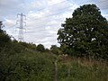
 Pylons north of Stoke Bardolph - geograph.org.uk - 5196347.jpg 1,024 × 768; 127 KB
-

-
 Radcliffe Viaduct - geograph.org.uk - 5028977.jpg 1,280 × 853; 243 KB
-

-
 Radcliffe-on-Trent, Notts. - geograph.org.uk - 3563777.jpg 3,790 × 2,284; 1.88 MB
-

-
 Railway to Newark - geograph.org.uk - 793928.jpg 640 × 426; 134 KB
-
 Ready for baling - geograph.org.uk - 1461723.jpg 640 × 479; 151 KB
-
 Rectory Junction Railway Bridge - geograph.org.uk - 5042711.jpg 3,072 × 1,728; 4.38 MB
-
 Rectory Junction signal box, Netherfield - geograph.org.uk - 5196422.jpg 1,024 × 768; 174 KB
-
 Rectory Junction signalbox - geograph.org.uk - 3901941.jpg 1,024 × 768; 168 KB
-
 Recycling site Nottingham - geograph.org.uk - 1850259.jpg 3,296 × 2,472; 1.9 MB
-
 Red boxes, red brick - geograph.org.uk - 1461766.jpg 640 × 479; 86 KB
-
 Registry details - geograph.org.uk - 1461887.jpg 640 × 479; 183 KB
-
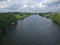 River Trent - geograph.org.uk - 1846860.jpg 3,296 × 2,472; 1.89 MB
-
 River Trent - geograph.org.uk - 4308978.jpg 640 × 430; 40 KB
-
 River Trent and Stoke Lock access road - geograph.org.uk - 5196368.jpg 1,024 × 768; 131 KB
-
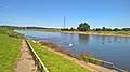
 River Trent at Stoke Bardolph - geograph.org.uk - 4868807.jpg 800 × 460; 68 KB
-
 River Trent at Stoke Bardolph - geograph.org.uk - 5042788.jpg 3,072 × 1,728; 3.16 MB
-

-

-
 Riverside path near Netherfield Lagoons - geograph.org.uk - 5196400.jpg 1,024 × 768; 178 KB
-

-
 Seat without a view, The Cliffs. - geograph.org.uk - 935544.jpg 640 × 480; 104 KB
-
 Sign and path along the River Trent - geograph.org.uk - 4868055.jpg 800 × 561; 120 KB
-
 Signal box - geograph.org.uk - 5355543.jpg 1,280 × 1,280; 508 KB
-
 St Luke's Church, Stoke Bardolph - geograph.org.uk - 1461798.jpg 640 × 479; 77 KB
-
 Stanhope Crescent, Stoke Bardolph - geograph.org.uk - 1461762.jpg 640 × 479; 93 KB
-
 Stoke Baldolph Vicinity, NG14 - geograph.org.uk - 3563805.jpg 3,758 × 2,527; 2.51 MB
-
 Stoke Bardolph - geograph.org.uk - 1461804.jpg 640 × 479; 98 KB
-
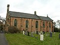 Stoke Bardolph Church - geograph.org.uk - 1760348.jpg 640 × 480; 69 KB
-
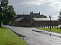
 Stoke Bardolph Farm - geograph.org.uk - 1461724.jpg 640 × 449; 77 KB
-
 Stoke Bardolph Lock on the River Trent - geograph.org.uk - 4868080.jpg 800 × 516; 121 KB
-
 Stoke Bardolph Vicinity, NG14 - geograph.org.uk - 3563793.jpg 3,083 × 2,029; 1.28 MB
-
 Stoke Bardolph Vicinity, NG14 - geograph.org.uk - 3563828.jpg 3,172 × 2,246; 1.73 MB
-
 Stoke Bardolph Vicinity, NG14 - geograph.org.uk - 3563842.jpg 3,025 × 2,673; 2.16 MB
-
 Stoke Bardolph Village - geograph.org.uk - 43278.jpg 640 × 480; 89 KB
-
 Stoke Bardolph Village Hall^ - geograph.org.uk - 1461779.jpg 640 × 479; 92 KB
-
 Stoke Bardolph Weir in full spate - geograph.org.uk - 4868089.jpg 800 × 560; 103 KB
-
 Stoke Ferry Lane - geograph.org.uk - 936765.jpg 640 × 480; 77 KB
-
 Stoke Lane - geograph.org.uk - 1461744.jpg 640 × 479; 55 KB
-
 Stoke Lane - geograph.org.uk - 1461775.jpg 479 × 640; 119 KB
-
 Stoke Lane near Top Row Cottages (1) - geograph.org.uk - 5196285.jpg 1,024 × 768; 212 KB
-
 Stoke Lane near Top Row Cottages (2) - geograph.org.uk - 5196287.jpg 1,024 × 768; 234 KB
-
 Stoke Lane next to the River Trent - geograph.org.uk - 4868849.jpg 800 × 500; 101 KB
-
 Stoke Lock - geograph.org.uk - 4292725.jpg 1,280 × 1,280; 486 KB
-
 Stoke Lock, River Trent - geograph.org.uk - 5196373.jpg 1,024 × 768; 213 KB
-
 Stoke Weir - geograph.org.uk - 1461855.jpg 479 × 640; 113 KB
-
 Stoke Weir - geograph.org.uk - 1936860.jpg 640 × 480; 82 KB
-
 The Deep Pit - geograph.org.uk - 1389728.jpg 640 × 479; 114 KB
-
 The Ferry Boat Inn - geograph.org.uk - 5048833.jpg 800 × 600; 147 KB
-
 The ford, Lower Path - geograph.org.uk - 1389710.jpg 479 × 640; 118 KB
-
 The Haven - geograph.org.uk - 1389717.jpg 640 × 479; 146 KB
-
 The Radcliffe Viaduct - geograph.org.uk - 5048804.jpg 800 × 600; 119 KB
-
 The River Trent and viaduct - geograph.org.uk - 3901935.jpg 1,024 × 768; 108 KB
-
 The River Trent at Radcliffe on Trent - geograph.org.uk - 5048811.jpg 800 × 600; 189 KB
-
 The River Trent at Radcliffe Viaduct - geograph.org.uk - 5048807.jpg 800 × 600; 70 KB
-
 The River Trent at Stoke Bardolph - geograph.org.uk - 5048821.jpg 800 × 600; 145 KB
-
 The River Trent at Stoke Bardolph - geograph.org.uk - 5048832.jpg 800 × 600; 133 KB
-

-
 The Slurry Lagoon - geograph.org.uk - 1389734.jpg 640 × 479; 106 KB
-
 The Slurry Lagoon - geograph.org.uk - 1389756.jpg 640 × 479; 118 KB
-
 Top Row Cottages - geograph.org.uk - 1461740.jpg 640 × 479; 89 KB
-
 Track beside River Trent - geograph.org.uk - 1760326.jpg 640 × 480; 59 KB
-
 Track down Gibbet Hill - geograph.org.uk - 935557.jpg 640 × 480; 99 KB
-
 Train crossing the Radcliffe viaduct - geograph.org.uk - 4867802.jpg 800 × 593; 127 KB
-
 Trent Valley Way - geograph.org.uk - 1461951.jpg 640 × 479; 98 KB
-
 Viaduct across the Trent north of Radcliffe (1) - geograph.org.uk - 5196402.jpg 1,024 × 768; 128 KB
-
 Viaduct across the Trent north of Radcliffe (2) - geograph.org.uk - 5196414.jpg 1,024 × 768; 148 KB
-
 Viaduct across the Trent north of Radcliffe (3) - geograph.org.uk - 5196417.jpg 1,024 × 768; 171 KB
-
 Walkers by the Trent - geograph.org.uk - 4292731.jpg 1,280 × 1,017; 361 KB
-
 Walking along the River Trent - geograph.org.uk - 4868799.jpg 800 × 467; 98 KB
-
 Walking on the Trent Valley Way - geograph.org.uk - 1191930.jpg 640 × 480; 81 KB
-
 Water point - geograph.org.uk - 1461895.jpg 479 × 640; 159 KB
-
 Weir warning - geograph.org.uk - 1461892.jpg 640 × 479; 124 KB
-
 Width barrier along the River Trent path - geograph.org.uk - 4867805.jpg 800 × 616; 204 KB
-
 Wind turbine near Stoke Bardolph - geograph.org.uk - 4868825.jpg 800 × 550; 121 KB
-
 Woodland at Stoke Lock - geograph.org.uk - 1461919.jpg 479 × 640; 155 KB
-
 Zulu Crossing and trig point - geograph.org.uk - 1656200.jpg 640 × 480; 67 KB


_-_geograph.org.uk_-_1936857.jpg)


_-_geograph.org.uk_-_5193955.jpg)
_-_geograph.org.uk_-_5193956.jpg)


_-_geograph.org.uk_-_5196291.jpg)
_-_geograph.org.uk_-_5196309.jpg)


_-_geograph.org.uk_-_5196325.jpg)
_-_geograph.org.uk_-_5196341.jpg)


_-_geograph.org.uk_-_5196379.jpg)
_-_geograph.org.uk_-_5196389.jpg)
_-_geograph.org.uk_-_5196398.jpg)


_-_geograph.org.uk_-_5196285.jpg)
_-_geograph.org.uk_-_5196287.jpg)


_-_geograph.org.uk_-_5196402.jpg)
_-_geograph.org.uk_-_5196414.jpg)
_-_geograph.org.uk_-_5196417.jpg)


