Category:Stobo (civil parish)
Jump to navigation
Jump to search
Scottish parish in Scottish Borders, Scotland, UK | |||||
| Upload media | |||||
| Instance of | |||||
|---|---|---|---|---|---|
| Part of |
| ||||
| Named after | |||||
| Location |
| ||||
| Population |
| ||||
| Area |
| ||||
 | |||||
Subcategories
This category has the following 3 subcategories, out of 3 total.
Media in category "Stobo (civil parish)"
The following 200 files are in this category, out of 633 total.
(previous page) (next page)-
 'Workings near Dreva Muirburn - geograph.org.uk - 1905602.jpg 640 × 480; 48 KB
-
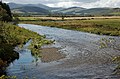
 A glimpse of the River Tweed - geograph.org.uk - 5601430.jpg 1,024 × 768; 211 KB
-
 A Line by the Lyne - geograph.org.uk - 2879702.jpg 640 × 474; 115 KB
-
 A line of symbolic stones - geograph.org.uk - 2165527.jpg 640 × 576; 93 KB
-
 A new woodland, Hammer Rig - geograph.org.uk - 4801543.jpg 1,024 × 576; 325 KB
-
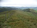
 A pass, Broughton Heights - geograph.org.uk - 4801586.jpg 1,024 × 576; 266 KB
-
 A river runs through it - geograph.org.uk - 963908.jpg 640 × 480; 98 KB
-

-
 A short tributary of the Lyne Water - geograph.org.uk - 4768790.jpg 1,024 × 683; 144 KB
-
 A stand of trees, Mid Hill - geograph.org.uk - 4563077.jpg 1,024 × 682; 144 KB
-
 A sweeping bend on the Tweed, Altarstone - geograph.org.uk - 2611160.jpg 800 × 530; 183 KB
-

-
 A view of the River Tweed near Dreva - geograph.org.uk - 1905559.jpg 640 × 480; 55 KB
-
 A72 at Wester Happrew - geograph.org.uk - 4768781.jpg 1,024 × 631; 125 KB
-
 Above the Hopehead Burn - geograph.org.uk - 964002.jpg 640 × 480; 79 KB
-
 Along the B712 - geograph.org.uk - 3895313.jpg 480 × 640; 570 KB
-
 Altarstone Farm - geograph.org.uk - 3895305.jpg 640 × 480; 448 KB
-
 Altarstone Pool - geograph.org.uk - 3895302.jpg 640 × 480; 404 KB
-
 Altarstone Pool - geograph.org.uk - 3895307.jpg 640 × 480; 513 KB
-

-
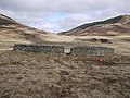 Another unusual fank - geograph.org.uk - 1750827.jpg 640 × 480; 86 KB
-

-
 Approaching ruined house at Harrowhope - geograph.org.uk - 5066246.jpg 4,896 × 3,672; 6.73 MB
-
 Approaching Stobo - geograph.org.uk - 4984787.jpg 1,024 × 718; 240 KB
-
 Approaching Stobo on the John Buchan Way - geograph.org.uk - 963912.jpg 640 × 480; 102 KB
-
 Avenue of beech trees, Stobo - geograph.org.uk - 5601422.jpg 1,024 × 768; 299 KB
-
 Back Road - geograph.org.uk - 3181314.jpg 800 × 600; 164 KB
-
 Back road from Broughton to Stobo - geograph.org.uk - 3895299.jpg 640 × 480; 463 KB
-
 Back road from Rachan to Dreva - geograph.org.uk - 3895286.jpg 640 × 480; 471 KB
-
 Back Road near Rachan Home Farm - geograph.org.uk - 3181121.jpg 800 × 600; 177 KB
-
 Badger at Sheriff Muir - geograph.org.uk - 2165901.jpg 1,024 × 768; 240 KB
-
 Barn at Easter Happrew Farm - geograph.org.uk - 3895333.jpg 640 × 480; 395 KB
-
 Beautiful Peeblesshire - geograph.org.uk - 3387121.jpg 640 × 480; 67 KB
-
 Beggarpath Bridge - geograph.org.uk - 4768795.jpg 1,024 × 676; 184 KB
-
 Beggarpath Bridge - geograph.org.uk - 5045768.jpg 640 × 401; 100 KB
-
 Belt of trees below Kerr's Knowe - geograph.org.uk - 5590423.jpg 1,024 × 768; 148 KB
-
 Black Meldon in sunshine - geograph.org.uk - 5853676.jpg 1,600 × 1,016; 236 KB
-
 Boat house, Hill Loch - geograph.org.uk - 2921459.jpg 800 × 530; 202 KB
-
 Boundary wall on Whitelaw Hill - geograph.org.uk - 2759659.jpg 800 × 530; 168 KB
-
 Bridge and farm, Rachan - geograph.org.uk - 2775074.jpg 800 × 530; 205 KB
-
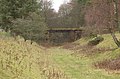
 Bridge at Dawyck Mill - geograph.org.uk - 3186886.jpg 800 × 600; 168 KB
-
 Bridge over Peebles - Broughton railway - geograph.org.uk - 1612016.jpg 640 × 424; 124 KB
-
 Bridge over the Easton Burn - geograph.org.uk - 963915.jpg 640 × 480; 138 KB
-
 Bridge over the Hopehead Burn - geograph.org.uk - 4983861.jpg 1,024 × 682; 213 KB
-
 Bridge over the Hopehead Burn - geograph.org.uk - 964260.jpg 640 × 480; 81 KB
-

-
 Bridge, Dawyck Mill - geograph.org.uk - 2821416.jpg 640 × 312; 224 KB
-
 Broomy Side - geograph.org.uk - 1562980.jpg 640 × 480; 115 KB
-
 Broughton Heights - geograph.org.uk - 1253193.jpg 640 × 480; 48 KB
-
 Broughton Heights - geograph.org.uk - 2925177.jpg 640 × 480; 79 KB
-
 Broughton Heights - Pyked Stane Hill - geograph.org.uk - 3367322.jpg 2,592 × 1,944; 1.71 MB
-
 Broughton Heights triangulation pillar - geograph.org.uk - 2912920.jpg 337 × 600; 253 KB
-
-
 Broughton to Dreva road - geograph.org.uk - 3683409.jpg 1,024 × 678; 214 KB
-
 Broughton to Stobo path - geograph.org.uk - 4801299.jpg 1,024 × 683; 242 KB
-
 Buildings at Dawyck Mill - geograph.org.uk - 3741805.jpg 1,024 × 678; 266 KB
-
 Burn at Easter Happrew in Peebbleshire - geograph.org.uk - 1737264.jpg 640 × 480; 125 KB
-
 Burning whins, Dreva Hill - geograph.org.uk - 1830237.jpg 640 × 480; 69 KB
-
 Bus shelter, Stobo - geograph.org.uk - 2611650.jpg 800 × 530; 211 KB
-
 By The B712 - geograph.org.uk - 5713787.jpg 640 × 419; 138 KB
-
 By The River Tweed - geograph.org.uk - 5713771.jpg 640 × 406; 104 KB
-
 Cademuir from Whitelaw Hill - geograph.org.uk - 2759668.jpg 800 × 530; 67 KB
-
 Cairn on the summit of Hammer Head - geograph.org.uk - 2854593.jpg 640 × 480; 71 KB
-
 Cairn on Torbank Hill - geograph.org.uk - 1069988.jpg 640 × 359; 63 KB
-
 Cannon Craig - geograph.org.uk - 2730306.jpg 800 × 600; 115 KB
-
 Caravan in Craig Hole - geograph.org.uk - 2854653.jpg 640 × 480; 116 KB
-
 Cat Hill from Penvalla - geograph.org.uk - 1066216.jpg 640 × 480; 89 KB
-
 Cattle and biomass farming, Drumelzier - geograph.org.uk - 3683383.jpg 1,024 × 678; 149 KB
-
 Caverhill Footbridge, Lyne - geograph.org.uk - 6354043.jpg 1,600 × 1,066; 466 KB
-
 Cloyhouse Burn - geograph.org.uk - 3895330.jpg 480 × 640; 608 KB
-
 Col above Glack Hope - geograph.org.uk - 5377990.jpg 1,600 × 1,060; 462 KB
-

-

-
-
 Communications mast and hill fort, Dreva - geograph.org.uk - 1714700.jpg 800 × 530; 117 KB
-
 Communications mast near Dreva - geograph.org.uk - 2774795.jpg 800 × 530; 203 KB
-

-
 Confluence of the Tweed and the Biggar Water - geograph.org.uk - 3683397.jpg 1,024 × 678; 243 KB
-
 Coshbog, Stobo - geograph.org.uk - 2921394.jpg 800 × 530; 141 KB
-
 Cows on the line, Dreva - geograph.org.uk - 2774806.jpg 800 × 530; 221 KB
-
 Craig Hole and Dreva Farm - geograph.org.uk - 1714752.jpg 1,024 × 679; 410 KB
-
 Crownhead Bridge - geograph.org.uk - 3186853.jpg 800 × 600; 141 KB
-
 Crownhead Bridge - geograph.org.uk - 3321366.jpg 640 × 382; 238 KB
-
 Crownhead Bridge - geograph.org.uk - 5772053.jpg 3,888 × 2,592; 4.92 MB
-
 Crownhead Bridge and autumnal trees - geograph.org.uk - 5173930.jpg 1,024 × 682; 226 KB
-

-
 Crownhead Bridge Plaque - geograph.org.uk - 5772052.jpg 3,888 × 2,592; 3.08 MB
-
 Cutting for the old Peebles line, Rachan - geograph.org.uk - 2775068.jpg 800 × 530; 241 KB
-

-
 Dawyck House and woodland - geograph.org.uk - 3741867.jpg 1,024 × 678; 190 KB
-
 Dawyck Mill - geograph.org.uk - 6384300.jpg 1,600 × 1,060; 475 KB
-
 Dawyck Mill Bridge - geograph.org.uk - 6384171.jpg 1,600 × 1,060; 573 KB
-
 Dawyck Mill farm, Stobo - geograph.org.uk - 2759773.jpg 800 × 530; 161 KB
-
 Dawyck trees in autumn colours - geograph.org.uk - 5173945.jpg 1,024 × 742; 252 KB
-
 Dawyck, from across Tweeddale - geograph.org.uk - 1906295.jpg 1,024 × 768; 116 KB
-
 Dead elm on the road to Dreva - geograph.org.uk - 1906258.jpg 1,024 × 768; 108 KB
-
 Descending to Glack Hope - geograph.org.uk - 5752241.jpg 1,600 × 1,066; 478 KB
-
 Descent from Cat Hill - geograph.org.uk - 4568707.jpg 1,024 × 678; 225 KB
-
 Descent from White Knowe - geograph.org.uk - 3227476.jpg 640 × 360; 237 KB
-
 Detail, Harrowhope - geograph.org.uk - 1563399.jpg 480 × 640; 132 KB
-
 Distant View To Penvalla - geograph.org.uk - 3370320.jpg 2,592 × 1,944; 1.46 MB
-
 Disused railway, Stobo - geograph.org.uk - 2817013.jpg 640 × 360; 209 KB
-
 Down the B712 - geograph.org.uk - 5836573.jpg 4,896 × 3,264; 5.53 MB
-
 Dreva Craig - geograph.org.uk - 984960.jpg 640 × 427; 131 KB
-
 Dreva Craig hillfort - geograph.org.uk - 984968.jpg 427 × 640; 133 KB
-
 Dreva Hill - geograph.org.uk - 1031528.jpg 640 × 359; 78 KB
-
 Dreva Hill fort - geograph.org.uk - 1031537.jpg 640 × 359; 91 KB
-
 Dreva Hill from the cairn on Dreva Craig - geograph.org.uk - 2775363.jpg 800 × 530; 147 KB
-
 Dreva Hill summit 344m - geograph.org.uk - 1714739.jpg 800 × 530; 171 KB
-
 Dreva Muirburn - geograph.org.uk - 6281969.jpg 3,414 × 2,330; 2.66 MB
-
 Dreva Wood - geograph.org.uk - 1906285.jpg 1,024 × 768; 127 KB
-
 Dreva Wood - geograph.org.uk - 2820530.jpg 640 × 360; 211 KB
-
 Dreva Wood and Weston Burn - geograph.org.uk - 4906537.jpg 3,264 × 2,448; 4.91 MB
-
 Drive, Stobo Castle - geograph.org.uk - 3218522.jpg 640 × 480; 363 KB
-
 Drive, Stobo Castle - geograph.org.uk - 3224942.jpg 640 × 480; 383 KB
-
 Driveway to Stobo Castle - geograph.org.uk - 3689785.jpg 640 × 480; 86 KB
-
 Dyke junction - geograph.org.uk - 3229041.jpg 640 × 360; 232 KB
-
 Dyke on Tor Hill - geograph.org.uk - 1069308.jpg 640 × 359; 87 KB
-
 Dyke, Easter Dawyck - geograph.org.uk - 5135066.jpg 800 × 450; 193 KB
-
 Dyke, Tor Hill - geograph.org.uk - 1069311.jpg 640 × 359; 99 KB
-
 East side of Trahenna Hill - geograph.org.uk - 1475510.jpg 640 × 480; 58 KB
-
 Easter Dawyck - geograph.org.uk - 2759723.jpg 800 × 530; 177 KB
-
 Easter Dawyck - geograph.org.uk - 5372709.jpg 4,896 × 3,672; 6.69 MB
-
 Easter Dawyck Bridge - geograph.org.uk - 3186941.jpg 800 × 600; 122 KB
-
 Easton Burn - geograph.org.uk - 1562578.jpg 640 × 496; 104 KB
-
 Easton Burn - geograph.org.uk - 1562595.jpg 640 × 480; 135 KB
-
 Easton Burn - geograph.org.uk - 1563393.jpg 640 × 359; 69 KB
-
 Easton Burn at Harrowhope - geograph.org.uk - 3822686.jpg 1,024 × 682; 233 KB
-
 Easton Burn, Stobo - geograph.org.uk - 1563416.jpg 640 × 480; 67 KB
-
 Easton Burn, Stobo - geograph.org.uk - 4801172.jpg 1,024 × 683; 436 KB
-
 Easton Burn, Stobo - geograph.org.uk - 4801185.jpg 1,024 × 683; 313 KB
-
 Easton Burn, Stobo - geograph.org.uk - 4801260.jpg 1,024 × 683; 481 KB
-
 Edge of the in-bye land, Brownsland - geograph.org.uk - 1064989.jpg 640 × 359; 108 KB
-
 Edge of the moorland - geograph.org.uk - 1065265.jpg 640 × 359; 60 KB
-
 Edge of the moors, Penvalla - geograph.org.uk - 4801291.jpg 1,024 × 683; 360 KB
-
 Enclosure near Stobo Hopehead - geograph.org.uk - 3229497.jpg 3,075 × 2,304; 3.21 MB
-
 Entrance drive to Stobo Castle - geograph.org.uk - 3824308.jpg 1,024 × 682; 290 KB
-
 Estate road near Harrow - geograph.org.uk - 1562589.jpg 640 × 480; 150 KB
-

-
 Farm road to Dawyck Mill - geograph.org.uk - 3895314.jpg 640 × 480; 491 KB
-
 Farm road to Easter Dawyck - geograph.org.uk - 3895322.jpg 640 × 480; 407 KB
-
 Farm road, Stobo - geograph.org.uk - 4801170.jpg 1,024 × 683; 307 KB
-
 Farm track at Harrow, Stobo - geograph.org.uk - 3822676.jpg 1,024 × 682; 173 KB
-
 Farm track to Stobohope - geograph.org.uk - 2921419.jpg 800 × 530; 91 KB
-
 Farmland at Dreva Craig - geograph.org.uk - 992338.jpg 640 × 427; 146 KB
-
 Farmland at Easter Happrew - geograph.org.uk - 5713780.jpg 640 × 416; 107 KB
-

-

-

-
 Felled woodland, Stobo Hope - geograph.org.uk - 3218534.jpg 640 × 480; 312 KB
-
 Fence junction - geograph.org.uk - 1069994.jpg 640 × 480; 99 KB
-
 Fence on Trahenna Hill - geograph.org.uk - 3218585.jpg 640 × 480; 296 KB
-
 Fence, Riding Hill - geograph.org.uk - 1064595.jpg 640 × 480; 128 KB
-
 Field access bridge, former railway line - geograph.org.uk - 3683372.jpg 1,024 × 678; 347 KB
-
 Field beneath Dreva Wood - geograph.org.uk - 3218554.jpg 640 × 480; 259 KB
-
 Field shapes above the Lyne Water - geograph.org.uk - 4568672.jpg 1,024 × 624; 103 KB
-
 Field, Stobo Hope - geograph.org.uk - 3224968.jpg 640 × 480; 276 KB
-
 Fields by the Dreva Road - geograph.org.uk - 1906263.jpg 1,024 × 768; 143 KB
-
 Fields, Brownsland - geograph.org.uk - 1069879.jpg 640 × 390; 57 KB
-

-
 Five Mile Bridge - geograph.org.uk - 5771856.jpg 1,600 × 1,067; 711 KB
-
 Five Mile Bridge Plaque - geograph.org.uk - 5771857.jpg 3,888 × 2,592; 3.94 MB
-
 Flint Hill, Broughton Heights - geograph.org.uk - 4801577.jpg 1,024 × 576; 230 KB
-
 Follow the leader - geograph.org.uk - 984947.jpg 640 × 427; 124 KB
-
 Footbridge above the water garden, Stobo - geograph.org.uk - 3823216.jpg 1,024 × 682; 307 KB
-
 Footbridge on the John Buchan Way - geograph.org.uk - 1863742.jpg 800 × 600; 184 KB
-
 Footbridge over River Tweed - geograph.org.uk - 5372842.jpg 4,896 × 3,672; 7.21 MB
-
 Footbridge over the River Tweed - geograph.org.uk - 6006097.jpg 5,184 × 3,888; 1.18 MB
-
 Footpath to Lyne Station - geograph.org.uk - 5713769.jpg 640 × 422; 122 KB
-
 Ford near Easter Dawyck - geograph.org.uk - 5372730.jpg 4,896 × 3,672; 6.98 MB
-
 Forest track below Penveny - geograph.org.uk - 4564778.jpg 1,024 × 678; 243 KB
-
 Fork in the road, Stobo - geograph.org.uk - 4801183.jpg 1,024 × 683; 311 KB
-
 Former railway line near Rachan - geograph.org.uk - 3683390.jpg 1,024 × 678; 182 KB
-
 Former railway route near Stobo - geograph.org.uk - 5359219.jpg 1,024 × 682; 167 KB
-
 Fort and settlement on Dreva Craig - geograph.org.uk - 937695.jpg 640 × 480; 61 KB
-
 Fort on Tor Hill - geograph.org.uk - 1965026.jpg 800 × 600; 125 KB
-
 Fort, Syke Hill - geograph.org.uk - 1198029.jpg 640 × 424; 85 KB
-
 Frosted farmland - geograph.org.uk - 1619725.jpg 640 × 369; 124 KB
-
 Frosted marsh - geograph.org.uk - 1069305.jpg 640 × 480; 94 KB
-
 Frosted trees - geograph.org.uk - 1065271.jpg 640 × 359; 78 KB
-
 Frozen Pool near summit of Pyked Stane Hill - geograph.org.uk - 3197963.jpg 4,271 × 3,204; 5.46 MB
-
 Gate and stile above Glack Hope - geograph.org.uk - 5376860.jpg 1,600 × 1,096; 498 KB
-
 Gate and stile above Harrowhope - geograph.org.uk - 4983899.jpg 1,024 × 682; 183 KB
-
 Gate and stile near the Easton Burn - geograph.org.uk - 4983910.jpg 1,024 × 682; 277 KB
-
 Gate and stile to Glack Hope - geograph.org.uk - 4986850.jpg 1,024 × 723; 207 KB
-
 German Hill Wood, Dawyck - geograph.org.uk - 6384190.jpg 1,600 × 1,060; 523 KB
-

-
 Grazing lands near Dreva Wood - geograph.org.uk - 1905542.jpg 640 × 480; 45 KB
-

-
 Green Lairs - geograph.org.uk - 2925699.jpg 640 × 480; 63 KB
-
 Green Lairs from Hammer Head - geograph.org.uk - 2587027.jpg 640 × 481; 72 KB
-
 Green slime - geograph.org.uk - 1562669.jpg 640 × 480; 194 KB
-
 Grey Yade - geograph.org.uk - 3226287.jpg 640 × 480; 292 KB
-
 Grey Yade - geograph.org.uk - 5395401.jpg 640 × 427; 89 KB
-

-
 Hammer Head - geograph.org.uk - 1563946.jpg 640 × 480; 65 KB
-
 Hammer Knowe - geograph.org.uk - 4801663.jpg 1,024 × 576; 156 KB
-
 Hammer Rig - geograph.org.uk - 1563960.jpg 640 × 359; 61 KB
-
 Hammer Rig - geograph.org.uk - 4801335.jpg 1,024 × 576; 313 KB
-
 Hammer Rig - geograph.org.uk - 4801666.jpg 1,024 × 576; 133 KB


&filefrom=Happrew+Clump+and+Tweeddale+-+geograph.org.uk+-+1064562.jpg#mw-category-media)