Category:Stiperstones
Jump to navigation
Jump to search
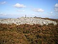
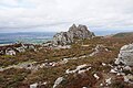
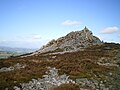
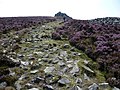
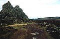
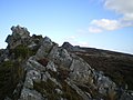
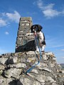
English: The Stiperstones is a very distinctive hill in the county of Shropshire, England. It is a quartzite ridge formed some 480 Million years ago. During the last Ice Age the summit stood out above the glaciers and was subject to constant freezing and thawing which shattered the quartzite into a mass of jumbled scree surrounding several residual rocky tors. At 536 metres above sea level it is the second highest hill in the county, surpassed only by Brown Clee Hill (546 m). Stiperstones' five-mile (8 km) long summit ridge is crowned by several rugged, jagged outcrops of rock silouetted against the sky.

hill in Shropshire, United Kingdom  | |||||
| Upload media | |||||
| Instance of | |||||
|---|---|---|---|---|---|
| Location | Shropshire, West Midlands, England | ||||
| Topographic prominence |
| ||||
| Elevation above sea level |
| ||||
| Parent peak | |||||
 | |||||
Subcategories
This category has the following 5 subcategories, out of 5 total.
C
- Cranberry Rock (4 F)
D
- Devils Chair (Stiperstones) (12 F)
M
- Manstone Rock (24 F)
N
- Nipstone Rock (7 F)
S
- Stiperstones trig point (1 F)
Media in category "Stiperstones"
The following 149 files are in this category, out of 149 total.
-

-
 Along the Stiperstones - geograph.org.uk - 6089268.jpg 6,000 × 4,000; 4.57 MB
-
 Alongside the rocks of The Devil's Chair - geograph.org.uk - 1498546.jpg 640 × 480; 120 KB
-
 Ancient boundary on the Stiperstones - geograph.org.uk - 5955092.jpg 6,000 × 4,000; 5.01 MB
-
 Blue Sky and Cars. - geograph.org.uk - 623540.jpg 640 × 480; 48 KB
-
 Cairn in Stiperstones National Nature Reserve, Shropshire, England.jpg 640 × 480; 132 KB
-

-

-
 Cairn on top of a large rock outcrop at Stiperstones (geograph 7383428).jpg 1,600 × 900; 727 KB
-
 Car park at the Stiperstones NNR - geograph.org.uk - 2960962.jpg 640 × 480; 47 KB
-
 Cranberry Rock - geograph.org.uk - 5953575.jpg 6,000 × 4,000; 4.66 MB
-
 Cranberry Rock, Stiperstones - geograph.org.uk - 6041521.jpg 1,024 × 768; 413 KB
-
 Cranberry Rock, Stiperstones - geograph.org.uk - 6089283.jpg 6,000 × 4,000; 3.85 MB
-
 Devil's Chair - geograph.org.uk - 4628763.jpg 640 × 480; 81 KB
-
 Devil's Chair - geograph.org.uk - 5953690.jpg 6,000 × 4,000; 4.01 MB
-
 Devil's Chair - geograph.org.uk - 5954348.jpg 6,000 × 4,000; 4.48 MB
-
 Devil's Chair, Stiperstones - geograph.org.uk - 5762065.jpg 5,184 × 3,888; 3.63 MB
-
 Devil's Chair.jpg 640 × 480; 111 KB
-
 Disused barite shaft, near Gatten Lodge - geograph.org.uk - 635863.jpg 480 × 640; 120 KB
-

-
 Eastern side of the Stiperstones - geograph.org.uk - 5954454.jpg 6,000 × 4,000; 4.78 MB
-
 Erosion control at the Stiperstones - geograph.org.uk - 2254292.jpg 3,872 × 2,592; 3.56 MB
-
 Erosion repair sign at the Stiperstones - geograph.org.uk - 2254296.jpg 3,363 × 2,482; 3.18 MB
-

-

-

-

-

-
 Gate on path near The Bog - geograph.org.uk - 1111759.jpg 514 × 640; 102 KB
-
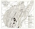 Geological Map Ordovician Rocks Shropshire Welsh Borderland 3rd Edn Page076.jpg 4,057 × 3,369; 3.39 MB
-

-

-

-

-
 Looking towards the Stipperstones - geograph.org.uk - 1566174.jpg 640 × 480; 74 KB
-
 Lower slopes of the Stiperstones - geograph.org.uk - 5956897.jpg 6,000 × 4,000; 7.44 MB
-
 Manstone Rock - geograph.org.uk - 5953651.jpg 6,000 × 4,000; 4.58 MB
-
 Manstone Rock from Cranberry Rock - geograph.org.uk - 1498303.jpg 640 × 480; 99 KB
-
 Manstone Rock from the south - geograph.org.uk - 1498515.jpg 640 × 480; 102 KB
-
 Manstone Rock on the Stiperstones - geograph.org.uk - 5570718.jpg 640 × 480; 48 KB
-
 Manstone Rock ^ trig point, Stiperstones - geograph.org.uk - 5608246.jpg 5,184 × 2,920; 4.88 MB
-
 Manstone Rock, Stiperstones - geograph.org.uk - 6041526.jpg 1,024 × 731; 394 KB
-
 Manstone Rock, Stiperstones - geograph.org.uk - 6089262.jpg 4,358 × 2,957; 3.23 MB
-
 Minsterley Yard Full.jpg 4,032 × 3,024; 3.77 MB
-
 Nipstone Rock - geograph.org.uk - 2019.jpg 640 × 480; 124 KB
-
 Nipstone Rock and mist - geograph.org.uk - 1112116.jpg 640 × 407; 40 KB
-
 On Stiperstones in summer - geograph.org.uk - 4083148.jpg 640 × 360; 51 KB
-
 On the Stiperstones in summer - geograph.org.uk - 4083111.jpg 640 × 360; 42 KB
-
 On the Stiperstones ridge in July - geograph.org.uk - 4083180.jpg 640 × 360; 62 KB
-

-

-
 One of the Stiperstones - geograph.org.uk - 1108772.jpg 640 × 480; 68 KB
-
 Part of the Stiperstones Ridge - geograph.org.uk - 2162700.jpg 640 × 480; 111 KB
-

-

-

-

-

-

-
 Rock at the Devil's Chair - geograph.org.uk - 1111782.jpg 640 × 480; 108 KB
-

-

-
 Rocky bridleway below Shepherd's Rock - geograph.org.uk - 1499517.jpg 640 × 480; 129 KB
-
-
 Round cairn north of Manstone Rock (geograph 7383413).jpg 1,600 × 900; 722 KB
-
 Runner on the Stiperstones ridge - geograph.org.uk - 2393091.jpg 640 × 480; 93 KB
-
 Sheep on the Stiperstones - geograph.org.uk - 5952692.jpg 6,000 × 4,000; 5.15 MB
-
 Shepherd's Rock from below - geograph.org.uk - 1499520.jpg 640 × 480; 139 KB
-

-
 Shepherd's Rock on Stiperstones - geograph.org.uk - 1812677.jpg 640 × 480; 94 KB
-
 Shepherd's Rock, Stiperstones - geograph.org.uk - 2721999.jpg 640 × 480; 60 KB
-
 Shepherd's Rock, Stiperstones - geograph.org.uk - 5762070.jpg 5,184 × 3,888; 3.98 MB
-
 Small cairn above The Hollies farm - geograph.org.uk - 1500093.jpg 640 × 480; 124 KB
-
 Snow on the Stiperstones car park - geograph.org.uk - 3392957.jpg 1,600 × 1,140; 360 KB
-

-
 Stiperstone from Stiperstones. - geograph.org.uk - 1877092.jpg 640 × 457; 229 KB
-
 Stiperstones (1) - geograph.org.uk - 6041543.jpg 1,024 × 768; 409 KB
-
 Stiperstones (2) - geograph.org.uk - 6041544.jpg 1,024 × 762; 374 KB
-
 Stiperstones by bladeflyer.jpg 4,416 × 3,312; 6.91 MB
-
 Stiperstones C of E Primary School - geograph.org.uk - 3040655.jpg 979 × 734; 266 KB
-
 Stiperstones car park - geograph.org.uk - 5124881.jpg 4,608 × 3,456; 1.52 MB
-
 Stiperstones from Black Rhadley hill - geograph.org.uk - 684175.jpg 640 × 419; 82 KB
-
 Stiperstones path - geograph.org.uk - 5979394.jpg 800 × 600; 117 KB
-
 Stiperstones ridge 2.jpg 2,048 × 1,536; 1.4 MB
-
 Stiperstones ridge 4.jpg 2,048 × 1,536; 1.29 MB
-
 Stiperstones ridge from Corndon Hill - geograph.org.uk - 1499006.jpg 640 × 480; 63 KB
-

-
 Stiperstones ridge from Shelve - geograph.org.uk - 3534162.jpg 640 × 480; 48 KB
-

-
 Stiperstones rocks, Shropshire - geograph.org.uk - 2253643.jpg 1,175 × 1,600; 462 KB
-
 Stiperstones trig point - geograph.org.uk - 1194216.jpg 640 × 369; 59 KB
-
 Stiperstones, Shropshire - geograph.org.uk - 6095872.jpg 6,000 × 4,000; 4 MB
-
 Stiperstones, Shropshire. - geograph.org.uk - 868801.jpg 640 × 427; 49 KB
-
 Stiperstones, Shropshire. - geograph.org.uk - 869193.jpg 640 × 427; 59 KB
-
 Sun and shade on the Stiperstones - geograph.org.uk - 1067827.jpg 640 × 429; 83 KB
-
 The Black Ditch - geograph.org.uk - 1498286.jpg 640 × 480; 109 KB
-
 The Devil's Chair - geograph.org.uk - 1194214.jpg 640 × 423; 65 KB
-
 The Devil's Chair, Stiperstones - geograph.org.uk - 5608247.jpg 5,184 × 2,920; 5.82 MB
-
-

-
 The North end of Manstone Rock - geograph.org.uk - 1067819.jpg 640 × 429; 80 KB
-

-
 The shadow from Manstone Rock - geograph.org.uk - 1067932.jpg 640 × 446; 113 KB
-
 The Stiperstones - geograph.org.uk - 1111765.jpg 640 × 442; 99 KB
-
 The Stiperstones - geograph.org.uk - 1592988.jpg 640 × 480; 142 KB
-
 The Stiperstones - geograph.org.uk - 1592991.jpg 640 × 480; 78 KB
-
 The Stiperstones - geograph.org.uk - 1594111.jpg 640 × 480; 73 KB
-
 The Stiperstones - geograph.org.uk - 1651093.jpg 640 × 337; 72 KB
-
 The Stiperstones - geograph.org.uk - 2581028.jpg 3,888 × 2,592; 3.17 MB
-
 The Stiperstones - geograph.org.uk - 5363058.jpg 2,000 × 1,333; 1.86 MB
-
 The Stiperstones - geograph.org.uk - 5953633.jpg 6,000 × 4,000; 4.29 MB
-
 The Stiperstones - geograph.org.uk - 5954375.jpg 6,000 × 4,000; 4.4 MB
-
 The Stiperstones in May - geograph.org.uk - 3490260.jpg 640 × 480; 35 KB
-
 The Stiperstones under low cloud - geograph.org.uk - 2952316.jpg 2,592 × 1,944; 1.28 MB
-
 The Stiperstones, Shropshire - geograph.org.uk - 4551554.jpg 1,920 × 1,080; 640 KB
-
 The Stipertones ridge - geograph.org.uk - 5953540.jpg 6,000 × 4,000; 4.88 MB
-
 Three gates in one - geograph.org.uk - 1500131.jpg 640 × 480; 134 KB
-
 Tree and gate on the Shropshire Way - geograph.org.uk - 1108740.jpg 640 × 510; 84 KB
-
 Trig pillar, Manstone Rock - geograph.org.uk - 5996781.jpg 600 × 800; 107 KB
-
 View along the Stiperstones, Shropshire - geograph.org.uk - 2253662.jpg 1,600 × 1,071; 174 KB
-

-

-
 View south near Whitebanks - geograph.org.uk - 714699.jpg 640 × 480; 154 KB
-
 View SW from near Lower Santley Wood - geograph.org.uk - 714620.jpg 640 × 480; 121 KB
-
 View towards Stiperstones from Nipstone Rock - geograph.org.uk - 5608244.jpg 5,184 × 2,920; 5.32 MB
-

-
 View west to the distant Stiperstones - geograph.org.uk - 723831.jpg 640 × 382; 96 KB
-

-

-

-
 Walking on the Stiperstones in July - geograph.org.uk - 4083106.jpg 640 × 360; 54 KB
-
 Walking on the Stiperstones ridge - geograph.org.uk - 2393263.jpg 640 × 480; 89 KB
-

-

-
 Wooded hill near Whitebanks - geograph.org.uk - 714633.jpg 640 × 393; 67 KB
-
 Bridleway above The Paddock - geograph.org.uk - 1499185.jpg 640 × 480; 129 KB
-

-

-
 Far Gatten - geograph.org.uk - 672016.jpg 640 × 480; 63 KB
-
 Grumpy rock - geograph.org.uk - 171353.jpg 640 × 480; 87 KB
-
 House and farmland - geograph.org.uk - 723583.jpg 640 × 474; 135 KB
-
 Manstone Rocks - geograph.org.uk - 271563.jpg 640 × 427; 43 KB
-
 Meadow on the Stiperstones ridge - geograph.org.uk - 170783.jpg 640 × 480; 103 KB
-
 Near the Stiperstones - geograph.org.uk - 271559.jpg 640 × 356; 60 KB
-
 Sheep grazing near Snailbeach - geograph.org.uk - 171364.jpg 640 × 480; 90 KB
-
 Snape Cottage - geograph.org.uk - 672014.jpg 640 × 480; 69 KB
-
 Stiperstones, North End - geograph.org.uk - 82646.jpg 640 × 433; 106 KB
-
 The Stiperstones - geograph.org.uk - 7117.jpg 480 × 640; 103 KB
-
 Winding Engine - geograph.org.uk - 326484.jpg 273 × 358; 22 KB


.jpg)


.jpg)


_-_geograph.org.uk_-_6041543.jpg)
_-_geograph.org.uk_-_6041544.jpg)


