Category:Stielers Handatlas
Jump to navigation
Jump to search
German world atlas  | |||||
| Upload media | |||||
| Instance of | |||||
|---|---|---|---|---|---|
| Genre | |||||
| Country of origin | |||||
| Author | |||||
| Publisher | |||||
| Language of work or name | |||||
| Publication date |
| ||||
| Mass |
| ||||
| Width |
| ||||
| Height |
| ||||
| |||||
Subcategories
This category has the following 6 subcategories, out of 6 total.
O
S
- Stielers Handatlas 1891 (2 P, 121 F)
Media in category "Stielers Handatlas"
The following 44 files are in this category, out of 44 total.
-
 1859 - Zug der Israeliten aus Ägypten nach Kanaan.jpg 1,556 × 2,283; 1.4 MB
-
 Afrika - Stieler's Hand-Atlas 1859.jpg 5,586 × 4,551; 6.75 MB
-
 America - Stieler's Hand-Atlas.jpg 4,619 × 5,546; 6.72 MB
-
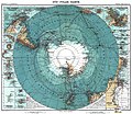 Antarctica 1912 edit.jpg 4,940 × 4,296; 17.94 MB
-
 Asia - Stieler's Hand-Atlas.jpg 5,591 × 4,604; 7.58 MB
-
 China Korea und Japan im Massstab 1-7.500.000 LOC 2006629397 clipping matsushima.jpg 1,886 × 1,691; 2.74 MB
-
 China und Japan.jpg 5,592 × 4,574; 8.82 MB
-
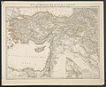
 Das Mittelländische und Schwarze Meer Nebst Übersicht Der Länder Des Osmanischen Reichs.jpg 5,607 × 4,581; 8.62 MB
-
 Das Osmanische Reich in Asien (Klein-Asien, Armenien, Kurdistan, Mesopotamien, Syrien).jpg 5,620 × 4,579; 8.97 MB
-
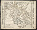 Die Europaeische Türkei, Griechenland und die Ionischen Inseln.jpg 5,570 × 4,553; 9.19 MB
-
 Die Europaeische Türkei.jpg 5,559 × 4,554; 10.25 MB
-
 Die Ostindischen Inseln.jpg 5,825 × 4,667; 8.33 MB
-
 Frankreich in IV Blättern - HK 1107.jpg 5,357 × 4,445; 12.41 MB
-
 Frankreich in IV Blättern - HK1119.jpg 5,292 × 4,377; 8.47 MB
-
 Frankreich in IV Blättern - HK1120.jpg 5,350 × 4,435; 10.05 MB
-
 Frankreich in IV Blättern - HK1121.jpg 5,283 × 4,431; 10.73 MB
-
 Griechenland und der Griechisch-Türkische Archipel.jpg 5,643 × 4,870; 9.06 MB
-
 Hinter-Indien u. Archipel.png 12,235 × 8,781; 141.84 MB
-

-
 Italien - Stieler's Hand-Atlas.jpg 5,630 × 4,624; 7.5 MB
-
 Königreich Beider Sicilien nebst dem Südlichen Theile des Kirchenstaats.jpg 4,547 × 5,521; 7.54 MB
-
 Königreich Griechenland und die Ionischen Inseln.jpg 5,620 × 4,553; 8.33 MB
-

-
 Map of Tibet in 1831 from Ost-Indien Mit Den Inseln (cropped).jpg 1,898 × 981; 851 KB
-

-

-
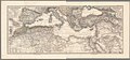 Mediterranean map 1875.jpg 13,961 × 6,485; 25.33 MB
-
 Mittel- und Nord-Africa (Oestl. Theil) und Arabien.jpg 5,784 × 4,651; 8.14 MB
-
 Mittel- und Nord-Africa (Westl. Theil).jpg 5,803 × 4,647; 7.99 MB
-
 Noerdliches Italien.jpg 5,606 × 4,570; 9.58 MB
-

-
 Ost-Indien Mit Den Inseln - Vollständige Ausgabe No. 44a aus Stieler's Hand-Atlas.jpg 5,772 × 4,630; 7.98 MB
-
 Ost-Indien Mit Den Inseln.jpg 5,304 × 4,331; 7.17 MB
-
 Palaestina.jpg 5,680 × 4,618; 8.86 MB
-

-
 Polarkarte.jpg 5,635 × 4,520; 7.3 MB
-
 Russian Empire - European part, 1825.jpg 5,722 × 9,000; 13.32 MB
-
 Stieler - 1859 map of ancient Palaestina.jpg 3,060 × 4,064; 4.86 MB
-
 Stieler - Jerusalem in the 70s and the 1850s.jpg 851 × 2,027; 929 KB
-
 Stielers Hand-Atlas Hundertjahr-Ausgabe Einband.png 2,378 × 3,010; 10.38 MB
-
 Stielers Hand-Atlas Hundertjahr-Ausgabe Titelseite.png 1,798 × 2,809; 4.82 MB
-

-

-
 Weltkarte - Map of the World (index map).jpg 1,680 × 1,029; 910 KB


.jpg)


.jpg)
.jpg)
.jpg)
.jpg)

_und_Arabien.jpg)
.jpg)

.jpg)


.jpg)


.jpg)

.jpg)