Category:Stepps
Jump to navigation
Jump to search
town in North Lanarkshire, Scotland, UK  | |||||
| Upload media | |||||
| Instance of | |||||
|---|---|---|---|---|---|
| Location |
| ||||
| Population |
| ||||
 | |||||
English: Stepps is a small town in North Lanarkshire, Scotland, on the north-eastern outskirts of Glasgow. The town consists of Stepps Village, Cardowan, Stepps Hill and Millerston It had a population of 4,802 according to the 2001 census, however large scale housing developments in Cardowan and Stepps since 2001 mean that the current population is likely to be somewhat larger.
Nederlands: Stepps is een plaats in het Schotse bestuurlijke gebied North Lanarkshire en telt 4802 inwoners. Stepps bestaat uit Stepps Village, Cardowan, Stepps Hill en Millerston.
Subcategories
This category has the following 6 subcategories, out of 6 total.
B
- Buchanan Tower, Stepps (4 F)
C
- Crowwood roundabout (2 F)
G
- Garfield House Hotel (2 F)
S
- Stepps bypass bridge (2 F)
- Stepps railway station (4 F)
- Stepps Road railway station (2 F)
Media in category "Stepps"
The following 25 files are in this category, out of 25 total.
-
 Buchanan Business Park - geograph.org.uk - 699835.jpg 640 × 480; 51 KB
-
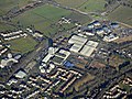
 Buchanan Business Park from the air (geograph 5679255).jpg 640 × 480; 198 KB
-
 Buchanan Business Park from the air (geograph 5681680).jpg 640 × 480; 183 KB
-
 Bulrush Marsh - geograph.org.uk - 123483.jpg 640 × 447; 127 KB
-
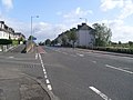 Cumbernauld Road - geograph.org.uk - 1480295.jpg 640 × 480; 123 KB
-
 Fourth Avenue - geograph.org.uk - 1480289.jpg 640 × 480; 120 KB
-
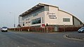 Health Club - geograph.org.uk - 382194.jpg 622 × 349; 71 KB
-
 Heathfield Marshland - geograph.org.uk - 123489.jpg 640 × 455; 104 KB
-
 Highpit Plantation - geograph.org.uk - 1491811.jpg 640 × 480; 132 KB
-
 Hornshill Farm Track - geograph.org.uk - 127397.jpg 640 × 480; 137 KB
-
 Horse in a frosty field - geograph.org.uk - 699833.jpg 640 × 480; 109 KB
-
 How long^^ - geograph.org.uk - 1491816.jpg 640 × 480; 112 KB
-
 Leaving Stepps on Lenzie Road - geograph.org.uk - 1480394.jpg 640 × 480; 115 KB
-
 Looking down Third Avenue - geograph.org.uk - 1480294.jpg 640 × 480; 131 KB
-
 Looking into Garnkirk Glen - geograph.org.uk - 1491847.jpg 640 × 480; 130 KB
-
 Mount Harriet Drive - geograph.org.uk - 1491843.jpg 640 × 480; 114 KB
-
 No through road on Hornshill Farm Road - geograph.org.uk - 1480390.jpg 640 × 480; 124 KB
-
 Power lines crossing the A80 - geograph.org.uk - 1491827.jpg 640 × 480; 135 KB
-
 Reddish house on Cumbernauld Road - geograph.org.uk - 1480313.jpg 640 × 480; 119 KB
-
 Somerfield, Stepps - geograph.org.uk - 1480310.jpg 640 × 480; 119 KB
-
 Stepps Parish Church - geograph.org.uk - 127393.jpg 640 × 480; 112 KB
-
 The A80 near Stepps - geograph.org.uk - 1480384.jpg 640 × 480; 150 KB
-
 The narrowing Lenzie Road - geograph.org.uk - 1491850.jpg 640 × 480; 141 KB
-
 Third Avenue meets Fourth Avenue - geograph.org.uk - 1480288.jpg 640 × 480; 108 KB
-
 Third Avenue, Stepps - geograph.org.uk - 1480283.jpg 640 × 480; 134 KB

.jpg)
.jpg)


