Category:Staverton, Devon
Jump to navigation
Jump to search
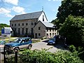
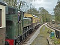
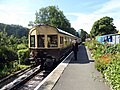
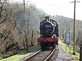
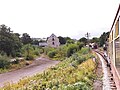
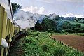
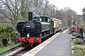
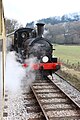
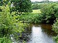
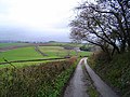
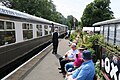
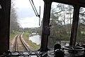
English: Staverton is a village in the South Hams of Devon, England, situated on the north side of the River Dart about 2 miles north west of Totnes. Staverton bridge, over the Dart, was probably built in 1413 and is one of the best medieval bridges to survive in Devon. The church of St. Paul is mostly early 14th century. The village has a public house: the Sea Trout Inn. The village also has its own railway station with regular steam trains. The line was built by the South Devon Railway and first opened on 1 May 1872.
village and civil parish in Devon, UK  | |||||
| Upload media | |||||
| Instance of | |||||
|---|---|---|---|---|---|
| Location | South Hams, Devon, South West England, England | ||||
 | |||||
Subcategories
This category has the following 8 subcategories, out of 8 total.
K
- Kingston, Staverton (4 F)
M
N
- Nappers Halt railway station (9 F)
S
- Sea Trout Inn, Staverton (6 F)
- Staverton Bridge (20 F)
- Staverton Mill (20 F)
Media in category "Staverton, Devon"
The following 200 files are in this category, out of 733 total.
(previous page) (next page)-
 "Premier development of riverside apartments" - geograph.org.uk - 1936683.jpg 1,024 × 768; 182 KB
-
 3803 on the South Devon Railway.jpg 4,216 × 2,848; 7.46 MB
-
 5786 en route to Buckfastleigh - geograph.org.uk - 1009836.jpg 640 × 429; 120 KB
-
 A 6430 'auto-sandwich' - geograph.org.uk - 6132812.jpg 640 × 480; 104 KB
-
 A backwater of the Dart - geograph.org.uk - 1090659.jpg 640 × 429; 117 KB
-
 A good place for an accident^ Bumpston Cross - geograph.org.uk - 2202686.jpg 1,024 × 768; 298 KB
-
 A line of trees - geograph.org.uk - 5356021.jpg 640 × 426; 51 KB
-
 A Peacock Butterfly feeding on Buddleia - geograph.org.uk - 5582629.jpg 1,024 × 634; 164 KB
-
 A small copse near Copper Tree Cross - geograph.org.uk - 3034921.jpg 1,000 × 750; 621 KB
-

-
-
 A View Across the Valley near Bulland - geograph.org.uk - 3294158.jpg 1,024 × 768; 330 KB
-
 A View down the Hillside - geograph.org.uk - 5582595.jpg 1,024 × 683; 382 KB
-
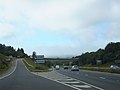
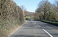
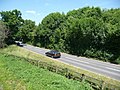
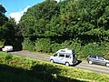
 A38 and sliproad, Ashburton - geograph.org.uk - 1203050.jpg 640 × 480; 76 KB
-
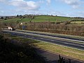
 A38 exit to B3352 and road to Dartmoor - geograph.org.uk - 2597748.jpg 800 × 600; 272 KB
-
 A38 near Ashburton - geograph.org.uk - 1203103.jpg 640 × 480; 75 KB
-
 A384 - geograph.org.uk - 5327138.jpg 640 × 426; 81 KB
-
 A384 approaching Riverford Bridge - geograph.org.uk - 3942793.jpg 1,600 × 1,009; 571 KB
-
 A384 approaching Riverford Bridge - geograph.org.uk - 3942796.jpg 1,600 × 1,030; 498 KB
-
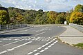
 A384 approaching the A38 - geograph.org.uk - 3034393.jpg 567 × 640; 67 KB
-
 A384 diverging from the railway line - geograph.org.uk - 1936754.jpg 1,024 × 768; 203 KB
-
 A384 near Buckfastleigh - geograph.org.uk - 5246928.jpg 1,024 × 768; 343 KB
-
 A384 north of Riverford Bridge - geograph.org.uk - 3034384.jpg 640 × 398; 54 KB
-
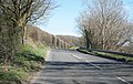
 A384, Landscove turning - geograph.org.uk - 3034385.jpg 640 × 345; 33 KB
-
-
 Abham Copse - geograph.org.uk - 1074088.jpg 640 × 455; 100 KB
-
 Above Penn Recca - geograph.org.uk - 1075356.jpg 575 × 640; 103 KB
-
 Abraham's Wood - geograph.org.uk - 1996722.jpg 640 × 480; 294 KB
-
 Altered junction at Charlies Cross - geograph.org.uk - 1076158.jpg 640 × 480; 60 KB
-
 Animal feeder, Woodend - geograph.org.uk - 3777075.jpg 1,251 × 1,437; 487 KB
-
 Approach to Staverton Bridge - geograph.org.uk - 3938542.jpg 4,912 × 3,264; 7.25 MB
-
 Approaching Five Lanes - geograph.org.uk - 1204098.jpg 640 × 480; 104 KB
-
 Approaching Gullaford - geograph.org.uk - 3778014.jpg 1,920 × 2,455; 1 MB
-
 Approaching Higher Beara Cross - geograph.org.uk - 1075362.jpg 640 × 480; 111 KB
-
 Approaching Napper's Crossing - geograph.org.uk - 4893999.jpg 640 × 480; 110 KB
-
 Approaching Staverton by train - geograph.org.uk - 5246837.jpg 1,024 × 768; 229 KB
-
 Ashburton Solar Farm - geograph.org.uk - 5397201.jpg 1,600 × 977; 215 KB
-
 At the 5 1-4 mile post, 1969 - geograph.org.uk - 2806313.jpg 640 × 428; 99 KB
-
 Autotrain arriving at Staverton - geograph.org.uk - 5281638.jpg 640 × 427; 120 KB
-
 Baddaford - geograph.org.uk - 1204112.jpg 640 × 480; 85 KB
-
 Baddaford - geograph.org.uk - 1204124.jpg 640 × 480; 70 KB
-
 Barn and oak, Staverton - geograph.org.uk - 4335838.jpg 1,920 × 1,400; 803 KB
-
 Barn at Gullaford - geograph.org.uk - 3778077.jpg 1,920 × 2,393; 1.19 MB
-
 Barn, Baddaford - geograph.org.uk - 3777556.jpg 1,920 × 1,440; 384 KB
-
 Barn, Lower Combe - geograph.org.uk - 1076314.jpg 640 × 480; 94 KB
-
 Barn, Stretchford Farm - geograph.org.uk - 5350675.jpg 640 × 426; 63 KB
-
 Barns at Gullaford - geograph.org.uk - 3778123.jpg 1,920 × 1,303; 290 KB
-
 Barns, Caddaford - geograph.org.uk - 1075437.jpg 640 × 480; 148 KB
-
 Bat droppings in Mill - geograph.org.uk - 729521.jpg 640 × 480; 56 KB
-
 Bears and mirror, Hill House - geograph.org.uk - 1905124.jpg 480 × 640; 126 KB
-
 Beattie well tank, 143 years young - geograph.org.uk - 5281645.jpg 427 × 640; 94 KB
-
 Beginning of the power line - geograph.org.uk - 1089295.jpg 554 × 640; 88 KB
-
 Bend in the lane, Parkfield - geograph.org.uk - 1072969.jpg 640 × 460; 74 KB
-
 Beneath Austin's Bridge - geograph.org.uk - 1081068.jpg 640 × 480; 132 KB
-
 Beside The River Dart - geograph.org.uk - 5038179.jpg 640 × 480; 174 KB
-
 Between Penn and Parkfield - South Devon - geograph.org.uk - 144010.jpg 640 × 480; 138 KB
-
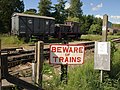 Beware of trains - geograph.org.uk - 1906147.jpg 640 × 480; 114 KB
-
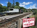 Beware of Trains - geograph.org.uk - 5115926.jpg 4,000 × 3,000; 4.06 MB
-

-
 Bracket fungi near the Dart (2) - geograph.org.uk - 1080862.jpg 640 × 480; 114 KB
-
 Bracket fungi near the Dart - geograph.org.uk - 1080855.jpg 480 × 640; 125 KB
-
 Bridge at Wash - geograph.org.uk - 1075044.jpg 480 × 640; 122 KB
-
 Bridleway near Tidswell - geograph.org.uk - 1075287.jpg 640 × 480; 130 KB
-
 Bridleway to Baddaford - geograph.org.uk - 3777441.jpg 1,920 × 2,560; 1.36 MB
-
 Bridleway to Baddaford - geograph.org.uk - 3777447.jpg 1,920 × 2,560; 1.37 MB
-
 Bridleway to Baddaford - geograph.org.uk - 3777452.jpg 1,920 × 2,560; 1.2 MB
-
 Bridleway to Baddaford - geograph.org.uk - 3777464.jpg 1,920 × 2,560; 1.28 MB
-
 Bridleway to High Beara - geograph.org.uk - 5222617.jpg 3,072 × 2,048; 1.51 MB
-
 Bridleway, Lower Combe - geograph.org.uk - 1076301.jpg 640 × 480; 95 KB
-
 Brook and road from Gladridgeford Bridge - geograph.org.uk - 4307685.jpg 2,560 × 1,920; 2.01 MB
-
 Buildings, Whiteway Farm - geograph.org.uk - 1089333.jpg 640 × 479; 99 KB
-
 Bumpstone Cross signpost - geograph.org.uk - 1461829.jpg 480 × 640; 324 KB
-
 Bus shelter or billboard^ - geograph.org.uk - 3894978.jpg 4,150 × 2,762; 2.28 MB
-
 Byway above Pridhamsleigh - geograph.org.uk - 3777290.jpg 1,920 × 1,440; 615 KB
-
 Byway above Pridhamsleigh - geograph.org.uk - 3777307.jpg 1,920 × 1,440; 685 KB
-
 Byway east of Parkfield - geograph.org.uk - 1930737.jpg 640 × 427; 316 KB
-
 Byway from Five Lanes - geograph.org.uk - 1204120.jpg 470 × 640; 91 KB
-
 Byway from Five Lanes - geograph.org.uk - 2821783.jpg 1,536 × 2,048; 672 KB
-
 Byway to Bulland - geograph.org.uk - 1203585.jpg 640 × 480; 135 KB
-
 Byway to Bulland - geograph.org.uk - 3777365.jpg 1,920 × 1,254; 536 KB
-
 Byway to Woolston Green - geograph.org.uk - 4307692.jpg 2,560 × 1,920; 2.02 MB
-
 Caddaford - geograph.org.uk - 1075445.jpg 640 × 446; 85 KB
-
 Campsite by the River Dart - geograph.org.uk - 5246897.jpg 1,024 × 768; 175 KB
-
 Car park by Staverton Station - geograph.org.uk - 3938497.jpg 4,051 × 2,889; 2.78 MB
-
 Car park, Dartbridge Inn - geograph.org.uk - 5356023.jpg 640 × 426; 90 KB
-
 Cardoons at Wash - geograph.org.uk - 3123991.jpg 640 × 462; 55 KB
-
 Cattle at Sparkwell - geograph.org.uk - 1089307.jpg 640 × 480; 119 KB
-
 Cattle By The River Dart - geograph.org.uk - 5038270.jpg 640 × 456; 122 KB
-
 Cattle Country - geograph.org.uk - 5038296.jpg 640 × 393; 107 KB
-

-
 Cattle Field - geograph.org.uk - 5038192.jpg 640 × 419; 85 KB
-
 Cattle in the Dart Valley - geograph.org.uk - 5327178.jpg 640 × 426; 54 KB
-
 Christmas tree farm near Reevacre Cross - geograph.org.uk - 6124425.jpg 4,288 × 2,848; 2.8 MB
-
 Chuley Cross - geograph.org.uk - 1200550.jpg 640 × 427; 109 KB
-
 Church and lych-gate, Landscove (geograph 6715113).jpg 4,047 × 2,660; 883 KB
-
 Church Cottage - geograph.org.uk - 952600.jpg 640 × 427; 71 KB
-
 Clouds above Well - geograph.org.uk - 2578165.jpg 640 × 430; 40 KB
-
 Combe above Landscove - geograph.org.uk - 1075316.jpg 640 × 470; 101 KB
-
 Combe above Pridhamsleigh - geograph.org.uk - 3777269.jpg 1,920 × 1,331; 399 KB
-
 Combe below Higher Penn - geograph.org.uk - 3777940.jpg 4,000 × 2,839; 2.49 MB
-
 Combe below Higher Penn - geograph.org.uk - 6020535.jpg 3,816 × 2,356; 1.17 MB
-
 Combe below Higher Penn - geograph.org.uk - 6022230.jpg 4,125 × 2,446; 1.6 MB
-
 Combe below Higher Penn - geograph.org.uk - 6022242.jpg 4,288 × 2,848; 1.93 MB
-
 Combe below Higher Penn - geograph.org.uk - 6022259.jpg 4,282 × 2,473; 1.5 MB
-
 Combe, Staverton - geograph.org.uk - 155907.jpg 640 × 480; 92 KB
-
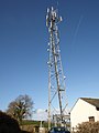
 Communications mast at Chuley Cross - geograph.org.uk - 1727580.jpg 480 × 640; 47 KB
-
-
 Copper Tree Cross - geograph.org.uk - 1067133.jpg 640 × 480; 90 KB
-
 Cottage, Kingston Estate - geograph.org.uk - 4756097.jpg 1,920 × 1,275; 731 KB
-
 Countryside at Kingston House - geograph.org.uk - 3779746.jpg 1,920 × 1,302; 555 KB
-
 Countryside near Baddaford - geograph.org.uk - 3777437.jpg 1,920 × 1,263; 542 KB
-
 Countryside near Baddaford - geograph.org.uk - 3777601.jpg 1,920 × 1,273; 505 KB
-
 Countryside near Kingston House - geograph.org.uk - 3779820.jpg 1,920 × 1,302; 500 KB
-
 Countryside near Wash Farm - geograph.org.uk - 1075109.jpg 640 × 480; 94 KB
-
 Cow in the Ashburn valley - geograph.org.uk - 3777233.jpg 1,920 × 2,560; 989 KB
-
 Crop strips below Tor Hill - geograph.org.uk - 1074418.jpg 640 × 468; 119 KB
-
 Crop strips below Tor Hill Plantation - geograph.org.uk - 1074462.jpg 640 × 480; 124 KB
-
 Crop, Riverford - geograph.org.uk - 1074434.jpg 480 × 640; 139 KB
-
 Crops at Riverford - geograph.org.uk - 1074346.jpg 640 × 442; 83 KB
-
 Crops at Riverford - geograph.org.uk - 1074427.jpg 640 × 480; 126 KB
-
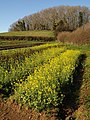 Crops below Tor Hill Plantation - geograph.org.uk - 1074449.jpg 480 × 640; 135 KB
-
 Crops, Riverford - geograph.org.uk - 1074475.jpg 640 × 480; 130 KB
-
 Crops, Riverford - geograph.org.uk - 1074484.jpg 640 × 471; 124 KB
-
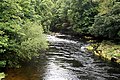 Crossing the Dart - geograph.org.uk - 944440.jpg 640 × 427; 154 KB
-
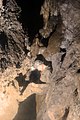 Crossing the Well in Pridhamsleigh Cavern - geograph.org.uk - 2840989.jpg 2,048 × 3,072; 1.6 MB
-
 Crossroads at Copper Tree Cross - geograph.org.uk - 3034924.jpg 1,000 × 750; 421 KB
-
 Dart near Austin's Bridge - geograph.org.uk - 1080969.jpg 640 × 480; 133 KB
-
 Dart river 2018 1.jpg 3,648 × 2,736; 4.96 MB
-
 Dart river 2018 2.jpg 3,648 × 2,736; 4.47 MB
-
 Dart river 2018 3.jpg 3,648 × 2,736; 4.84 MB
-
 Dart river 2018 4.jpg 3,648 × 2,736; 4.99 MB
-
 Dart river 2018 5.jpg 3,648 × 2,736; 4.97 MB
-
 Dart valley - geograph.org.uk - 22565.jpg 640 × 425; 127 KB
-
 Dart valley near Caddaford - geograph.org.uk - 1075391.jpg 640 × 393; 77 KB
-
 Dart Valley Railway 1973 - 12682553725.jpg 1,024 × 682; 221 KB
-
 Dart Valley Railway 1973.jpg 1,024 × 677; 307 KB
-
 Dart Valley View - geograph.org.uk - 5038256.jpg 640 × 431; 68 KB
-
 Dart valley, Caddaford - geograph.org.uk - 1075399.jpg 640 × 480; 99 KB
-
 Dart Water - geograph.org.uk - 944634.jpg 640 × 427; 114 KB
-
 Devon green lane - geograph.org.uk - 19577.jpg 640 × 425; 133 KB
-
 Devon Lane - geograph.org.uk - 19062.jpg 640 × 425; 137 KB
-
 Devon Lane - geograph.org.uk - 19064.jpg 640 × 425; 112 KB
-
 Diesel Departing - geograph.org.uk - 5582653.jpg 1,024 × 683; 275 KB
-
 Diesel departure from Staverton - geograph.org.uk - 4893919.jpg 640 × 480; 66 KB
-
 Dovecote at Pridhamsleigh - geograph.org.uk - 2011257.jpg 1,600 × 1,200; 839 KB
-
 Dovecote from bridge over the A38 at Pridhamsleigh - geograph.org.uk - 2011249.jpg 1,600 × 1,200; 513 KB
-
 Drivers eye view of Riverford Bridge.jpg 1,024 × 683; 367 KB
-
 Driving through Staverton - geograph.org.uk - 3894974.jpg 1,600 × 1,027; 494 KB
-
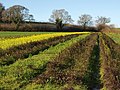
 Early January daffodils at road junction in Staverton - geograph.org.uk - 4307730.jpg 2,560 × 1,920; 2.07 MB
-
 East of Baddaford - South Devon - geograph.org.uk - 144005.jpg 640 × 480; 121 KB
-
 Edge of Hooper Hayes Copse - geograph.org.uk - 1072738.jpg 640 × 480; 121 KB
-
 Eight Trees - geograph.org.uk - 3780213.jpg 1,911 × 1,341; 873 KB
-
 Eight Trees, Staverton - geograph.org.uk - 5113287.jpg 1,600 × 1,200; 652 KB
-

-
 Entering Pridhamsleigh Cavern - geograph.org.uk - 2840980.jpg 2,526 × 1,768; 1.19 MB
-
 Enthusiasts at work - geograph.org.uk - 3938499.jpg 4,912 × 3,264; 7.03 MB
-
 Farm buildings, Tidwell - geograph.org.uk - 1320330.jpg 640 × 480; 113 KB
-
 Farm equipment and bales - geograph.org.uk - 3156702.jpg 1,024 × 768; 613 KB
-
-

-
 Farmer's Son- Life on Mount Barton Farm, Devon, England, 1942 D9980.jpg 800 × 785; 102 KB
-
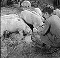 Farmer's Son- Life on Mount Barton Farm, Devon, England, 1942 D9982.jpg 800 × 772; 104 KB
-
 Farmer's Son- Life on Mount Barton Farm, Devon, England, 1942 D9984.jpg 800 × 786; 110 KB
-

-
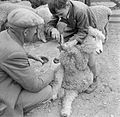 Farmer's Son- Life on Mount Barton Farm, Devon, England, 1942 D9988.jpg 800 × 780; 111 KB
-
-
 Farmhouse, Tidwell (geograph 6714819).jpg 3,787 × 2,307; 1.28 MB
-
 Farmland at Kingston House - geograph.org.uk - 3779651.jpg 1,920 × 1,253; 309 KB
-
 Farmland below Tor Hill - geograph.org.uk - 1075088.jpg 640 × 466; 126 KB
-
 Farmland by the Hems - geograph.org.uk - 3778714.jpg 1,920 × 1,316; 470 KB
-
 Farmland near Higher Penn - geograph.org.uk - 6022289.jpg 4,060 × 2,410; 1.56 MB
-
 Farmland near Landscove - geograph.org.uk - 6020513.jpg 4,104 × 2,377; 2.15 MB
-
 Farmland near Well Farm - geograph.org.uk - 5397195.jpg 1,925 × 1,156; 415 KB
-
 Farmland, Baddaford - geograph.org.uk - 3777585.jpg 1,920 × 1,440; 769 KB
-
 Farmland, Higher Penn - geograph.org.uk - 3777815.jpg 3,989 × 2,673; 1.54 MB
-
 Farmland, Stretchford - geograph.org.uk - 5350671.jpg 640 × 426; 41 KB
-
 Fence above Staverton - geograph.org.uk - 3780126.jpg 1,920 × 1,377; 488 KB
-
 Field above Baddaford - geograph.org.uk - 6022401.jpg 4,288 × 2,848; 1.35 MB
-
 Field above Baddaford - geograph.org.uk - 6022404.jpg 4,264 × 2,488; 1.5 MB
-
 Field above Chuley Cross - geograph.org.uk - 1200484.jpg 640 × 480; 108 KB
-
 Field above Pridhamsleigh - geograph.org.uk - 1203679.jpg 640 × 480; 103 KB
-
 Field alongside the River Dart - geograph.org.uk - 1936709.jpg 1,024 × 768; 131 KB
-
 Field and trees near Rosemount House - geograph.org.uk - 3777186.jpg 1,920 × 1,179; 371 KB
-
 Field beside Chuley Hill - geograph.org.uk - 1200774.jpg 640 × 480; 92 KB
-
 Field beside Chuley Hill - geograph.org.uk - 1200793.jpg 640 × 480; 87 KB
-
 Field boundaries near Stretchford - geograph.org.uk - 1075486.jpg 640 × 480; 103 KB
-
 Field by Blacker's Land Cross - geograph.org.uk - 1067144.jpg 640 × 480; 106 KB
-
 Field by the River Dart - geograph.org.uk - 5246921.jpg 1,024 × 768; 172 KB
-
 Field entrance north of Pridhamsleigh - geograph.org.uk - 3777261.jpg 1,920 × 1,482; 548 KB
-

-
 Field in the Hems valley - geograph.org.uk - 3778986.jpg 1,920 × 1,304; 343 KB
-
 Field near Abham - geograph.org.uk - 1074055.jpg 640 × 480; 94 KB
-
 Field near Barkingdon Manor - geograph.org.uk - 1074298.jpg 640 × 480; 100 KB
-
 Field near Higher Penn - geograph.org.uk - 6022328.jpg 4,288 × 2,848; 2.03 MB
-
 Field near Hooper Hayes Copse - geograph.org.uk - 1073014.jpg 640 × 480; 105 KB
-
 Field near Kingston House - geograph.org.uk - 3778942.jpg 1,920 × 1,041; 289 KB
-
 Field near Moothill Cross - geograph.org.uk - 3780043.jpg 1,920 × 1,277; 380 KB
-
 Field near Parkfield - geograph.org.uk - 1727590.jpg 640 × 480; 63 KB
-
 Field near Parkfield Farm - geograph.org.uk - 1200142.jpg 640 × 480; 78 KB
-
 Field near Penn Recca Quarry - geograph.org.uk - 6022335.jpg 4,171 × 2,333; 1.69 MB


_-_geograph.org.uk_-_1080862.jpg)


.jpg)


.jpg)


