Category:State of the Map posters
Jump to navigation
Jump to search
Subcategories
This category has only the following subcategory.
2
Media in category "State of the Map posters"
The following 3 files are in this category, out of 3 total.
-
 Flags – Wikidata-tagged flags on flagpoles in OpenStreetMap as of 30 June 2020.pdf 4,964 × 7,020; 2.23 MB
-
 Flags – Wikidata-tagged flags on flagpoles in OpenStreetMap as of 30 June 2020.svg 2,980 × 4,213; 8.38 MB
-
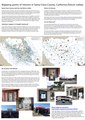 Mapping points of interest in Santa Clara County (Silicon Valley).pdf 4,966 × 7,020; 6.56 MB
