Category:Stadtgarten (concert hall)
Jump to navigation
Jump to search
| Object location | | View all coordinates using: OpenStreetMap |
|---|
concert hall in Cologne  | |||||
| Upload media | |||||
| Instance of | |||||
|---|---|---|---|---|---|
| Location | Neustadt-Nord, Cologne-Innenstadt, Cologne, Cologne Government Region, North Rhine-Westphalia, Germany | ||||
| official website | |||||
 | |||||
Media in category "Stadtgarten (concert hall)"
The following 39 files are in this category, out of 39 total.
-
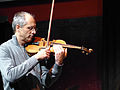
 Angelika Sheridan (120921 Peter-Kowald-Konzert Stadtgarten) P1040778.jpg 1,280 × 960; 972 KB
-

-
 Christoph Irmer M-Sp P1040801.jpg 4,000 × 3,000; 6 MB
-
 Dieter Manderscheid (Peter Kowald-Konzert Stadtgarten 120921) P1040783.jpg 960 × 1,280; 991 KB
-
 Dominik Mahnig (2020) (Annamarie Ursula) P1360717.JPG 4,000 × 3,000; 4.82 MB
-
 Dominik Mahnig (2020) (Annamarie Ursula) P1360719.JPG 4,000 × 3,000; 4.83 MB
-
 Dominik Mahnig (2020) (Annamarie Ursula) P1360723.JPG 1,536 × 2,048; 929 KB
-
 Felix Hauptmann 2019 CCJO (Annamarie Ursula) P1320360.JPG 2,048 × 1,536; 884 KB
-
 Felix Hauptmann 2019 CCJO (Annamarie Ursula) P1320361.JPG 2,048 × 1,536; 984 KB
-
 Jakob Kühnemann (2020) (Annamarie Ursula) P1360709.JPG 3,000 × 4,000; 4.83 MB
-
 Jakob Kühnemann (2020) (Annamarie Ursula) P1360710.JPG 3,000 × 4,000; 4.64 MB
-
 Jan Schneider 2019 (Annamarie Ursula) P1320420.JPG 2,048 × 1,536; 915 KB
-
 John Hollenbeck 2019 (Annamarie Ursula) P1320369.JPG 2,048 × 1,536; 989 KB
-
 John Hollenbeck 2019 (Annamarie Ursula) P1320383.JPG 1,536 × 2,048; 917 KB
-
 John Hollenbeck 2019 (Annamarie Ursula) P1320395.JPG 2,048 × 1,536; 947 KB
-
 John Hollenbeck 2019 (Annamarie Ursula) P1320410.JPG 1,536 × 2,048; 936 KB
-
 John Hollenbeck 2019 (Annamarie Ursula) P1320443.JPG 4,000 × 3,000; 4.71 MB
-
 Konzerthaus Stadtgarten im Stadtgarten Köln-7711.jpg 4,716 × 2,653; 9.29 MB
-
 Konzerthaus Stadtgarten im Stadtgarten Köln-7712.jpg 3,824 × 2,151; 5.19 MB
-
 Laura Totenhagen 2019 (Annamarie Ursula) P1320329.JPG 2,048 × 1,536; 969 KB
-
 Laura Totenhagen 2019 (Annamarie Ursula) P1320330.JPG 2,048 × 1,536; 922 KB
-
 Martin Gasser 2019 CCJO (Annamarie Ursula) P1320400.JPG 2,048 × 1,536; 945 KB
-
 Martin Gasser 2019 CCJO (Annamarie Ursula) P1320402.JPG 2,048 × 1,536; 933 KB
-
 Matthias Knoop 2019 (Annamarie Ursula) P1320404.JPG 2,048 × 1,536; 936 KB
-
 Niels Klein 2019 (Annamarie Ursula) P1320426.JPG 1,536 × 2,048; 966 KB
-
 Niels Klein 2019 CCJO (Annamarie Ursula) P1320441.JPG 3,000 × 4,000; 4.74 MB
-
 Pascal Klewer 2019 (Annamarie Ursula) P1320375.JPG 2,048 × 1,536; 862 KB
-
 Pascal Klewer 2019 (Annamarie Ursula) P1320376.JPG 2,048 × 1,536; 894 KB
-
 Pascal Klewer 2019 (Annamarie Ursula) P1320377.JPG 1,536 × 2,048; 787 KB
-
 Paul Hubweber (120921 Peter Kowald-Konzert Stadtgarten) P1040816.jpg 1,280 × 960; 801 KB
-
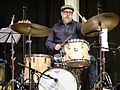
 Paul Lytton (beim Peter Kowald-Konzert 120921 Stadtgarten) P1040787.jpg 1,280 × 960; 1.08 MB
-
 Peter Jacquemyn+Barre Phillips+Carl Ludwig Hübsch (Stadtgarten 120921) P1040866.jpg 960 × 1,280; 1.13 MB
-
 Pinguin Moschner (120921 Peter Kowald Konzert Stadtgarten) P1040814.jpg 1,280 × 960; 1.07 MB
-
 Pinguin Moschner (120921 Peter Kowald-Konzert im Stadtgarten) P1040790.jpg 3,000 × 4,000; 5.72 MB
-
 Stadtgarten WM 2013 1.JPG 5,184 × 3,456; 13.61 MB
-
 Stadtgarten WM 2013 2.jpg 5,184 × 3,456; 15.31 MB
-
 Stadtgarten-Köln-B-Gartenrestaurant-007.JPG 2,048 × 1,536; 1.75 MB
-
 Stadtgarten-Köln-C-Gartenrestaurant-009.JPG 2,048 × 1,536; 1.7 MB
-
 Stadtgarten-Köln-D-Gartenrestaurant-010.JPG 1,536 × 2,048; 1.82 MB
_P1040778.jpg)
_DMR,_Thomas_K%C3%B6lsch_32.jpg)

_P1040783.jpg)
_(Annamarie_Ursula)_P1360717.JPG)
_(Annamarie_Ursula)_P1360719.JPG)
_(Annamarie_Ursula)_P1360723.JPG)
_P1320360.JPG)
_P1320361.JPG)
_(Annamarie_Ursula)_P1360709.JPG)
_(Annamarie_Ursula)_P1360710.JPG)
_P1320420.JPG)
_P1320369.JPG)
_P1320383.JPG)
_P1320395.JPG)
_P1320410.JPG)
_P1320443.JPG)

_P1320329.JPG)
_P1320330.JPG)
_P1320400.JPG)
_P1320402.JPG)
_P1320404.JPG)
_P1320426.JPG)
_P1320441.JPG)
_P1320375.JPG)
_P1320376.JPG)
_P1320377.JPG)
_P1040816.jpg)
_P1040787.jpg)
_P1040866.jpg)
_P1040814.jpg)
_P1040790.jpg)


