Category:Stadspomp Grave
Jump to navigation
Jump to search
| Object location | | View all coordinates using: OpenStreetMap |
|---|
 | |||||
| Upload media | |||||
| Instance of | |||||
|---|---|---|---|---|---|
| Location | Grave, Land van Cuijk, North Brabant, Netherlands | ||||
| Street address |
| ||||
| Heritage designation |
| ||||
 | |||||
|
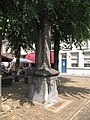
This is a category about rijksmonument number 17289
|
| Address |
|
Media in category "Stadspomp Grave"
The following 5 files are in this category, out of 5 total.
-
 5361 Grave, Netherlands - panoramio (25).jpg 2,048 × 1,148; 599 KB
-
 Grave - Markt - Natuurstenen pomp.jpg 1,944 × 2,592; 1.71 MB
-
 Grave - Waterput op de Markt.jpg 3,000 × 4,000; 3.04 MB
-
 Overzicht Markt - Grave - 20083601 - RCE.jpg 1,200 × 959; 295 KB
-
 T.T Stadspomp Grave.jpg 1,728 × 2,304; 605 KB
.jpg)


