Category:St Werburgh's Church, Hanbury
Jump to navigation
Jump to search
| Object location | | View all coordinates using: OpenStreetMap |
|---|
This is a category about listed building number 1374435. |
church in Hanbury, Staffordshire, UK  | |||||
| Upload media | |||||
| Instance of | |||||
|---|---|---|---|---|---|
| Dedicated to | |||||
| Location | Hanbury, East Staffordshire, Staffordshire, West Midlands, England | ||||
| Diocese | |||||
| Heritage designation |
| ||||
| Religion or worldview | |||||
 | |||||
Media in category "St Werburgh's Church, Hanbury"
The following 10 files are in this category, out of 10 total.
-
 Hanbury Churchyard - geograph.org.uk - 1975259.jpg 1,122 × 1,496; 864 KB
-
 Hanbury Churchyard - geograph.org.uk - 1975269.jpg 1,496 × 1,122; 949 KB
-
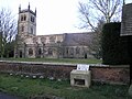
 St Werburgh's Church, Hanbury - geograph.org.uk - 4461520.jpg 640 × 446; 568 KB
-

-

-

-
 St Werburgh's Church, Hanbury, Staffordshire.jpg 640 × 480; 108 KB
-
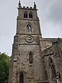
 St Werburgh's Church, Hanbury.jpg 4,284 × 3,190; 5.4 MB
-
 St Werburghs Church.jpg 3,024 × 4,032; 3.43 MB
-
 Village of church and crater - Hanbury, Staffordshire - geograph.org.uk - 3568258.jpg 3,072 × 2,304; 2.46 MB


_-_geograph.org.uk_-_4461534.jpg)


