Category:St Werburgh's Church, Derby
Jump to navigation
Jump to search
| Object location | | View all coordinates using: OpenStreetMap |
|---|
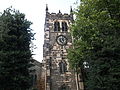
Grade II* listed church in Derby, England  | |||||
| Upload media | |||||
| Instance of | |||||
|---|---|---|---|---|---|
| Dedicated to | |||||
| Location | City of Derby, Derbyshire, East Midlands, England | ||||
| Architect | |||||
| Heritage designation |
| ||||
| Inception |
| ||||
| Date of official closure |
| ||||
| official website | |||||
 | |||||
Media in category "St Werburgh's Church, Derby"
The following 26 files are in this category, out of 26 total.
-
 Derby - panoramio (8).jpg 4,000 × 3,000; 4.69 MB
-
 Saint Werburghs Church, Cheapside, Derby (4346611266).jpg 1,200 × 1,600; 397 KB
-
 Saint Werburghs Church, Cheapside, Derby (4346611272).jpg 1,600 × 1,200; 338 KB
-
 Saint Werburghs Church, Cheapside, Derby (4346611276).jpg 1,600 × 1,200; 208 KB
-
 Saint Werburghs Church, Friar Gate, Derby (4346614858).jpg 1,600 × 1,200; 335 KB
-
 Saint Werburghs Church, Friar Gate, Derby - geograph.org.uk - 1704016.jpg 1,600 × 1,200; 352 KB
-
 St Werburgh's Church - geograph.org.uk - 2355014.jpg 1,280 × 959; 425 KB
-
 St Werburgh's Church, Derby (1).JPG 4,608 × 3,440; 4.36 MB
-
 St Werburgh's Church, Derby (10).JPG 4,608 × 3,440; 4 MB
-
 St Werburgh's Church, Derby (11).JPG 4,608 × 3,440; 4.14 MB
-
 St Werburgh's Church, Derby (12).JPG 4,608 × 3,440; 4.17 MB
-
 St Werburgh's Church, Derby (13).JPG 4,608 × 3,440; 4.11 MB
-
 St Werburgh's Church, Derby (14).JPG 4,608 × 3,440; 4.01 MB
-
 St Werburgh's Church, Derby (15).JPG 4,608 × 3,440; 4.15 MB
-
 St Werburgh's Church, Derby (16).JPG 4,608 × 3,440; 4.05 MB
-
 St Werburgh's Church, Derby (17).JPG 4,608 × 3,440; 3.9 MB
-
 St Werburgh's Church, Derby (2).JPG 4,608 × 3,440; 4.27 MB
-
 St Werburgh's Church, Derby (3).JPG 4,608 × 3,440; 4.06 MB
-
 St Werburgh's Church, Derby (4).JPG 4,608 × 3,440; 4.24 MB
-
 St Werburgh's Church, Derby (5).JPG 4,608 × 3,440; 4.2 MB
-
 St Werburgh's Church, Derby (6).JPG 4,608 × 3,440; 4.11 MB
-
 St Werburgh's Church, Derby (7).JPG 4,608 × 3,440; 3.54 MB
-
 St Werburgh's Church, Derby (8).JPG 4,608 × 3,440; 3.73 MB
-
 St Werburgh's Church, Derby (9).JPG 4,608 × 3,440; 4.03 MB
-
 StWurburghs.jpg 600 × 482; 29 KB
-
 The former St Werburgh's Church - geograph.org.uk - 720733.jpg 640 × 457; 110 KB
.jpg)
.jpg)
.jpg)
.jpg)
.jpg)


.JPG)
.JPG)
.JPG)
.JPG)
.JPG)
.JPG)
.JPG)
.JPG)
.JPG)
.JPG)
.JPG)
.JPG)
.JPG)
.JPG)
.JPG)
.JPG)
.JPG)
