Category:St Thomas, Ashton-in-Makerfield
Jump to navigation
Jump to search
| Object location | | View all coordinates using: OpenStreetMap |
|---|
grade II listed church in Ashton-in-Makerfield, Wigan, Greater Manchester, UK  | |||||
| Upload media | |||||
| Instance of | |||||
|---|---|---|---|---|---|
| Location | Wigan, Greater Manchester, North West England, England | ||||
| Architectural style | |||||
| Diocese | |||||
| Heritage designation |
| ||||
| Inception |
| ||||
| Religion or worldview | |||||
| official website | |||||
 | |||||
Subcategories
This category has the following 4 subcategories, out of 4 total.
C
L
Media in category "St Thomas, Ashton-in-Makerfield"
The following 14 files are in this category, out of 14 total.
-
 Benchmark at St Thomas, Ashton-in-Makerfield.jpg 3,441 × 5,166; 20.85 MB
-
 North door of St Thomas, Ashton-in-Makerfield.jpg 5,073 × 3,387; 20.13 MB
-
 Parish Hall, St Thomas, Ashton-in-Makerfield - geograph.org.uk - 1740815.jpg 2,754 × 1,809; 1.12 MB
-
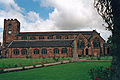
 St Thomas Church, Ashton-in-Makerfield (1).jpg 4,320 × 3,240; 7.61 MB
-

-
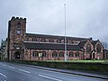
 St Thomas Church, Ashton-in-Makerfield - geograph.org.uk - 606547.jpg 640 × 480; 176 KB
-
 St Thomas Church, Ashton-in-Makerfield - geograph.org.uk - 606559.jpg 592 × 444; 131 KB
-

-
 St Thomas' Church, Ashton-in-Makerfield.jpg 640 × 427; 112 KB
-
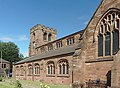
 St Thomas, Ashton-in-Makerfield 1.jpg 5,015 × 2,975; 18.11 MB
-
 St Thomas, Ashton-in-Makerfield 2.jpg 4,707 × 3,442; 21.08 MB
-
 St Thomas, Ashton-in-Makerfield 3.jpg 4,335 × 3,392; 16.64 MB
-
 St Thomas, Ashton-in-Makerfield 4.jpg 4,855 × 3,249; 16.13 MB
-
 The Vicarage, St Thomas, Ashton-in-Makerfield - geograph.org.uk - 1740809.jpg 3,008 × 2,000; 3.24 MB


.jpg)


Categories:
- Grade II listed buildings in Ashton-in-Makerfield
- Churches in Ashton-in-Makerfield
- Churches in the Diocese of Liverpool
- Anglican churches in Greater Manchester
- Grade II listed churches in the Metropolitan Borough of Wigan
- Saint Thomas churches in Greater Manchester
- 1890s churches in Greater Manchester
- Churches in England built in 1893
- Ashton-in-Makerfield Conservation Area