Category:St Oswald's, Horton in Ribblesdale
Jump to navigation
Jump to search
| Object location | | View all coordinates using: OpenStreetMap |
|---|
church in Craven, UK  | |||||
| Upload media | |||||
| Instance of | |||||
|---|---|---|---|---|---|
| Dedicated to | |||||
| Location | Horton in Ribblesdale, Craven, North Yorkshire, Yorkshire and the Humber, England | ||||
| Diocese | |||||
| Heritage designation |
| ||||
| Inception |
| ||||
| Religion or worldview | |||||
 | |||||
Subcategories
This category has the following 2 subcategories, out of 2 total.
Media in category "St Oswald's, Horton in Ribblesdale"
The following 40 files are in this category, out of 40 total.
-
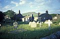 Churchyard, Horton In Ribblesdale.jpg 640 × 422; 81 KB
-
 Graveyard at St. Oswald's Church, Horton in Ribblesdale - geograph.org.uk - 2798469.jpg 1,500 × 1,125; 1.31 MB
-
 Church porch, Horton in Ribblesdale - geograph.org.uk - 275672.jpg 640 × 480; 156 KB
-
 Church, Horton in Ribblesdale - geograph.org.uk - 114049.jpg 1,024 × 683; 134 KB
-

-
 St Oswald Church, Horton in Ribblesdale - geograph.org.uk - 405166.jpg 640 × 480; 220 KB
-
 St Oswald's Tower and Two Benchmarks - geograph.org.uk - 525147.jpg 640 × 480; 205 KB
-
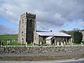
 St Oswalds, Horton in Ribblesdale - geograph.org.uk - 428510.jpg 640 × 480; 126 KB
-
 St Oswalds, Horton in Ribblesdale - geograph.org.uk - 428513.jpg 640 × 480; 171 KB
-

-
 StOswaldsHorton.JPG 1,600 × 1,067; 1.52 MB
-

-

-
 Horton in Ribblesdale - geograph.org.uk - 1384152.jpg 640 × 480; 52 KB
-

-
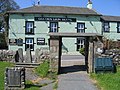 Lychgate and Double Stile at St Oswalds - geograph.org.uk - 428561.jpg 640 × 480; 202 KB
-
 St Oswald's Church - geograph.org.uk - 2307449.jpg 640 × 480; 63 KB
-
 St Oswald's Church - geograph.org.uk - 3122440.jpg 2,048 × 1,536; 483 KB
-
 St Oswald's Church - geograph.org.uk - 3793796.jpg 3,094 × 4,130; 2.82 MB
-
 St Oswald's Church - geograph.org.uk - 4082028.jpg 4,000 × 3,000; 5.02 MB
-
 St Oswald's Church - geograph.org.uk - 5055526.jpg 5,184 × 3,456; 2.05 MB
-
 St Oswald's Church - Horton - geograph.org.uk - 465878.jpg 640 × 424; 42 KB
-
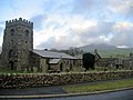
 St Oswald's Church and Pen-y-Ghent - geograph.org.uk - 4735132.jpg 1,024 × 683; 142 KB
-

-

-
 St Oswald's Church, Horton in Ribblesdale with Pen-y-Ghent behind.jpg 4,608 × 3,456; 4.87 MB
-
 St Oswald's Church, Horton in Ribblesdale.jpg 4,608 × 3,456; 4.72 MB
-
-
 St Oswalds Church, Horton-in-Ribblesdale - geograph.org.uk - 3573694.jpg 4,439 × 3,056; 5.87 MB
-
 St Oswalds, Horton in Ribblesdale - geograph.org.uk - 427658.jpg 480 × 640; 162 KB
-
 St. Oswald's Church - geograph.org.uk - 3991803.jpg 1,200 × 1,600; 587 KB
-
 St. Oswald's Church - geograph.org.uk - 4082030.jpg 4,000 × 3,000; 5.56 MB
-
 St. Oswald's Church - geograph.org.uk - 4281218.jpg 427 × 640; 587 KB
-
 St. Oswald's Church lych gate - geograph.org.uk - 1438443.jpg 640 × 427; 69 KB
-

-
 St. Oswald's Church, Horton-in-Ribblesdale - geograph.org.uk - 3343610.jpg 4,320 × 3,240; 3.49 MB
-
 St. Oswald's in Horton - geograph.org.uk - 4082034.jpg 4,000 × 3,000; 4.91 MB
-
 St.Oswald's Church - geograph.org.uk - 5238500.jpg 3,099 × 2,055; 1.58 MB
-
 The B6479 at Horton in Ribblesdale - geograph.org.uk - 968714.jpg 640 × 480; 133 KB
-
 Welcome to Horton in Ribblesdale - geograph.org.uk - 709366.jpg 640 × 480; 181 KB


