Category:St Martin-in-Meneage
Jump to navigation
Jump to search
village in Cornwall, England, UK  | |||||
| Upload media | |||||
| Instance of | |||||
|---|---|---|---|---|---|
| Location | Cornwall, South West England, England | ||||
 | |||||
English: St Martin-in-Meneage is a village and civil parish in the Lizard Peninsula of Cornwall, United Kingdom south of the Helford River. The village is five miles (8 km) south-southeast of Helston.
Subcategories
This category has the following 4 subcategories, out of 4 total.
Media in category "St Martin-in-Meneage"
The following 72 files are in this category, out of 72 total.
-
 'Arthur ' at the Goonhilly Earth Station 1972 - geograph.org.uk - 2273509.jpg 2,592 × 1,680; 1.52 MB
-
 Alongside Mawgan Creek - geograph.org.uk - 5643021.jpg 1,000 × 662; 716 KB
-
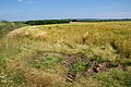 Barley field near Newtown-in-St Martin - geograph.org.uk - 4078312.jpg 3,872 × 2,592; 6.44 MB
-
 Bridge over stream - geograph.org.uk - 5642982.jpg 1,000 × 662; 1.05 MB
-
 Bus stop on the B3293 - geograph.org.uk - 5468247.jpg 640 × 480; 48 KB
-
 Cows and a bull resting near Tretharrup - geograph.org.uk - 4078288.jpg 3,872 × 2,592; 2.32 MB
-

-
 Down to Mawgan Creek - geograph.org.uk - 5643007.jpg 1,000 × 662; 767 KB
-
 Down to Mawgan Creek - geograph.org.uk - 5643009.jpg 1,000 × 662; 777 KB
-
 Down to the Helford River - geograph.org.uk - 5643001.jpg 1,000 × 662; 539 KB
-
 Dry Tree menhir - geograph.org.uk - 6132768.jpg 680 × 1,024; 252 KB
-
 Dry Tree menhir - geograph.org.uk - 6132770.jpg 680 × 1,024; 234 KB
-
 Fallen oak tree in Frenchman's Pill - geograph.org.uk - 3552088.jpg 2,346 × 3,128; 2.64 MB
-
 Farmland on the South shore of the Helford River - geograph.org.uk - 4980911.jpg 3,648 × 2,048; 1.71 MB
-
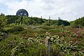 Fencing and wild growth by Goonhilly Earth Station - geograph.org.uk - 4076799.jpg 3,872 × 2,592; 5.68 MB
-
 Ford at Carnbarges - geograph.org.uk - 3213527.jpg 2,634 × 1,781; 858 KB
-
 Ford at Tregidden - geograph.org.uk - 369165.jpg 640 × 480; 141 KB
-
 Ford at Tregidden - geograph.org.uk - 4684134.jpg 6,000 × 4,000; 6.58 MB
-
 Forestry operations at Gear - geograph.org.uk - 3213671.jpg 3,035 × 1,781; 1.55 MB
-
 Frenchman's Creek at high tide - geograph.org.uk - 3553445.jpg 2,346 × 3,128; 1.74 MB
-
 Frenchman's Pill or Creek at low tide - geograph.org.uk - 3552084.jpg 3,648 × 2,736; 4.04 MB
-
 Gear Hill - geograph.org.uk - 5642989.jpg 1,000 × 662; 795 KB
-
 Gear Hill - geograph.org.uk - 5642995.jpg 1,000 × 662; 1.03 MB
-
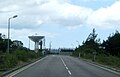
 Goonhilly Earth Station - geograph.org.uk - 5469583.jpg 1,352 × 1,016; 379 KB
-
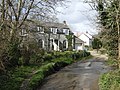
 Halanoweth Farm - geograph.org.uk - 5643010.jpg 1,000 × 662; 705 KB
-
 Hedge-lined road to the north of Sworn - geograph.org.uk - 5388268.jpg 4,000 × 3,000; 4.03 MB
-
 Helford River - geograph.org.uk - 740013.jpg 640 × 480; 131 KB
-
 Helford River - geograph.org.uk - 740047.jpg 640 × 480; 103 KB
-

-
 Looking downstream from Tremayne Quay.jpg 3,024 × 4,032; 3.56 MB
-
 Maize field near Newtown-in-St Martin - geograph.org.uk - 4078304.jpg 3,872 × 2,592; 2.12 MB
-
 Maize field near Newtown-in-St Martin - geograph.org.uk - 4078307.jpg 3,872 × 2,592; 2.68 MB
-
 Mawgan Creek - geograph.org.uk - 5643013.jpg 1,000 × 662; 668 KB
-
 Mawgan Creek - geograph.org.uk - 5643014.jpg 1,000 × 662; 585 KB
-
 Mawgan, Trelowarren Quay - geograph.org.uk - 5723491.jpg 1,600 × 1,073; 738 KB
-
 Merthen Woods from Tremayne Quay - geograph.org.uk - 746554.jpg 640 × 480; 75 KB
-

-

-
 Muddy field entrance - geograph.org.uk - 4078280.jpg 3,872 × 2,592; 5.14 MB
-

-

-
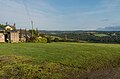
 Pasture south of Withan - geograph.org.uk - 3213537.jpg 3,648 × 2,048; 1.2 MB
-
 Pasture southeast of Bunnell Farm - geograph.org.uk - 3213654.jpg 3,648 × 2,048; 997 KB
-
 Road looking towards Tretharrup - geograph.org.uk - 5388258.jpg 4,000 × 3,000; 3.37 MB
-
 Road near Trelaminney - geograph.org.uk - 5388255.jpg 4,000 × 3,000; 3.73 MB
-
-
 Road to Tregevis Farm - geograph.org.uk - 5388266.jpg 4,000 × 3,000; 3.35 MB
-
 Sailing boat moored at Tremayne Quay - geograph.org.uk - 4679200.jpg 453 × 640; 81 KB
-

-

-
 Snags-fallen oak tree in Frenchman's Creek - geograph.org.uk - 3553435.jpg 3,648 × 2,736; 2.67 MB
-
-
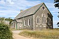
 St Martin in Meneage Methodist Church - geograph.org.uk - 4534610.jpg 2,560 × 1,920; 2.72 MB
-
 St. Martin's Primary School - geograph.org.uk - 418363.jpg 640 × 480; 70 KB
-
 Sworne Farm Trig Point - geograph.org.uk - 4534596.jpg 2,560 × 1,920; 2.98 MB
-
 The entrance to Frenchman's Creek from the Helford River - geograph.org.uk - 4980785.jpg 3,648 × 2,048; 2.03 MB
-
 The lane at Tretharrup - geograph.org.uk - 4078300.jpg 3,872 × 2,592; 2.03 MB
-
 The Old Quay at the entrance to Frenchman's Creek - geograph.org.uk - 4980790.jpg 3,648 × 2,048; 2.82 MB
-
 The Old Quay at the Western edge of Frenchman's Creek - geograph.org.uk - 4980787.jpg 3,648 × 2,048; 2.29 MB
-
 The upper reaches of Frenchman's Creek at high tide - geograph.org.uk - 3553431.jpg 3,648 × 2,736; 4.11 MB
-
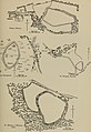 The Victoria history of the county of Cornwall (1906) (14591330017).jpg 2,674 × 3,890; 852 KB
-
 Track to north drive to Trelowarren - geograph.org.uk - 5642987.jpg 662 × 1,000; 934 KB
-
 Track to Tregevis Farm - geograph.org.uk - 5388264.jpg 4,000 × 3,000; 2.88 MB
-
 Tremayne boathouse on the South Bank of the Helford River - geograph.org.uk - 4980748.jpg 3,648 × 2,048; 2.64 MB
-
 Tremayne Quay on the Helford River - geograph.org.uk - 746547.jpg 640 × 480; 77 KB
-
 Tremayne Quay on the south bank of the Helford River.jpg 3,024 × 4,032; 4.49 MB
-
 Tremayne quay on the Trelowarren estate - geograph.org.uk - 4980759.jpg 3,648 × 2,048; 2.29 MB
-
 Tremayne Quay, Helford River, Cornwall.jpg 3,024 × 4,032; 4.04 MB
-
 Tributary of Tremayne Creek - geograph.org.uk - 3213633.jpg 2,048 × 3,648; 2.22 MB
-
 Unnamed lane crosses Ford's Hill - geograph.org.uk - 3213549.jpg 3,648 × 2,048; 1.17 MB
-
 Unnamed lane junction with Gear Hill - geograph.org.uk - 3213677.jpg 3,427 × 1,922; 1.42 MB
-
 View from Goonhilly Down Triangulation Pillar - geograph.org.uk - 5388063.jpg 4,000 × 3,000; 4.72 MB


_(14591330017).jpg)


