Category:St John, Cornwall
Jump to navigation
Jump to search
village and civil parish in south east Cornwall, England in the United Kingdom  | |||||
| Upload media | |||||
| Instance of | |||||
|---|---|---|---|---|---|
| Location | Cornwall, South West England, England | ||||
 | |||||
English: St John is a coastal civil parish and a village in south-east Cornwall, United Kingdom three miles (5 km) south of Saltash.
Subcategories
This category has the following 5 subcategories, out of 5 total.
F
- Freathy Cliff (4 F)
G
- Gooseford Lane Tidal Ford (7 F)
S
- St John's Church, St John (1 F)
T
- Tregonhawke Cliff (17 F)
Media in category "St John, Cornwall"
The following 79 files are in this category, out of 79 total.
-

-
 Approaching Treninnow and Wiggle chalets - geograph.org.uk - 2634929.jpg 640 × 442; 102 KB
-
 Beach below Freathy (0030).jpg 4,288 × 2,848; 5.33 MB
-
 Beach below Withnoe Common - geograph.org.uk - 2634625.jpg 640 × 436; 71 KB
-
 Benskin's Wood - geograph.org.uk - 372991.jpg 640 × 480; 178 KB
-

-
 Bus shelter at Freathy - geograph.org.uk - 2297883.jpg 640 × 480; 86 KB
-
 Car park near Freathy - geograph.org.uk - 2634603.jpg 640 × 443; 95 KB
-
 Cattle near Tregonhawke - geograph.org.uk - 2369257.jpg 1,024 × 768; 216 KB
-
 Chalets at Freathy on the Military Road - geograph.org.uk - 2367491.jpg 1,024 × 768; 223 KB
-
 Church Lane, St John - geograph.org.uk - 6153112.jpg 4,288 × 2,848; 2.05 MB
-
 Church Lane, St John - geograph.org.uk - 6153208.jpg 2,788 × 3,863; 1.84 MB
-
 Church Lane, St John - geograph.org.uk - 6153216.jpg 4,288 × 2,848; 2.47 MB
-
 Cliff top chalets at Freathy - geograph.org.uk - 2298057.jpg 640 × 480; 93 KB
-
 Coast at Freathy - geograph.org.uk - 2367476.jpg 1,024 × 768; 254 KB
-
 Coast path at Freathy - geograph.org.uk - 2634548.jpg 640 × 480; 101 KB
-
 Coast road near Withnoe - geograph.org.uk - 2634631.jpg 640 × 436; 79 KB
-
 Cornwall , Farm Track - geograph.org.uk - 4426298.jpg 4,288 × 2,848; 5.36 MB
-
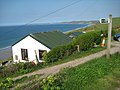
 Cottage, St John - geograph.org.uk - 6153330.jpg 3,352 × 2,336; 1.03 MB
-
 Cottage, St John - geograph.org.uk - 6153466.jpg 2,811 × 4,082; 1.02 MB
-
 Cottage, St John - geograph.org.uk - 6153477.jpg 2,848 × 4,288; 1.65 MB
-
 Donkey Lane - geograph.org.uk - 2634792.jpg 640 × 460; 69 KB
-
 Down to the beach - geograph.org.uk - 5768401.jpg 2,048 × 1,536; 1.15 MB
-
 Down to the Village - geograph.org.uk - 5764665.jpg 2,048 × 1,536; 1 MB
-
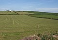
 Farmland at Freathy - geograph.org.uk - 2367497.jpg 1,024 × 768; 250 KB
-
 Farmland at Freathy - geograph.org.uk - 2634590.jpg 640 × 439; 64 KB
-
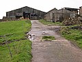 Farmyard off Withnoe Lane - geograph.org.uk - 371229.jpg 640 × 480; 107 KB
-
 Freathy - geograph.org.uk - 2367470.jpg 1,024 × 768; 213 KB
-
 Freathy cliff top chalets - geograph.org.uk - 5768355.jpg 2,048 × 1,536; 1.14 MB
-
 Gates near Tregonhawke - geograph.org.uk - 2634686.jpg 640 × 433; 109 KB
-
 Graveyard, St John - geograph.org.uk - 6153259.jpg 2,848 × 4,288; 2.39 MB
-
 Graveyard, St John - geograph.org.uk - 6153289.jpg 4,243 × 2,635; 2.14 MB
-
 Houses at Freathy (0029).jpg 4,288 × 2,848; 6.91 MB
-
 Houses at Freathy (0036).jpg 4,288 × 2,848; 6.24 MB
-
 Jack's Lane, St John - geograph.org.uk - 6153303.jpg 3,887 × 2,206; 1.3 MB
-
 Jack's Lane, St John - geograph.org.uk - 6153312.jpg 2,713 × 3,429; 1.71 MB
-
 Lane, St John - geograph.org.uk - 6153471.jpg 3,848 × 2,580; 1.42 MB
-
 Lane, St John - geograph.org.uk - 6153475.jpg 4,109 × 2,774; 1.75 MB
-
 Little Egret and seagull in flight - geograph.org.uk - 3832040.jpg 1,008 × 1,000; 898 KB
-
 Military Road near Treathy - geograph.org.uk - 2369254.jpg 1,024 × 768; 240 KB
-
 Ninney Rocks (1) - geograph.org.uk - 529712.jpg 640 × 480; 237 KB
-
 Ninney Rocks (2) - geograph.org.uk - 529723.jpg 640 × 480; 157 KB
-
 Old Milestone - geograph.org.uk - 371234.jpg 640 × 480; 186 KB
-

-
 Old military building - geograph.org.uk - 5769084.jpg 2,048 × 1,536; 874 KB
-
 On the beach at Tregonhawke - geograph.org.uk - 5183949.jpg 1,469 × 1,102; 550 KB
-
 Pathway down to the beach - geograph.org.uk - 5183944.jpg 1,469 × 1,102; 597 KB
-
 Portwrinkle from Freathy (0032).jpg 4,288 × 2,848; 4.65 MB
-
 Rame Head at Freathy (0035).jpg 4,288 × 2,848; 5.48 MB
-
 Rame Head from Freathy (0031).jpg 4,288 × 2,848; 5.1 MB
-
 Rame Head from Freathy beach - geograph.org.uk - 359448.jpg 640 × 480; 47 KB
-
 Road through Freathy - geograph.org.uk - 2634615.jpg 640 × 465; 84 KB
-
 Saturated^ - geograph.org.uk - 371222.jpg 640 × 480; 107 KB
-
 Sheep on hill - geograph.org.uk - 5764662.jpg 2,048 × 1,536; 1.1 MB
-
 Signpost, St John - geograph.org.uk - 6152996.jpg 4,275 × 2,685; 2.18 MB
-
 St John - geograph.org.uk - 372943.jpg 640 × 480; 121 KB
-
 St John - geograph.org.uk - 6153481.jpg 3,723 × 2,547; 1.08 MB
-
 St John Inn - geograph.org.uk - 6153484.jpg 4,282 × 2,616; 1.58 MB
-
 St John's church, St John - geograph.org.uk - 6152949.jpg 3,581 × 2,395; 1.5 MB
-
 St John's church, St John - geograph.org.uk - 6152953.jpg 4,171 × 2,752; 1.6 MB
-
 St John's church, St John - geograph.org.uk - 6152973.jpg 3,793 × 2,667; 1.45 MB
-
 St John's church, St John - geograph.org.uk - 6153241.jpg 2,696 × 3,654; 2.29 MB
-
 St Johns Church - geograph.org.uk - 5764740.jpg 2,048 × 1,536; 1.33 MB
-

-
 Stream, St John - geograph.org.uk - 6153124.jpg 2,848 × 4,288; 3.32 MB
-
 Stream, St John - geograph.org.uk - 6153199.jpg 4,288 × 2,848; 2.46 MB
-
 Sunwell Lane, St John - geograph.org.uk - 6153005.jpg 2,769 × 3,693; 1.47 MB
-
 The coastal road at Freathy - geograph.org.uk - 2298082.jpg 640 × 480; 80 KB
-

-
 The Road outside the Church in St John - geograph.org.uk - 372960.jpg 640 × 480; 117 KB
-
 Tidal Creek and Saltmarsh, St John's Lake - geograph.org.uk - 372998.jpg 640 × 480; 100 KB
-
 Treninnow Farm - geograph.org.uk - 5768323.jpg 2,048 × 1,536; 1.09 MB
-
 Trough, St John - geograph.org.uk - 6153464.jpg 4,112 × 2,801; 2.13 MB
-
 Valley at Freathy - geograph.org.uk - 2634528.jpg 640 × 454; 95 KB
-
 View over St John Village - geograph.org.uk - 372942.jpg 640 × 480; 105 KB
-
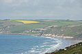
 View to Rame Head - geograph.org.uk - 2369256.jpg 1,024 × 768; 234 KB
-
 Whitesand Beach towards Ninney Rock - geograph.org.uk - 5183950.jpg 1,632 × 1,224; 427 KB
-
 Whitsand Bay - geograph.org.uk - 2634620.jpg 640 × 480; 69 KB
-
 Withnoe Barton - geograph.org.uk - 2634600.jpg 640 × 336; 44 KB


.jpg)


.jpg)
.jpg)


_-_geograph.org.uk_-_529712.jpg)
_-_geograph.org.uk_-_529723.jpg)


.jpg)
.jpg)
.jpg)


