Category:St Edmund of Canterbury parish centre, Waterloo
Jump to navigation
Jump to search
| Object location | | View all coordinates using: OpenStreetMap |
|---|
The parish centre is housed in the Grade II listed conservatory attached to the manse.
Media in category "St Edmund of Canterbury parish centre, Waterloo"
The following 3 files are in this category, out of 3 total.
-
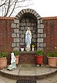 Shrine at St Edmund of Canterbury, Waterloo.jpg 3,218 × 4,672; 18.42 MB
-
 St Edmund of Canterbury parish centre, Waterloo 1.jpg 4,880 × 3,258; 19.08 MB
-
 St Edmund of Canterbury parish centre, Waterloo 2.jpg 5,154 × 3,268; 19.53 MB


