Category:St Edmund's Church, Allestree
Jump to navigation
Jump to search
| Object location | | View all coordinates using: OpenStreetMap |
|---|
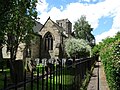
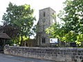
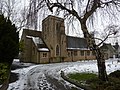
church in Allestree, Derbyshire, United Kingdom  | |||||
| Upload media | |||||
| Instance of | |||||
|---|---|---|---|---|---|
| Dedicated to | |||||
| Location | Allestree, Derby, City of Derby, Derbyshire, East Midlands, England | ||||
| Diocese | |||||
| Heritage designation |
| ||||
| Religion or worldview | |||||
 | |||||
Media in category "St Edmund's Church, Allestree"
The following 8 files are in this category, out of 8 total.
-
 St.Edmunds.Church.JPG 1,704 × 2,272; 972 KB
-
 Allestree Church Walk 5035633.jpg 1,280 × 960; 527 KB
-
 Saint Edmunds church (geograph 4883203).jpg 640 × 480; 53 KB
-
 St Edmund Allestree Geograph-3578092-by-Alex-McGregor.jpg 640 × 480; 114 KB
-
 St Edmund King ^ Martyr, Allestree - geograph.org.uk - 3253095.jpg 1,067 × 1,600; 340 KB
-
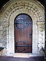 St Edmund's Church door - geograph.org.uk - 3578095.jpg 480 × 640; 87 KB
-
 St Edmunds Church, Allenton (geograph 3645033).jpg 1,280 × 960; 254 KB
-
 St. Edmund Church, Sinfin Avenue, Derby - geograph.org.uk - 2794712.jpg 3,648 × 2,736; 5.98 MB


.jpg)


.jpg)
