Category:St Buryan, Lamorna and Paul
Jump to navigation
Jump to search
English: St Buryan, Lamorna and Paul is a civil parish in the Cornwall district, in the ceremonial county of Cornwall, England.
civil parish in Cornwall, England | |||||
| Upload media | |||||
| Instance of | |||||
|---|---|---|---|---|---|
| Location | Cornwall, South West England, England | ||||
 | |||||
Subcategories
This category has the following 4 subcategories, out of 4 total.
Media in category "St Buryan, Lamorna and Paul"
The following 200 files are in this category, out of 322 total.
(previous page) (next page)-
 "Megalithic structure" at Treave - geograph.org.uk - 5504587.jpg 4,896 × 3,672; 7 MB
-
 5 Miles to Penzance - geograph.org.uk - 5464235.jpg 480 × 640; 119 KB
-
 A delight of flowers on the bridle way - geograph.org.uk - 5092239.jpg 2,592 × 1,944; 2.34 MB
-
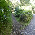
 A junction in the bridle way - geograph.org.uk - 5092234.jpg 2,592 × 1,944; 2.73 MB
-
 A new bridle path has been created - geograph.org.uk - 4736962.jpg 4,896 × 3,672; 6.81 MB
-
 A30 heading north east through woodland - geograph.org.uk - 5464327.jpg 640 × 480; 133 KB
-
 A30 towards Penzance - geograph.org.uk - 5464245.jpg 640 × 480; 73 KB
-
 A30 towards Penzance - geograph.org.uk - 5464251.jpg 640 × 480; 60 KB
-
 A30 towards Penzance - geograph.org.uk - 5464329.jpg 640 × 480; 103 KB
-
 A30, Treave - geograph.org.uk - 5464203.jpg 640 × 480; 54 KB
-
 Access to Higher Alsia Farm - geograph.org.uk - 3634820.jpg 640 × 427; 123 KB
-
 All quiet in April - geograph.org.uk - 6140133.jpg 1,024 × 768; 262 KB
-
 Along the lane towards Alsia Mill - geograph.org.uk - 4785361.jpg 1,142 × 857; 425 KB
-
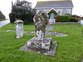
 Ancient Cross And Guidestone - geograph.org.uk - 4488911.jpg 2,443 × 1,734; 1.54 MB
-
 Ancient field boundary at No Man's Land - geograph.org.uk - 4791142.jpg 1,142 × 857; 343 KB
-
 Approaching Sparnon on B3283 - geograph.org.uk - 5986262.jpg 4,000 × 3,000; 4.44 MB
-
 B3283 towards Lands End - geograph.org.uk - 5463816.jpg 640 × 480; 43 KB
-
 B3315 toward Treen - geograph.org.uk - 5463765.jpg 640 × 480; 73 KB
-
 B3315 toward Treen - geograph.org.uk - 5463769.jpg 640 × 480; 74 KB
-
 Bellowal Farm - geograph.org.uk - 5009018.jpg 4,608 × 3,456; 5.8 MB
-
 Boscawen Point - geograph.org.uk - 3668204.jpg 640 × 427; 150 KB
-
 Boscawen-un circle in the mist - geograph.org.uk - 3721077.jpg 1,224 × 918; 620 KB
-
 Boscawen-un Stone Circle - geograph.org.uk - 5157156.jpg 1,024 × 485; 172 KB
-
 Boskenna Cross and lay-by - geograph.org.uk - 6121959.jpg 1,600 × 1,200; 268 KB
-
 Boskenna Cross and layby - geograph.org.uk - 5503480.jpg 4,896 × 3,672; 6.59 MB
-
 Boskenna Cross St Buryan Junction - geograph.org.uk - 6203756.jpg 640 × 385; 61 KB
-
 Bridle path junction near Chyenhâl Moor - geograph.org.uk - 5093342.jpg 2,592 × 1,944; 1.62 MB
-
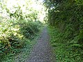
 Bridle path near Kerrisvean - geograph.org.uk - 5093333.jpg 2,592 × 1,944; 1.34 MB
-
 Bridle path near Lamorna - geograph.org.uk - 5502796.jpg 3,587 × 3,577; 4.14 MB
-
 Bridle path near Lamorna - geograph.org.uk - 5502801.jpg 4,896 × 3,672; 6.97 MB
-
 Buildings at Tregadgwith - geograph.org.uk - 5502492.jpg 4,896 × 3,672; 6.52 MB
-
 Buildings at Tregadgwith - geograph.org.uk - 5502493.jpg 1,600 × 1,200; 415 KB
-
 Bungalow near Boskenna - geograph.org.uk - 5503508.jpg 4,896 × 3,672; 6.95 MB
-
 Bunker's Hill Farm - geograph.org.uk - 5597733.jpg 1,024 × 768; 243 KB
-
 Bunker's Hill Farm from No Man's Land - geograph.org.uk - 4791131.jpg 1,306 × 979; 426 KB
-
 Carn Watch - geograph.org.uk - 5168870.jpg 1,024 × 768; 202 KB
-
 Cattle Farming near Bellowal Farm - geograph.org.uk - 5009023.jpg 4,608 × 3,456; 6.69 MB
-
 Cattle grazing, Trevedra Common - geograph.org.uk - 5464195.jpg 640 × 480; 60 KB
-
 Caves at Merthen Point - geograph.org.uk - 3668227.jpg 640 × 421; 117 KB
-
 Celtic cross and milestone at Crows-an-wra - geograph.org.uk - 5597606.jpg 1,024 × 768; 302 KB
-
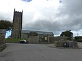
 Celtic cross and St Buryan church - geograph.org.uk - 5597701.jpg 768 × 1,024; 203 KB
-
 Celtic cross and St Buryan church - geograph.org.uk - 5986241.jpg 4,000 × 3,000; 4.58 MB
-
 Celtic cross at Trevorgans Cross - geograph.org.uk - 5597721.jpg 1,024 × 683; 294 KB
-
 Celtic cross in St Buryan churchyard - geograph.org.uk - 5986244.jpg 4,000 × 3,000; 4.84 MB
-
 Cereal crop, St Buryan - geograph.org.uk - 5463814.jpg 640 × 480; 47 KB
-
 Churchyard Cross, St Buryan - geograph.org.uk - 5120401.jpg 1,600 × 1,200; 506 KB
-
 Chyenhal Moor - geograph.org.uk - 4488122.jpg 2,560 × 1,920; 2.53 MB
-
 Coastal Path near St Loy's Cove - geograph.org.uk - 3674680.jpg 853 × 1,280; 1.96 MB
-
 Cottage on the A30, Crows-an-wra - geograph.org.uk - 5465352.jpg 2,808 × 1,790; 1.01 MB
-
 Cottages near Bosanketh Farm - geograph.org.uk - 5463840.jpg 640 × 480; 62 KB
-

-
 Cottages on the A30, Crows-an-wra - geograph.org.uk - 5464216.jpg 640 × 480; 63 KB
-
 Cottages, St Buryan - geograph.org.uk - 5463802.jpg 640 × 480; 72 KB
-
 Crean lane junction - geograph.org.uk - 4784386.jpg 1,469 × 1,102; 532 KB
-
 Cross and milestone, Crows-an-wra - geograph.org.uk - 5464214.jpg 640 × 480; 69 KB
-
 Cross at Trevorgans Cross - geograph.org.uk - 5597725.jpg 1,024 × 683; 229 KB
-
 Daffodil Crop near Alsia Farm - geograph.org.uk - 4981960.jpg 4,608 × 3,456; 6.38 MB
-
 Daffodil Crop near Chycandra - geograph.org.uk - 5008427.jpg 4,608 × 3,456; 5.92 MB
-
 Daffodils at Alsia Mill - geograph.org.uk - 4784391.jpg 1,306 × 979; 448 KB
-
 Dilapilapidated barn in St Buryan - geograph.org.uk - 5597703.jpg 1,024 × 683; 184 KB
-
 Disused China Clay Works, Tredinney Common - geograph.org.uk - 5120407.jpg 1,600 × 1,200; 629 KB
-
 Driveways to properties off the main road - geograph.org.uk - 5832549.jpg 1,024 × 768; 251 KB
-
 Dwellings near the main road - geograph.org.uk - 3641277.jpg 640 × 427; 86 KB
-
 Elizabeth II postbox on Lands End Road, St Buryan - geograph.org.uk - 5465372.jpg 2,848 × 2,136; 1.46 MB
-
 Entering St Buryan - geograph.org.uk - 5463796.jpg 640 × 480; 52 KB
-
 Entering St Buryan from the south-east - geograph.org.uk - 4785383.jpg 1,469 × 1,102; 560 KB
-
 Fancy some "Melt in the mouth" beef^ - geograph.org.uk - 4741262.jpg 1,600 × 1,200; 397 KB
-
 Farm buildings and conversions at Tregadgwith - geograph.org.uk - 4788657.jpg 1,469 × 1,102; 541 KB
-
 Farm House near Kerris - geograph.org.uk - 5008613.jpg 4,608 × 3,456; 5.77 MB
-
 Farm Track near Chycandra - geograph.org.uk - 5008278.jpg 4,608 × 3,456; 6.17 MB
-
 Farm track near Westmoor - geograph.org.uk - 5463817.jpg 640 × 480; 46 KB
-
 Farmland near Tredinney - geograph.org.uk - 5597574.jpg 1,024 × 768; 230 KB
-
 Farmland towards Bosanketh Farm - geograph.org.uk - 5463846.jpg 640 × 480; 76 KB
-

-

-
 Field entrance near Tregadgwith - geograph.org.uk - 5463775.jpg 640 × 480; 51 KB
-
 Field entrance near Tregadgwith - geograph.org.uk - 5463781.jpg 640 × 480; 56 KB
-

-
 Field entrance off the B3315 - geograph.org.uk - 5463768.jpg 640 × 480; 68 KB
-
 Field near Boskenna Nurseries - geograph.org.uk - 5503499.jpg 4,896 × 3,672; 6.79 MB
-
 Field near Higher Kerris Farm - geograph.org.uk - 5008606.jpg 4,608 × 3,456; 5.91 MB
-
 Field near Pendrea - geograph.org.uk - 4784381.jpg 1,469 × 1,102; 621 KB
-
 Field off the A30 - geograph.org.uk - 5464232.jpg 640 × 480; 65 KB
-
 Field, horses and stables at Lower Treave - geograph.org.uk - 5503519.jpg 4,896 × 3,672; 7.07 MB
-
 Fields near Bellowl Farm - geograph.org.uk - 5009014.jpg 4,608 × 3,456; 6.22 MB
-
 First and Last Coaches - geograph.org.uk - 4785368.jpg 1,469 × 1,102; 552 KB
-
 Flotsam on the beach at St Loy's Cove - geograph.org.uk - 4460676.jpg 640 × 480; 111 KB
-
 Footpath close to St. Buryan - geograph.org.uk - 5000351.jpg 4,608 × 3,456; 5.82 MB
-
 Former shop, St Buryan - geograph.org.uk - 5463799.jpg 640 × 480; 57 KB
-
 Gorse and heather on Tredinney Common - geograph.org.uk - 3652484.jpg 640 × 427; 113 KB
-

-
 Grassland near Bosanketh Farm - geograph.org.uk - 5463844.jpg 640 × 480; 64 KB
-
 Grassland off the A30 - geograph.org.uk - 5464248.jpg 640 × 480; 53 KB
-
 Grassland, Alsia - geograph.org.uk - 5463825.jpg 640 × 480; 66 KB
-
 Grazing near Bellowal - geograph.org.uk - 5463771.jpg 640 × 480; 51 KB
-
 Grazing near Crows-an-wra - geograph.org.uk - 5464207.jpg 640 × 480; 57 KB
-
 Grazing near Penmennor Farm - geograph.org.uk - 5463779.jpg 640 × 480; 55 KB
-
 Grazing near St Buryan - geograph.org.uk - 5463787.jpg 640 × 480; 58 KB
-
 Harvested field of maize - geograph.org.uk - 5597727.jpg 1,024 × 683; 247 KB
-
 Harvesting new potato crop - geograph.org.uk - 5463822.jpg 640 × 491; 65 KB
-
 Heading east from Crows-an-wra - geograph.org.uk - 5464218.jpg 640 × 480; 48 KB
-
 Heading east on the A30 - geograph.org.uk - 5464239.jpg 640 × 480; 53 KB
-
 Heading towards St Buryan - geograph.org.uk - 4788708.jpg 1,142 × 857; 336 KB
-
 Heading west towards St Buryan - geograph.org.uk - 5463776.jpg 640 × 480; 66 KB
-
 House, Newshop - geograph.org.uk - 5464200.jpg 640 × 480; 59 KB
-
 If druids caught buses - geograph.org.uk - 6123303.jpg 1,024 × 768; 119 KB
-
 Information panel at Tregiffian Burial Chamber - geograph.org.uk - 5502851.jpg 2,406 × 1,676; 1.08 MB
-
 Kestrel on the Penberth cliffs - geograph.org.uk - 4626520.jpg 4,896 × 3,672; 7.1 MB
-
 Lamorna Cove - geograph.org.uk - 4401002.jpg 1,795 × 1,024; 782 KB
-
 Lamorna Cove - geograph.org.uk - 5168885.jpg 1,024 × 768; 208 KB
-
 Lamorna Cove - geograph.org.uk - 5434529.jpg 640 × 480; 96 KB
-
 Lamorna Cove - geograph.org.uk - 6268933.jpg 1,024 × 768; 780 KB
-
 Lamorna Cove from the east - geograph.org.uk - 4401011.jpg 1,795 × 1,024; 817 KB
-
 Lamorna Cove Harbour - geograph.org.uk - 5009835.jpg 4,608 × 3,456; 6.51 MB
-
 Lamorna Cove looking landwards from Quay - geograph.org.uk - 4401007.jpg 1,795 × 1,024; 744 KB
-
 Lamorna Ford - geograph.org.uk - 4682723.jpg 6,000 × 4,000; 6.53 MB
-
 Lamorna Glamping site - geograph.org.uk - 5502815.jpg 4,896 × 3,672; 6.95 MB
-
 Lamorna Pottery surrounded by greenery - geograph.org.uk - 5502787.jpg 4,896 × 3,672; 6.77 MB
-
 Lamorna Quay - geograph.org.uk - 4400996.jpg 1,795 × 1,024; 689 KB
-
 Lamorna Wink - geograph.org.uk - 5169812.jpg 767 × 1,024; 273 KB
-
 Lamorna Wink - geograph.org.uk - 5444249.jpg 6,017 × 3,305; 5.89 MB
-
 Lamorna Wink, Lamorna Cove - geograph.org.uk - 5434518.jpg 427 × 640; 89 KB
-
 Lamorna Wink, Lamorna Cove - geograph.org.uk - 5434523.jpg 474 × 640; 87 KB
-
 Lane to Boscarne Farm - geograph.org.uk - 3641296.jpg 640 × 427; 117 KB
-
 Lane to Rospannel - geograph.org.uk - 3641267.jpg 640 × 427; 117 KB
-
 Lane to Trevore Farm - geograph.org.uk - 3641291.jpg 640 × 368; 74 KB
-
 Lane, Tregadgwith - geograph.org.uk - 5463783.jpg 640 × 480; 49 KB
-
 Le Scathe Cove - geograph.org.uk - 4626515.jpg 4,896 × 3,672; 6.98 MB
-
 Looking back to the Penberth beach - geograph.org.uk - 4626510.jpg 4,896 × 3,672; 6.83 MB
-
 Looking south west from Creeg Tol - geograph.org.uk - 3721069.jpg 1,224 × 918; 671 KB
-
 Looking towards Pridden - geograph.org.uk - 6245114.jpg 4,032 × 3,024; 1.53 MB
-
 Looking towards the glasshouses at Boskenna Nurseries - geograph.org.uk - 5503493.jpg 4,896 × 3,672; 6.85 MB
-
 Looking westwards from Rosemodress Cliffs - geograph.org.uk - 6268859.jpg 1,024 × 759; 727 KB
-
 Lots of signs at Lamorna Pottery - geograph.org.uk - 5502791.jpg 4,896 × 3,672; 5.31 MB
-
 Lower Treave - geograph.org.uk - 3652400.jpg 640 × 393; 71 KB
-
 Massey Ferguson 35 tractor - geograph.org.uk - 4785396.jpg 1,469 × 1,102; 768 KB
-
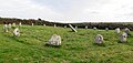
 Merry Maidens - geograph.org.uk - 5598769.jpg 640 × 427; 230 KB
-
 Merry Maidens Stone Circle - geograph.org.uk - 5146343.jpg 1,024 × 768; 223 KB
-
 Merry Maidens Stone Circle - geograph.org.uk - 5146351.jpg 1,024 × 768; 260 KB
-
 Merry Maidens Stone Circle - geograph.org.uk - 5598914.jpg 640 × 427; 237 KB
-
 Merry Maidens Stone Circle - geograph.org.uk - 6204437.jpg 1,024 × 768; 245 KB
-
 Merry Maidens Stone Circle from roadside gate - geograph.org.uk - 5155232.jpg 1,024 × 766; 279 KB
-
 Milestone at Crow-an-wra on the A30 - geograph.org.uk - 5597612.jpg 683 × 1,024; 284 KB
-
 Milestone at Crow-an-wra on the A30 - geograph.org.uk - 5597616.jpg 683 × 1,024; 271 KB
-
 Minor road near Penmennor Farm - geograph.org.uk - 5463780.jpg 640 × 480; 61 KB
-
 Minor road towards St Buryan - geograph.org.uk - 5463772.jpg 640 × 480; 46 KB
-
 Minor road towards St Buryan - geograph.org.uk - 5463790.jpg 640 × 480; 61 KB
-
 Moor Croft Cottages and Cross - geograph.org.uk - 5503512.jpg 4,896 × 3,672; 6.68 MB
-
 Mounting Block, St Buryan - geograph.org.uk - 5120403.jpg 1,200 × 1,600; 677 KB
-
 Mysterious stone in the churchyard wall - geograph.org.uk - 4779956.jpg 857 × 1,142; 646 KB
-
 Narrow Rural Road near Higher Kerris Farm - geograph.org.uk - 5008616.jpg 4,608 × 3,456; 6.32 MB
-
 National Cycle Route 3 - geograph.org.uk - 5463842.jpg 640 × 480; 52 KB
-
 National Cycle Route 3, Alsia - geograph.org.uk - 5463838.jpg 640 × 480; 55 KB
-
 Newly Planted Field near St. Buryan - geograph.org.uk - 4999660.jpg 4,608 × 3,456; 6.64 MB
-
 Newlyn Road at Tregadgwith - geograph.org.uk - 4788653.jpg 1,142 × 857; 381 KB
-
 Newlyn Road crosses the Lamorna stream - geograph.org.uk - 4788662.jpg 1,142 × 857; 583 KB
-
 Newlyn Road near Trevider - geograph.org.uk - 4788685.jpg 857 × 1,142; 554 KB
-
 Northeast of St Buryan - geograph.org.uk - 4788630.jpg 1,306 × 979; 486 KB
-
 Not as old as you may think - geograph.org.uk - 6140125.jpg 1,024 × 768; 272 KB
-
 Nothing to do with King Arthur - geograph.org.uk - 6138045.jpg 1,024 × 768; 258 KB
-
 Old and rusty - geograph.org.uk - 6189839.jpg 1,024 × 768; 322 KB
-

-

-

-
 Old Milestone by the A30, near Treave - geograph.org.uk - 5623385.jpg 480 × 640; 167 KB
-

-
 Old roadsign in St Buryan - geograph.org.uk - 5597873.jpg 768 × 1,024; 277 KB
-

-
 On top of Trevedran Cliffs - geograph.org.uk - 6296328.jpg 1,024 × 774; 760 KB
-
 One of The Pipers standing stones - geograph.org.uk - 5502828.jpg 4,896 × 3,672; 6.94 MB
-
 Ordnance Survey Cut Mark - geograph.org.uk - 5293913.jpg 640 × 394; 137 KB
-
 Ordnance Survey Cut Mark - geograph.org.uk - 5293915.jpg 640 × 354; 117 KB
-
 Ordnance Survey Flush Bracket 1566 - geograph.org.uk - 5431049.jpg 4,000 × 3,000; 5.32 MB
-
 OS benchmark - Alsia Mill lane junction - geograph.org.uk - 4784382.jpg 857 × 1,142; 546 KB
-
 OS benchmark - farm at Newshop - geograph.org.uk - 3804679.jpg 1,142 × 857; 545 KB
-
 OS benchmark - No man's Land, roadside boulder - geograph.org.uk - 4788624.jpg 1,102 × 1,469; 1,005 KB
-
 OS benchmark - St Buryan church - geograph.org.uk - 4779995.jpg 857 × 1,142; 687 KB
-
 OS benchmark - St Buryan, former smithy - geograph.org.uk - 4783244.jpg 741 × 988; 473 KB
-
 OS benchmark - St Buryan, Pendrea Cottage - geograph.org.uk - 4784379.jpg 949 × 1,245; 639 KB
-
 OS benchmark - St Buryan, Pendrea farm gatepost - geograph.org.uk - 4784380.jpg 857 × 1,142; 559 KB
-
 OS benchmark - St Buryan, Penzance Road - geograph.org.uk - 4785376.jpg 1,102 × 1,469; 427 KB
-
 OS benchmark - St Buryan, Poolpanenna - geograph.org.uk - 4778851.jpg 734 × 979; 488 KB
-
 OS benchmark - St Buryan, village hall - geograph.org.uk - 4783246.jpg 857 × 1,142; 586 KB
-
 Out of St Buryan towards Crows-an-Wra - geograph.org.uk - 4778830.jpg 1,306 × 979; 404 KB
-
 Pallbearers take a break - geograph.org.uk - 6138036.jpg 1,024 × 768; 307 KB
-
 Part of the Merry Maidens Stone Circle - geograph.org.uk - 6204443.jpg 1,024 × 768; 322 KB
-
 Penberth - geograph.org.uk - 5139705.jpg 1,024 × 768; 329 KB
-
 Penberth below Cribba Head - geograph.org.uk - 5140839.jpg 1,024 × 767; 389 KB
-
 Penberth Cove from Cribba Head - geograph.org.uk - 5140019.jpg 1,024 × 768; 278 KB
-
 Penzance Road - geograph.org.uk - 4771023.jpg 640 × 480; 54 KB
-
 Penzance Road out of St Buryan - geograph.org.uk - 4788703.jpg 1,142 × 857; 347 KB
-
 Penzance Road, St Buryan - geograph.org.uk - 4785372.jpg 1,469 × 1,102; 535 KB
-
 Ploughed field, Four Lanes End - geograph.org.uk - 5463764.jpg 640 × 480; 41 KB
-
 Pol-Pedn-Nanna - geograph.org.uk - 4778838.jpg 1,469 × 1,102; 468 KB
-
 Porthguarnon cove - geograph.org.uk - 5484176.jpg 4,608 × 2,592; 3.78 MB
-
 Post Office and stores, St Buryan - geograph.org.uk - 5463805.jpg 640 × 480; 50 KB
-
 Potato Field near Trevelloe Farm - geograph.org.uk - 4970134.jpg 4,608 × 3,456; 5.79 MB
-
 Pridden cottage - geograph.org.uk - 4788712.jpg 1,142 × 857; 308 KB
-
 Public Toilets - St. Buryan - geograph.org.uk - 5000353.jpg 4,608 × 3,456; 6.64 MB
-
 Raginnis Trig Point - geograph.org.uk - 4488123.jpg 2,560 × 1,920; 2.55 MB


