Category:St Andrew's Church, Clay Coton
Jump to navigation
Jump to search
| Object location | | View all coordinates using: OpenStreetMap |
|---|
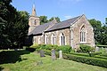
church in Clay Coton, Northamptonshire, England, UK  | |||||
| Upload media | |||||
| Instance of | |||||
|---|---|---|---|---|---|
| Dedicated to | |||||
| Location | Clay Coton, West Northamptonshire, Northamptonshire, East Midlands, England | ||||
| Heritage designation |
| ||||
 | |||||
Media in category "St Andrew's Church, Clay Coton"
The following 3 files are in this category, out of 3 total.
-
 Clay Coton - geograph.org.uk - 59876.jpg 640 × 480; 124 KB
-
 Claycoton church - geograph.org.uk - 4749489.jpg 800 × 531; 142 KB
-
 St Andrew, Clay Coton - geograph.org.uk - 3135646.jpg 1,000 × 667; 183 KB

