Category:St. Michael (Hillensberg)
Jump to navigation
Jump to search
| Object location | | View all coordinates using: OpenStreetMap |
|---|
  | |||||
| Upload media | |||||
| Instance of | |||||
|---|---|---|---|---|---|
| Location | Hillensberg, Selfkant, Heinsberg, Cologne Government Region, North Rhine-Westphalia, Germany | ||||
| Heritage designation | |||||
 | |||||
This is the category for an architectural monument.
It is on the list of cultural monuments of Selfkant, no. 10.
It is on the list of cultural monuments of Selfkant, no. 10.
Media in category "St. Michael (Hillensberg)"
The following 20 files are in this category, out of 20 total.
-
 Hillensberg Kirche St. Michael Außenansicht.JPG 1,200 × 800; 102 KB
-
 Hillensberg Kirche St. Michael Beichtstuhl.JPG 1,600 × 2,400; 293 KB
-
 Hillensberg Kirche St. Michael Buntglas.JPG 1,600 × 2,400; 443 KB
-
 Hillensberg Kirche St. Michael Herzjesu.JPG 1,600 × 2,400; 327 KB
-
 Hillensberg Kirche St. Michael Hl. Familie.JPG 2,400 × 1,600; 366 KB
-
 Hillensberg Kirche St. Michael Hochformat.jpg 600 × 900; 59 KB
-
 Hillensberg Kirche St. Michael Infotafel.JPG 1,200 × 800; 150 KB
-
 Hillensberg Kirche St. Michael Innenansicht.JPG 1,200 × 800; 125 KB
-
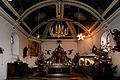 Hillensberg Kirche St. Michael Innenraum.JPG 2,400 × 1,600; 519 KB
-
 Hillensberg Kirche St. Michael Kreuzweg.JPG 2,400 × 1,600; 326 KB
-
 Hillensberg Kirche St. Michael Krippe.JPG 2,400 × 1,600; 422 KB
-
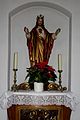
 Hillensberg Kirche St. Michael Marienaltar.JPG 1,600 × 2,400; 281 KB
-
 Hillensberg Kirche St. Michael Missionskreuz.JPG 800 × 1,200; 177 KB
-
 Hillensberg Kirche St. Michael Orgel.JPG 1,200 × 800; 84 KB
-
 Hillensberg Kirche St. Michael Patron.jpg 800 × 1,200; 54 KB
-
 Hillensberg Kirche St. Michael Taufstein.JPG 1,600 × 2,400; 274 KB
-
 Hillensberg Kirche St. Michael Turmkreuz.JPG 1,600 × 2,400; 150 KB
-
 Hillensberg Kirche St. Michael Vorlesepult.JPG 800 × 1,200; 84 KB
-
 Hillensberg Kirche.jpg 2,400 × 1,600; 471 KB
-
 Selfkant-Hillensberg Denkmal-Nr. 10, Bergstraße 48 (4898).jpg 600 × 400; 29 KB


.jpg)