Category:St. Martin (Rheinfelden)
Jump to navigation
Jump to search
| Object location | | View all coordinates using: OpenStreetMap |
|---|
church building in Rheinfelden in the canton of Aargau, Switzerland .jpg) _der_Stadtkirche_St._Martin_in_Rheinfelden_an_Weihnachten_2009_-_Bild_1.jpg) | |||||
| Upload media | |||||
| Instance of | |||||
|---|---|---|---|---|---|
| Part of | |||||
| Named after | |||||
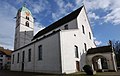
| Location | Rheinfelden, Rheinfelden District, Aargau, Switzerland | ||||
| Street address |
| ||||
| Architectural style | |||||
| Heritage designation | |||||
| Inception |
| ||||
 | |||||
Media in category "St. Martin (Rheinfelden)"
The following 10 files are in this category, out of 10 total.
-

-
 Egliserheinfeldenargovie.jpg 5,184 × 3,456; 9.64 MB
-
 Rheinfelden AG 15.JPG 2,688 × 4,047; 4.4 MB
-
 St. Martinskirche (Rheinfelden).jpg 3,000 × 1,892; 556 KB
-
 Stiftskirche St. Martin Rheinfelden AG 20230601 0634.jpg 4,456 × 6,685; 32.46 MB
-
 Stiftskirche St. Martin Rheinfelden AG 20230601 0635.jpg 4,402 × 7,441; 36.88 MB
-
 Stiftskirche St. Martin Rheinfelden AG 20230601 0636.jpg 4,048 × 7,661; 40.33 MB
-
 Stiftskirche St. Martin Rheinfelden AG 20230601 0637.jpg 2,996 × 6,128; 12.46 MB
-
 Stiftskirche St. Martin Rheinfelden AG 20230601 0638.jpg 5,504 × 8,256; 50.33 MB
-
 Stiftskirche St. Martin Rheinfelden AG 20230601 0639.jpg 4,151 × 7,642; 40.55 MB


