Category:St. Katharinen (Solothurn)
Jump to navigation
Jump to search
| Object location | | View all coordinates using: OpenStreetMap |
|---|
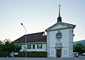
church buildings in the city of Solothurn, Switzerland  | |||||
| Upload media | |||||
| Instance of |
| ||||
|---|---|---|---|---|---|
| Part of | |||||
| Location | Solothurn, Solothurn District, Solothurn-Lebern, Solothurn, Switzerland | ||||
| Street address |
| ||||
| Heritage designation | |||||
 | |||||
Media in category "St. Katharinen (Solothurn)"
The following 2 files are in this category, out of 2 total.
-
 Kapelle und Pfrundhaus zu St. Katharinen sojujo Aug. 04 2020.jpg 2,752 × 1,946; 841 KB
-
 SBB Historic - F 122 00917 001 - St Katharinen SNB Haltestelle.jpg 5,267 × 3,706; 12.5 MB
