Category:St. Augustine Town Plan Historic District
Jump to navigation
Jump to search
|
This is a category about a place or building that is listed on the National Register of Historic Places in the United States of America. Its reference number is 70000847. |
English: St. Augustine Town Plan Historic District, a historic district in St. Augustine, Florida, and a U.S. National Historic Landmark. The district is bounded by Cordova, Orange, and St. Francis Streets, and Matanzas Bay.
historic district in Florida, United States   | |||||
| Upload media | |||||
| Instance of | |||||
|---|---|---|---|---|---|
| Location | St. Augustine, St. Johns County, Florida | ||||
| Heritage designation |
| ||||
| Area |
| ||||
 | |||||
Subcategories
This category has the following 36 subcategories, out of 36 total.
A
B
C
- Casa Monica Hotel (26 F)
E
- Espinosa-Sanchez House (6 F)
F
G
- Gonzalez-Alvarez House (92 F)
- Government House (St. Augustine) (22 F)
H
M
- Mill Top Tavern (5 F)
O
- Oldest Wooden Schoolhouse (50 F)
P
S
T
- Tovar House (46 F)
X
- Ximenez-Fatio House (49 F)
Media in category "St. Augustine Town Plan Historic District"
The following 64 files are in this category, out of 64 total.
-
 30 Spanish Street - panoramio.jpg 3,886 × 2,590; 11.88 MB
-
 FL St Augustine seawall marker01.jpg 3,216 × 4,288; 2.23 MB
-
 FL St Augustine seawall01.jpg 3,216 × 4,288; 2.42 MB
-
 FL St Augustine seawall02.jpg 3,216 × 4,288; 2.54 MB
-
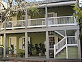
 Hemingway House B & B; Saint Augustine, Florida.jpg 3,648 × 2,736; 2.06 MB
-
 Inn on Charlotte B & B; Saint Augustine, Florida.jpg 3,648 × 2,736; 2.06 MB
-
 Pellicer-De Burgo House.jpg 2,016 × 1,512; 1.18 MB
-
 Rodriguez House.jpg 2,016 × 1,512; 1.05 MB
-
 Rue de St-Augustine.JPG 2,832 × 2,128; 1.44 MB
-
 Santoyo House.jpg 2,016 × 1,512; 1.06 MB
-
 Shipwreck Museum of Saint Augustine, Florida.jpg 3,648 × 2,736; 2.07 MB
-

-
 Spanish Dragoon Barracks HM; Saint Augustine.jpg 3,648 × 2,736; 2.03 MB
-
 Spanish Dragoon Barracks Site; 61 Cordova St; St Augustine.jpg 3,648 × 2,736; 2.08 MB
-
 St Aug 234 St George St01.jpg 3,264 × 2,448; 2.36 MB
-
 St Aug 268 St George plaque01.jpg 4,288 × 3,216; 2.35 MB
-
 St Aug 268 St George01.jpg 3,264 × 2,448; 2.3 MB
-
 St Aug Colonial Spanish Quarter Museum01.jpg 3,264 × 2,448; 1.67 MB
-
 St Aug Colonial Spanish Quarter Museum02.jpg 3,264 × 2,448; 1.34 MB
-
 St Aug FL Cofradia Coquina Well sign01.jpg 3,264 × 2,448; 2.76 MB
-
 St Aug FL Cofradia Coquina Well01.jpg 3,264 × 2,448; 2.18 MB
-
 St Aug FL Town Plan HD NHL plaque01.jpg 3,264 × 2,448; 2.48 MB
-
 St Aug Murat House01.jpg 3,264 × 2,448; 1.63 MB
-
 St Aug Sanchez Powder Site area01.jpg 3,264 × 2,448; 2.85 MB
-
 St Aug Sanchez Powder Site area02.jpg 3,264 × 2,448; 2.46 MB
-
 St Aug Sanchez Powder Site garden01.jpg 3,264 × 2,448; 3.46 MB
-
 St Aug Sanchez Powder Site garden03.jpg 3,264 × 2,448; 2.85 MB
-
 St Aug St Francis Barracks plaque01.jpg 2,448 × 3,264; 999 KB
-
 St Aug St Francis Barracks plaque02.jpg 2,448 × 3,264; 1.07 MB
-
 St Aug St Francis Inn GF plaque01.jpg 4,288 × 3,216; 2.21 MB
-
 St Aug St Francis Inn01.jpg 3,264 × 2,448; 1.14 MB
-
 St Aug St Francis Inn02.jpg 4,288 × 3,216; 2.12 MB
-
 St Aug St George and Cuna north01.jpg 3,264 × 2,448; 1.81 MB
-
 St Aug St George south01.jpg 3,264 × 2,448; 1.32 MB
-
 St Aug St George south02.jpg 3,264 × 2,448; 1.66 MB
-
 St Aug St George south03.jpg 3,264 × 2,448; 1.5 MB
-
 St Aug St George south04.jpg 3,264 × 2,448; 1.89 MB
-
 St Aug St George south05.jpg 3,264 × 2,448; 1.77 MB
-
 St Aug Stanbury Cottage01.jpg 3,264 × 2,448; 2.64 MB
-
 St Aug Stanbury Cottage02.jpg 2,448 × 3,264; 1.98 MB
-
 St Aug Town Plan HD Marin House01.jpg 3,216 × 4,288; 2.59 MB
-
 St Aug Town Plan HD Westcott House01.jpg 4,288 × 3,216; 2.4 MB
-
 St Augustine FL Charlotte St01.jpg 3,264 × 2,448; 1.38 MB
-
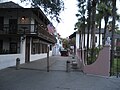
 St Augustine, FL - St. Augustine Town Plan Historic District.jpg 1,200 × 804; 299 KB
-
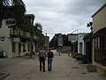
 St. Augustine (Florida)-old town.jpg 515 × 600; 116 KB
-
 St. Augustine Town Plan Historic District, St. Augustine, Florida, USA2.jpg 3,264 × 2,448; 4.3 MB
-
 ST. GEORGE INN, COLONIAL QUARTER, ST. AUGUSTINE, FLORIDA (10802266674).jpg 2,048 × 1,536; 1.52 MB
-
 StAugFLSept07Backyards.jpg 2,816 × 2,112; 3.03 MB
-
 StAugFLSept07GalleryStreet.jpg 2,816 × 2,112; 1.74 MB
-
 StAugFLSept07MorningBalconies.jpg 2,112 × 2,816; 2.19 MB
-
 StAugFLSept07MorningBalconies2.jpg 2,816 × 2,112; 1.91 MB
-
 StAugFLSept07MorningDampStreet.jpg 2,816 × 2,112; 1.84 MB
-
 StAugFLSept07MorningLights.jpg 2,816 × 2,112; 1.6 MB
-
 StAugFLSept07MorningStreet.jpg 2,816 × 2,112; 1.79 MB
-
 StAugFLSept07OldA.jpg 2,816 × 2,112; 1.86 MB
-
 StAugFLSept07OldC.jpg 2,816 × 2,112; 2.02 MB
-
 StAugFLSept07OldD.jpg 2,816 × 2,112; 1.86 MB
-
 StAugFLSept07OldI.jpg 2,816 × 2,112; 1.35 MB
-
 StAugFLSept07ParadiseBurger.jpg 2,816 × 2,112; 1.8 MB
-
 StAugFLSept07PonceStatueBrewpub.jpg 2,816 × 1,512; 1.24 MB
-
 StAugFLSept07PrinceWales.jpg 2,816 × 2,112; 2.41 MB
-
 StAugFLSept07SideLightnerToFlagler.jpg 2,816 × 2,112; 1.66 MB
-
 StAugFLSept07Sideyard.jpg 2,112 × 2,816; 2.96 MB
-
 William watson house.jpg 855 × 641; 166 KB


-old_town.jpg)

.jpg)


