Category:Stöbber
Jump to navigation
Jump to search
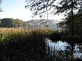
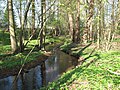
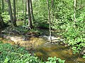
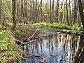
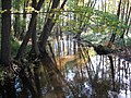
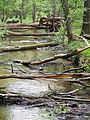
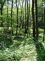
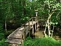
Deutsch: Der Stobber oder Stöbber ist das zentrale Fließgewässer der Brandenburger Märkischen Schweiz und des Naturparks Märkische Schweiz. Der 25 Kilometer lange Bach fließt vom Quell- und Niedermoorgebiet Rotes Luch nach Nordosten durch Buckow zum Oderbruch. Er mündet bei Altfriedland in den Friedländer Strom, dessen Wasser über die Alte Oder, die Hohensaaten-Friedrichsthaler Wasserstraße und die Oder der Ostsee zugeführt wird. Auf rund 13 Kilometern seines Laufs ist das „Naturschutzgebiet Stobbertal“ ausgewiesen.
English: The Stobber (also called Stöbber) is the central river in the hill country „Märkische Schweiz“ and the Märkische Schweiz Nature Park, Brandenburg, Germany. The stream runs over a distance of 25 kilometers from the lowland moor and source area Rotes Luch towards the northeast through Buckow to the Oderbruch. The Stobber flows at Neuhardenberg to the „Friedländer Strom“, whose waters run over some canals to the Oder River → Baltic Sea. On a roughly 13 kilometer long route of its course there is designated the nature protection area „Naturschutzgebiet Stobbertal“.
river in Germany   | |||||
| Upload media | |||||
| Instance of | |||||
|---|---|---|---|---|---|
| Location | Brandenburg, Germany | ||||
| Length |
| ||||
| Mouth of the watercourse | |||||
| Drainage basin | |||||
| Tributary | |||||
| Lake on watercourse | |||||
 | |||||
- See also: Stobberbach
Subcategories
This category has the following 6 subcategories, out of 6 total.
Media in category "Stöbber"
The following 45 files are in this category, out of 45 total.
-
 Am.Grossen.Barschpfuhl.JPG 2,560 × 1,920; 1.88 MB
-
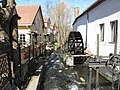
 Buckow (Märkische Schweiz) Stobbermühle.JPG 2,592 × 1,944; 2.8 MB
-
 Buckow (Märkische Schweiz) Stöbber-Zufluss.JPG 3,240 × 4,320; 3.99 MB
-
 Buckow (Märkische Schweiz) Stöbbermühle.JPG 2,847 × 3,247; 1.3 MB
-
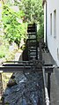 BuckowWasserrad.jpg 1,288 × 2,288; 1.8 MB
-
 Rotes Luch Stöbber bei Werder.jpg 4,032 × 3,024; 3.66 MB
-
 Schlosspark Buckow (Märkische Schweiz) 04.jpg 3,533 × 2,650; 4.88 MB
-
 Schlosspark Buckow (Märkische Schweiz) 05.jpg 3,533 × 2,650; 5.12 MB
-
 Schlosspark Buckow (Märkische Schweiz) 06.jpg 3,533 × 2,650; 3.64 MB
-
 Stobber 01.jpg 3,533 × 2,650; 5.16 MB
-
 Stobber 02.jpg 3,533 × 2,650; 4.98 MB
-
 Stobber 03.jpg 3,533 × 2,650; 5.11 MB
-
 Stobber 04.jpg 3,394 × 2,600; 3.96 MB
-
 Stobber 05.jpg 3,533 × 2,650; 5.84 MB
-
 Stobber 06.jpg 3,533 × 2,650; 3.58 MB
-
 Stobber 07.jpg 3,533 × 2,650; 3.35 MB
-
 Stobber 08.jpg 3,092 × 2,319; 2.58 MB
-
 Stobber 09.jpg 3,533 × 2,650; 4.74 MB
-
 Stobber 10.jpg 3,533 × 2,650; 4.72 MB
-
 Stobber 11.jpg 3,533 × 2,650; 4.81 MB
-
 Stobber 12.jpg 2,650 × 3,533; 3.06 MB
-
 Stobber Erlenbruch Buckowsee.jpg 3,533 × 2,650; 4.18 MB
-
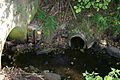 StobberPipe.jpg 3,072 × 2,048; 2.98 MB
-
 Stobbertal.Grosser.Barschpfuhl.longitude14.1072.latitude52.5676.jpg 2,560 × 1,920; 1.5 MB
-
 Stobbertal.JPG 1,920 × 2,560; 1.93 MB
-
 Stobbertal.Urwald.am.Stobber.longitude14.0928.latitude52.5750.jpg 2,560 × 1,920; 1.88 MB
-
 Stobbertal.verwitterter.Biberfrass.longitude14.0999.latitude52.5736.jpg 1,920 × 2,560; 906 KB
-
 Stöbber in Buckow Oktober 2021.jpg 3,000 × 4,000; 4.93 MB
-
 Stöbberquelle.png 1,388 × 1,498; 634 KB
-
 Wanderung Märkische Schweiz Entlang der Stöbber - panoramio.jpg 3,072 × 2,304; 3.16 MB
-
 Wanderung Märkische Schweiz Stöbber - panoramio - Gottfried Hoffmann -….jpg 3,072 × 2,304; 3.02 MB
-
 Wanderung Märkische Schweiz Stöbber - panoramio.jpg 2,304 × 3,072; 3.08 MB
-
 Wanderung Märkische Schweiz Stöbberniederung - panoramio - Gottfried Hoffmann -… (1).jpg 2,304 × 3,072; 3.15 MB
-
 Wanderung Märkische Schweiz Stöbberniederung - panoramio - Gottfried Hoffmann -… (2).jpg 2,304 × 3,072; 3.28 MB
-
 Wanderung Märkische Schweiz Stöbberniederung - panoramio - Gottfried Hoffmann -….jpg 3,072 × 2,304; 3.05 MB
-
 Wanderung Märkische Schweiz Stöbberniederung - panoramio.jpg 2,304 × 3,072; 3.19 MB
-
 Wanderung Märkische Schweiz Stöbbertal - panoramio - Gottfried Hoffmann -… (1).jpg 2,304 × 3,072; 3.5 MB
-
 Wanderung Märkische Schweiz Stöbbertal - panoramio - Gottfried Hoffmann -… (2).jpg 3,072 × 2,304; 3.05 MB
-
 Wanderung Märkische Schweiz Stöbbertal - panoramio - Gottfried Hoffmann -… (3).jpg 3,072 × 2,304; 3.02 MB
-
 Wanderung Märkische Schweiz Stöbbertal - panoramio - Gottfried Hoffmann -… (4).jpg 3,072 × 2,304; 3.08 MB
-
 Wanderung Märkische Schweiz Stöbbertal - panoramio - Gottfried Hoffmann -… (5).jpg 2,304 × 3,072; 2.49 MB
-
 Wanderung Märkische Schweiz Stöbbertal - panoramio - Gottfried Hoffmann -… (6).jpg 3,072 × 2,304; 3.07 MB
-
 Wanderung Märkische Schweiz Stöbbertal - panoramio - Gottfried Hoffmann -….jpg 2,304 × 3,072; 3.09 MB
-
 Wanderung Märkische Schweiz Stöbbertal - panoramio.jpg 2,304 × 3,072; 3.18 MB
-
 Wegweiser Stobbertal 01.jpg 3,533 × 2,650; 5.54 MB

_Stobberm%C3%BChle.JPG)
_St%C3%B6bber-Zufluss.JPG)
_St%C3%B6bberm%C3%BChle.JPG)


_04.jpg)
_05.jpg)
_06.jpg)


.jpg)
.jpg)


.jpg)
.jpg)
.jpg)
.jpg)
.jpg)
.jpg)


