Category:Spoorlaan, Etten-Leur
Jump to navigation
Jump to search
| Object location | | View all coordinates using: OpenStreetMap |
|---|
Nederlands: Afbeeldingen van de straat de Spoorlaan in de gemeente Etten-Leur in de provincie Noord-Brabant in het zuiden van Nederland. Nabij het Station Etten-Leur
street in Etten-Leur, the Netherlands | |||||
| Upload media | |||||
| Instance of | |||||
|---|---|---|---|---|---|
| Location | Etten-Leur, North Brabant, Netherlands | ||||
| Street address |
| ||||
 | |||||
Media in category "Spoorlaan, Etten-Leur"
The following 15 files are in this category, out of 15 total.
-
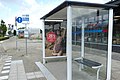
 Bushalte Station P1490824 copy2.jpg 1,337 × 893; 472 KB
-
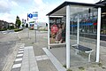
 Bushalte Station P1490835 copy.jpg 3,402 × 2,273; 1.51 MB
-
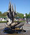 Etten-leur kunstwerk fontein.jpg 1,832 × 2,116; 1.42 MB
-
 Jan Tit bloemen en planten P1490834 copy.jpg 2,867 × 1,915; 1.6 MB
-
 Jan Tit bloemen en planten P1490834.jpg 4,000 × 2,672; 5.98 MB
-
 Spoorlaan, Etten-Leur P1490823.jpg 4,000 × 2,672; 5.55 MB
-
 Spoorlaan, Etten-Leur P1490824 copy.jpg 2,914 × 1,946; 1.44 MB
-
 Spoorlaan, Etten-Leur P1490824.jpg 4,000 × 2,672; 5.84 MB
-
 Spoorlaan, Etten-Leur P1490828 copy.jpg 2,656 × 1,774; 1.45 MB
-
 Spoorlaan, Etten-Leur P1490828 copy2.jpg 2,232 × 1,490; 1,006 KB
-
 Spoorlaan, Etten-Leur P1490828 copy3.jpg 1,326 × 885; 269 KB
-
 Spoorlaan, Etten-Leur P1490830.jpg 4,000 × 2,672; 5.91 MB
-
 Spoorlaan, Etten-Leur P1490833 copy.jpg 2,614 × 1,746; 845 KB
-
 Spoorlaan, Etten-Leur P1490833.jpg 4,000 × 2,672; 5.83 MB
-
 Spoorlaan, Etten-Leur P1490835.jpg 4,000 × 2,672; 5.87 MB


