Category:Spital Chapel, Tamworth
Jump to navigation
Jump to search
| Object location | | View all coordinates using: OpenStreetMap |
|---|
church in Tamworth, Staffordshire, England, UK  | |||||
| Upload media | |||||
| Instance of | |||||
|---|---|---|---|---|---|
| Location | Tamworth, Staffordshire, West Midlands, England | ||||
| Diocese | |||||
| Heritage designation |
| ||||
| Religion or worldview | |||||
 | |||||
Media in category "Spital Chapel, Tamworth"
The following 3 files are in this category, out of 3 total.
-
 Inside Spital Chapel - geograph.org.uk - 2109395.jpg 423 × 640; 70 KB
-
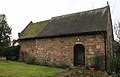 Spital Chapel of St James, Tamworth.jpg 640 × 411; 72 KB
-
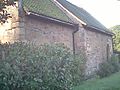 The Spital Chapel.jpg 640 × 480; 107 KB

